Ninetysix Hills Nw Topo Map Arizona
To zoom in, hover over the map of Ninetysix Hills Nw
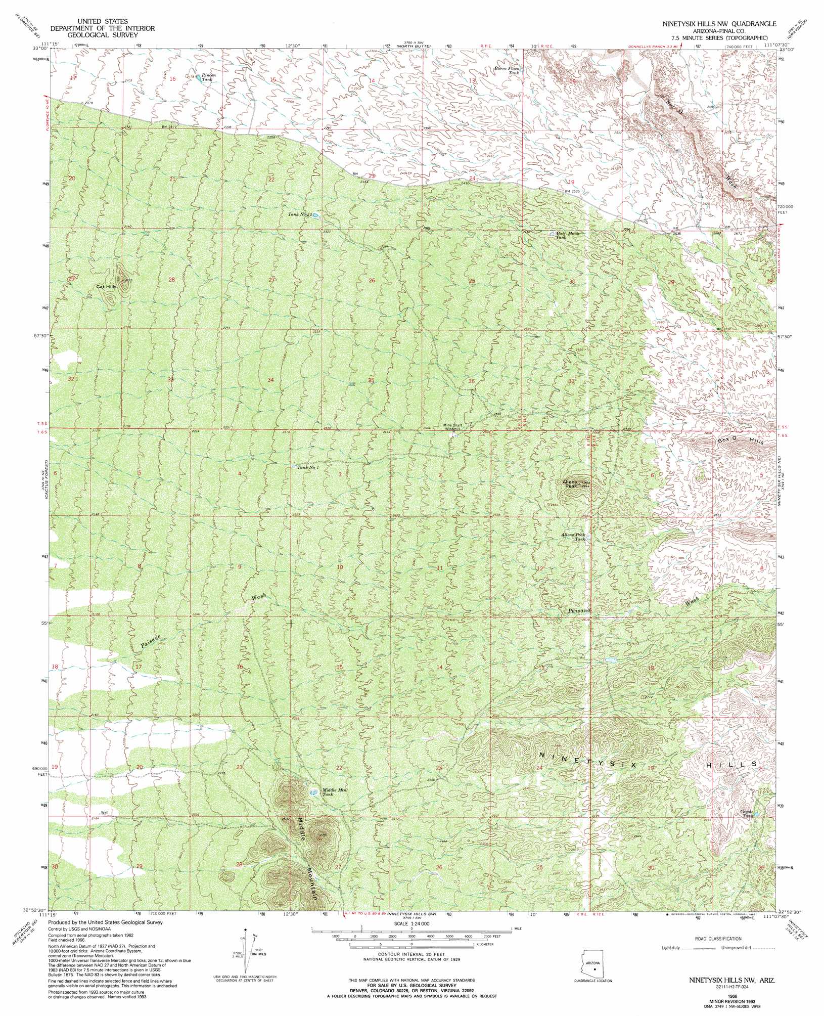
USGS Topo Quad 32111h2 - 1:24,000 scale
| Topo Map Name: | Ninetysix Hills Nw |
| USGS Topo Quad ID: | 32111h2 |
| Print Size: | ca. 21 1/4" wide x 27" high |
| Southeast Coordinates: | 32.875° N latitude / 111.125° W longitude |
| Map Center Coordinates: | 32.9375° N latitude / 111.1875° W longitude |
| U.S. State: | AZ |
| Filename: | o32111h2.jpg |
| Download Map JPG Image: | Ninetysix Hills Nw topo map 1:24,000 scale |
| Map Type: | Topographic |
| Topo Series: | 7.5´ |
| Map Scale: | 1:24,000 |
| Source of Map Images: | United States Geological Survey (USGS) |
| Alternate Map Versions: |
Ninetysix Hills NW AZ 1966, updated 1969 Download PDF Buy paper map Ninetysix Hills NW AZ 1966, updated 1979 Download PDF Buy paper map Ninetysix Hills NW AZ 1966, updated 1993 Download PDF Buy paper map Ninetysix Hills NW AZ 2011 Download PDF Buy paper map Ninetysix Hills NW AZ 2014 Download PDF Buy paper map |
1:24,000 Topo Quads surrounding Ninetysix Hills Nw
Magma |
Florence Ne |
Mineral Mountain |
Teapot Mountain |
Hot Tamale Peak |
Florence |
Florence Se |
North Butte |
Grayback |
Kearny |
Valley Farms |
Cactus Forest |
Ninetysix Hills Nw |
Ninetysix Hills Ne |
Crozier Peak |
Picacho Reservoir |
Picacho Reservoir Se |
Ninetysix Hills Sw |
Ninetysix Hills Se |
Black Mountain |
Newman Peak |
Picacho Pass |
Durham Hills |
Chief Butte |
Fortified Peak |
> Back to 32111e1 at 1:100,000 scale
> Back to 32110a1 at 1:250,000 scale
> Back to U.S. Topo Maps home
Ninetysix Hills Nw topo map: Gazetteer
Ninetysix Hills Nw: Reservoirs
Allens Peak Tank elevation 814m 2670′Burro Flaco Tank elevation 734m 2408′
Coyote Tank elevation 848m 2782′
Half Moon Tank elevation 767m 2516′
Middle Mountain Tank elevation 718m 2355′
Rincon Tank elevation 660m 2165′
Tank Number One elevation 708m 2322′
Tank Number Twentytwo elevation 704m 2309′
Ninetysix Hills Nw: Summits
Allens Peak elevation 872m 2860′Box O Hills elevation 924m 3031′
Cat Hills elevation 688m 2257′
Middle Mountain elevation 819m 2687′
Ninetysix Hills Nw digital topo map on disk
Buy this Ninetysix Hills Nw topo map showing relief, roads, GPS coordinates and other geographical features, as a high-resolution digital map file on DVD: