Mount Ajo Topo Map Arizona
To zoom in, hover over the map of Mount Ajo
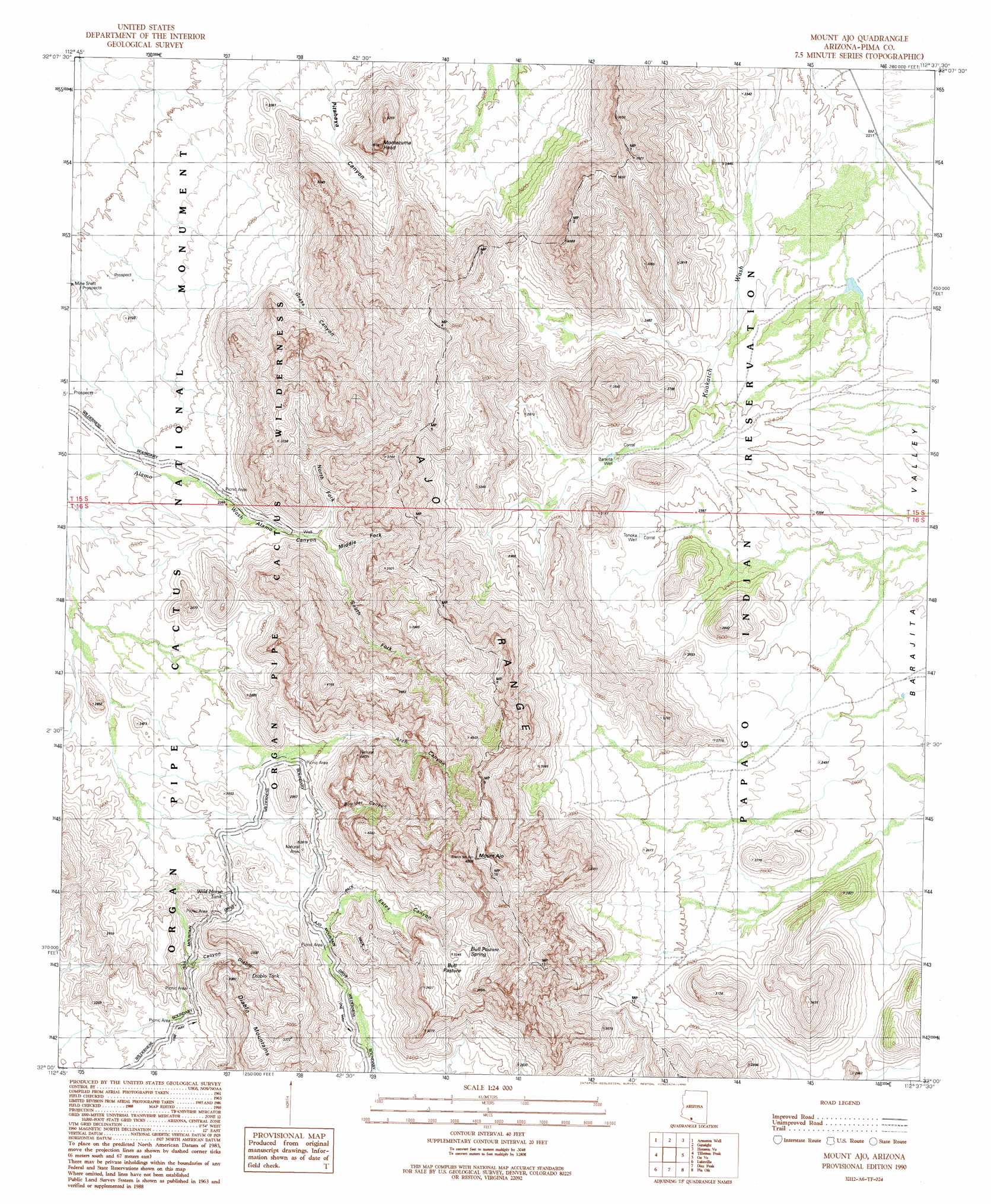
USGS Topo Quad 32112a6 - 1:24,000 scale
| Topo Map Name: | Mount Ajo |
| USGS Topo Quad ID: | 32112a6 |
| Print Size: | ca. 21 1/4" wide x 27" high |
| Southeast Coordinates: | 32° N latitude / 112.625° W longitude |
| Map Center Coordinates: | 32.0625° N latitude / 112.6875° W longitude |
| U.S. State: | AZ |
| Filename: | o32112a6.jpg |
| Download Map JPG Image: | Mount Ajo topo map 1:24,000 scale |
| Map Type: | Topographic |
| Topo Series: | 7.5´ |
| Map Scale: | 1:24,000 |
| Source of Map Images: | United States Geological Survey (USGS) |
| Alternate Map Versions: |
Mount Ajo AZ 1990, updated 1990 Download PDF Buy paper map Mount Ajo AZ 1996, updated 2000 Download PDF Buy paper map Mount Ajo AZ 2011 Download PDF Buy paper map Mount Ajo AZ 2014 Download PDF Buy paper map |
1:24,000 Topo Quads surrounding Mount Ajo
Chico Shunie |
Ajo South |
Sikort Chuapo |
Gakolik Mountains |
Hickiwan |
Bates Well |
Armenta Well |
Gunsight |
Hotason Vo |
West Of Wahak Hotrontk |
Kino Peak |
Tillotson Peak |
Mount Ajo |
Gu Vo |
West Of Pisinimo |
West Of Lukeville |
Lukeville |
Diaz Peak |
Pia Oik |
Chupan Mountain |
South Of Lukeville |
Blankenship Well |
Menagers Lake |
Bailey Peak |
> Back to 32112a1 at 1:100,000 scale
> Back to 32112a1 at 1:250,000 scale
> Back to U.S. Topo Maps home
Mount Ajo topo map: Gazetteer
Mount Ajo: Flats
Bull Pasture elevation 963m 3159′Mount Ajo: Ranges
Ajo Range elevation 1134m 3720′Mount Ajo: Reservoirs
Diablo Tank elevation 767m 2516′Wild Horse Tank elevation 731m 2398′
Mount Ajo: Springs
Bull Pasture Spring elevation 964m 3162′Mount Ajo: Summits
Diablo Mountains elevation 909m 2982′Montezuma Head elevation 1109m 3638′
Mount Ajo elevation 1458m 4783′
Mount Ajo: Valleys
Alamo Canyon elevation 698m 2290′Arch Canyon elevation 776m 2545′
Boulder Canyon elevation 800m 2624′
Canyon Diablo elevation 670m 2198′
Estes Canyon elevation 727m 2385′
Grass Canyon elevation 730m 2395′
Pitahaya Canyon elevation 670m 2198′
Mount Ajo: Wells
Barajita Well elevation 745m 2444′Tonoka Well elevation 739m 2424′
Mount Ajo digital topo map on disk
Buy this Mount Ajo topo map showing relief, roads, GPS coordinates and other geographical features, as a high-resolution digital map file on DVD: