Gunsight Topo Map Arizona
To zoom in, hover over the map of Gunsight
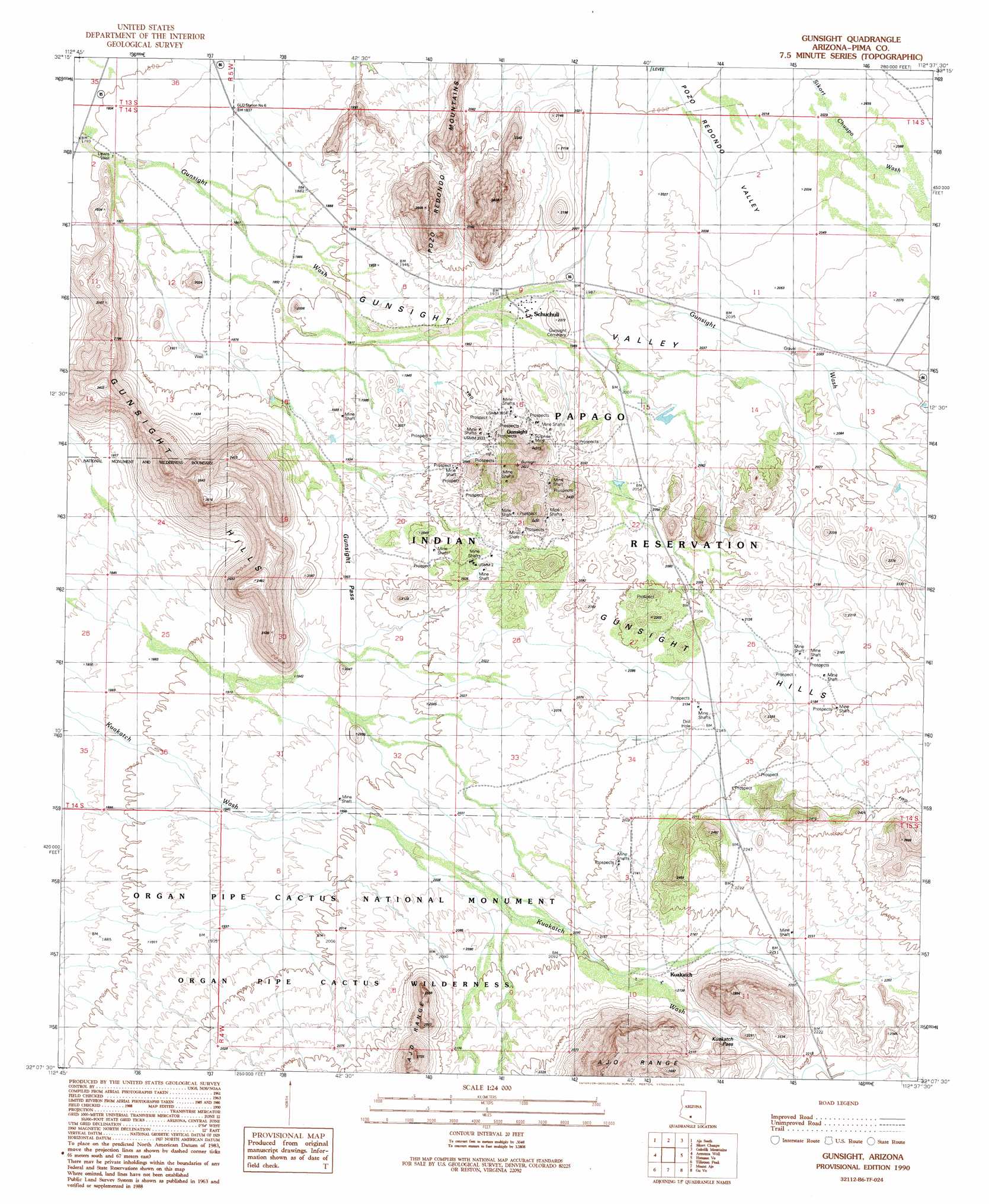
USGS Topo Quad 32112b6 - 1:24,000 scale
| Topo Map Name: | Gunsight |
| USGS Topo Quad ID: | 32112b6 |
| Print Size: | ca. 21 1/4" wide x 27" high |
| Southeast Coordinates: | 32.125° N latitude / 112.625° W longitude |
| Map Center Coordinates: | 32.1875° N latitude / 112.6875° W longitude |
| U.S. State: | AZ |
| Filename: | o32112b6.jpg |
| Download Map JPG Image: | Gunsight topo map 1:24,000 scale |
| Map Type: | Topographic |
| Topo Series: | 7.5´ |
| Map Scale: | 1:24,000 |
| Source of Map Images: | United States Geological Survey (USGS) |
| Alternate Map Versions: |
Gunsight AZ 1990, updated 1990 Download PDF Buy paper map Gunsight AZ 1996, updated 2000 Download PDF Buy paper map Gunsight AZ 2011 Download PDF Buy paper map Gunsight AZ 2014 Download PDF Buy paper map |
1:24,000 Topo Quads surrounding Gunsight
Childs Mountain |
Ajo North |
Burro Gap |
Coffeepot Mountain |
Cimarron Peak |
Chico Shunie |
Ajo South |
Sikort Chuapo |
Gakolik Mountains |
Hickiwan |
Bates Well |
Armenta Well |
Gunsight |
Hotason Vo |
West Of Wahak Hotrontk |
Kino Peak |
Tillotson Peak |
Mount Ajo |
Gu Vo |
West Of Pisinimo |
West Of Lukeville |
Lukeville |
Diaz Peak |
Pia Oik |
Chupan Mountain |
> Back to 32112a1 at 1:100,000 scale
> Back to 32112a1 at 1:250,000 scale
> Back to U.S. Topo Maps home
Gunsight topo map: Gazetteer
Gunsight: Gaps
Kuakatch Pass elevation 661m 2168′Gunsight: Mines
Surprise Mine elevation 643m 2109′Gunsight: Populated Places
Kuakatch elevation 653m 2142′Schuchuli elevation 0m 0′
Gunsight: Valleys
Gunsight Valley elevation 556m 1824′Gunsight: Wells
Lewis Well elevation 551m 1807′Gunsight digital topo map on disk
Buy this Gunsight topo map showing relief, roads, GPS coordinates and other geographical features, as a high-resolution digital map file on DVD: