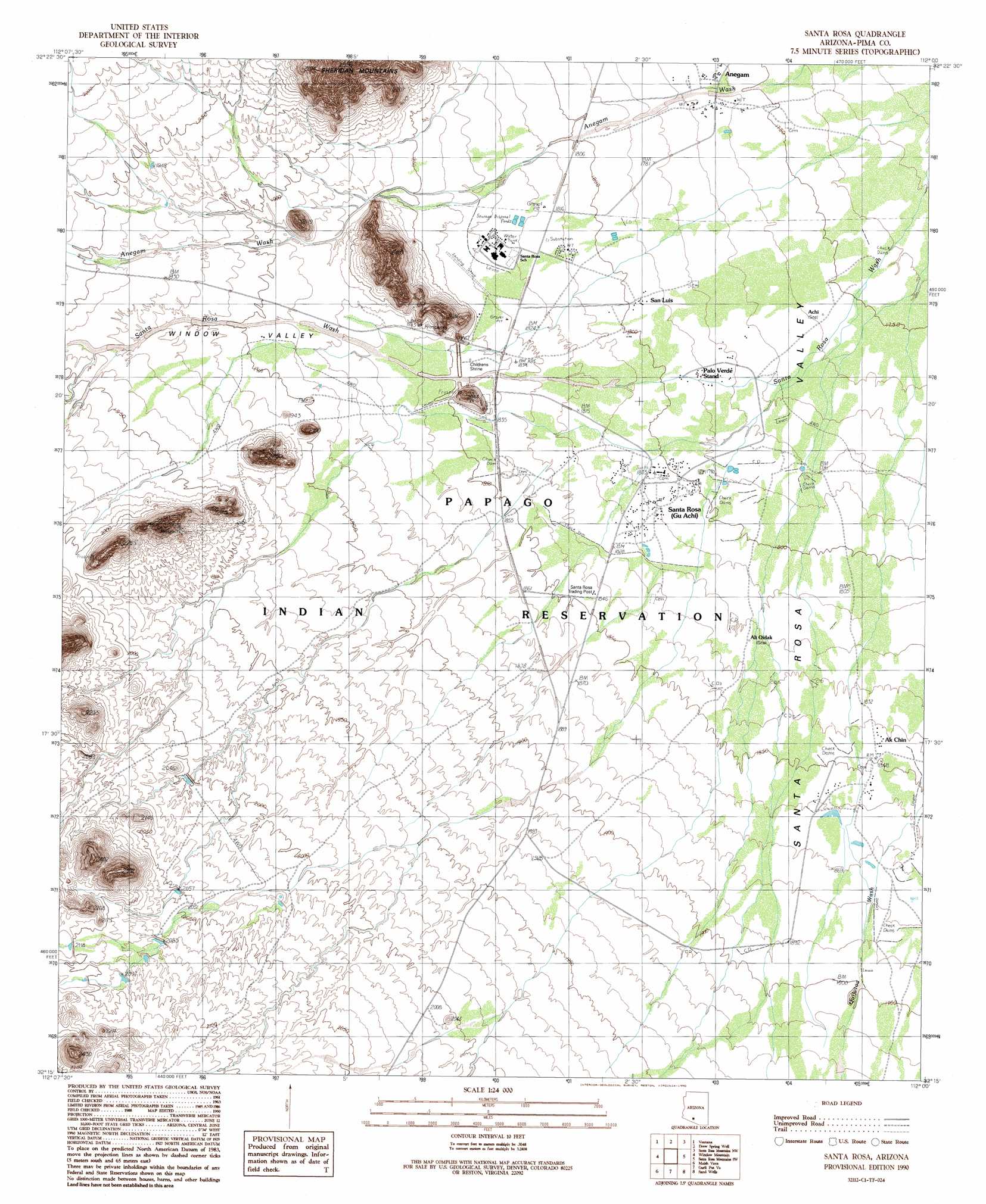
Gu Achi Topo Map Arizona
To zoom in, hover over the map of Gu Achi
USGS Topo Quad 32112c1 - 1:24,000 scale
| Topo Map Name: | Gu Achi |
| USGS Topo Quad ID: | 32112c1 |
| Print Size: | ca. 21 1/4" wide x 27" high |
| Southeast Coordinates: | 32.25° N latitude / 112° W longitude |
| Map Center Coordinates: | 32.3125° N latitude / 112.0625° W longitude |
| U.S. State: | AZ |
| Filename: | o32112c1.jpg |
| Download Map JPG Image: | Gu Achi topo map 1:24,000 scale |
| Map Type: | Topographic |
| Topo Series: | 7.5´ |
| Map Scale: | 1:24,000 |
| Source of Map Images: | United States Geological Survey (USGS) |
| Alternate Map Versions: |
Santa Rosa AZ 1990, updated 1990 Download PDF Buy paper map Santa Rosa AZ 1996, updated 2001 Download PDF Buy paper map Santa Rosa AZ 2011 Download PDF Buy paper map Santa Rosa AZ 2014 Download PDF Buy paper map |
1:24,000 Topo Quads surrounding Gu Achi
Kaka |
Copperosity Hills |
Kohatk |
North Komelik |
Silver Reef Mountains Se |
West Of Ventana |
Ventana |
Drew Spring Well |
Santa Rosa Mountains Nw |
Santa Rosa Mountains Ne |
Vaya Chin |
Window Mountain |
Gu Achi |
Santa Rosa Mountains Sw |
Santa Rosa Mountains Se |
Wahak Hotrontk |
Maish Vaya |
Gurli Put Vo |
Sand Wells |
Sil Nakya |
Pisinimo |
Ben Nevis Mountain |
Vainom Kug |
Ko Vaya |
Comobabi |
> Back to 32112a1 at 1:100,000 scale
> Back to 32112a1 at 1:250,000 scale
> Back to U.S. Topo Maps home
Gu Achi topo map: Gazetteer
Gu Achi: Populated Places
Achi elevation 536m 1758′Ak Chin elevation 0m 0′
Ali Oidak elevation 556m 1824′
Anegam elevation 537m 1761′
Palo Verde Stand elevation 546m 1791′
San Luis elevation 0m 0′
Santa Rosa elevation 552m 1811′
Gu Achi: Streams
Gu Achi Wash elevation 539m 1768′Gu Achi: Valleys
Window Valley elevation 541m 1774′Gu Achi digital topo map on disk
Buy this Gu Achi topo map showing relief, roads, GPS coordinates and other geographical features, as a high-resolution digital map file on DVD: