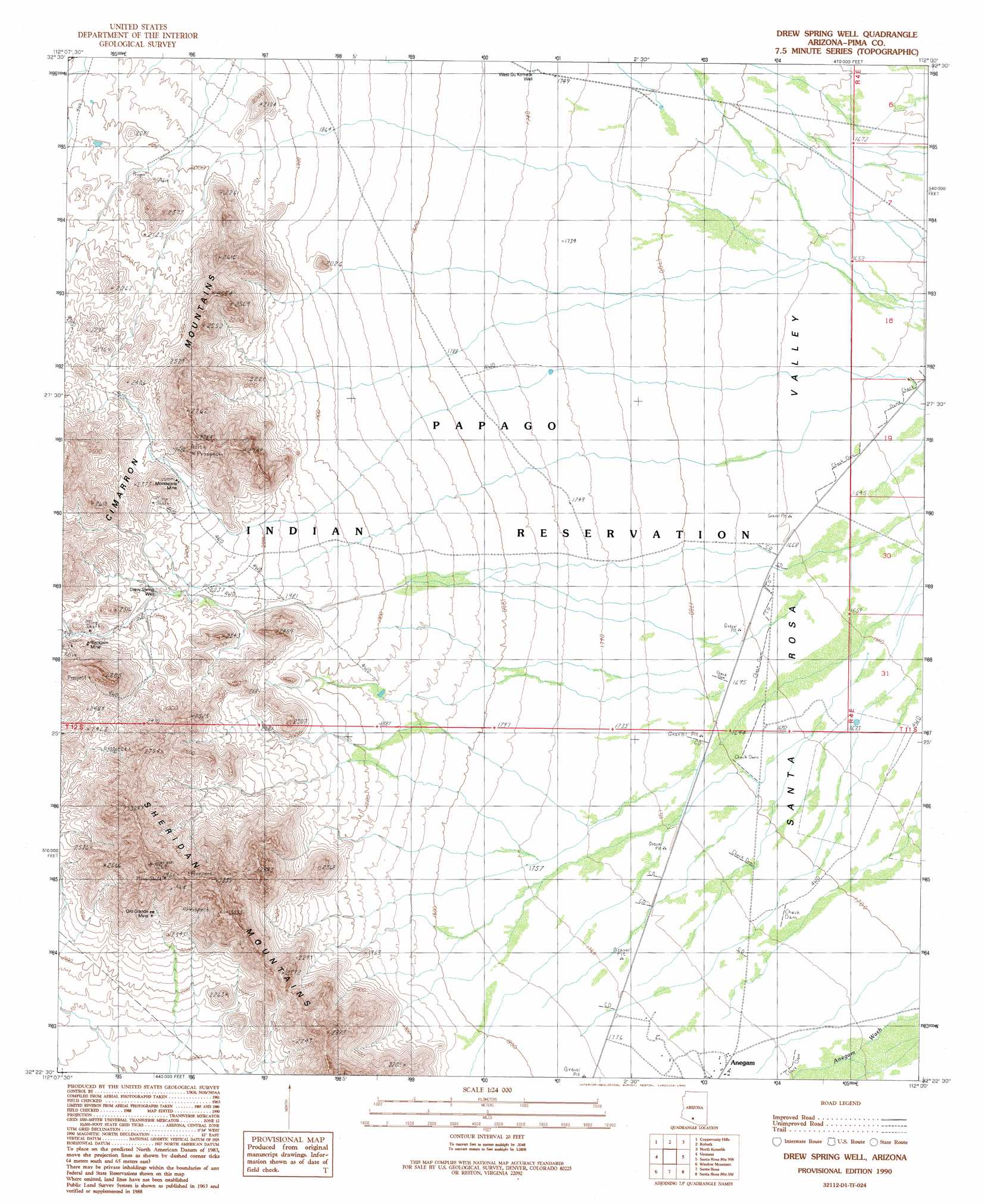
Drew Spring Well Topo Map Arizona
To zoom in, hover over the map of Drew Spring Well
USGS Topo Quad 32112d1 - 1:24,000 scale
| Topo Map Name: | Drew Spring Well |
| USGS Topo Quad ID: | 32112d1 |
| Print Size: | ca. 21 1/4" wide x 27" high |
| Southeast Coordinates: | 32.375° N latitude / 112° W longitude |
| Map Center Coordinates: | 32.4375° N latitude / 112.0625° W longitude |
| U.S. State: | AZ |
| Filename: | o32112d1.jpg |
| Download Map JPG Image: | Drew Spring Well topo map 1:24,000 scale |
| Map Type: | Topographic |
| Topo Series: | 7.5´ |
| Map Scale: | 1:24,000 |
| Source of Map Images: | United States Geological Survey (USGS) |
| Alternate Map Versions: |
Drew Spring Well AZ 1990, updated 1990 Download PDF Buy paper map Drew Spring Well AZ 1996, updated 2003 Download PDF Buy paper map Drew Spring Well AZ 2011 Download PDF Buy paper map Drew Spring Well AZ 2014 Download PDF Buy paper map |
1:24,000 Topo Quads surrounding Drew Spring Well
Johnson Well |
Little Table Top |
Vekol Mountains Ne |
Vaiva Vo |
Silver Reef Mountains |
Kaka |
Copperosity Hills |
Kohatk |
North Komelik |
Silver Reef Mountains Se |
West Of Ventana |
Ventana |
Drew Spring Well |
Santa Rosa Mountains Nw |
Santa Rosa Mountains Ne |
Vaya Chin |
Window Mountain |
Gu Achi |
Santa Rosa Mountains Sw |
Santa Rosa Mountains Se |
Wahak Hotrontk |
Maish Vaya |
Gurli Put Vo |
Sand Wells |
Sil Nakya |
> Back to 32112a1 at 1:100,000 scale
> Back to 32112a1 at 1:250,000 scale
> Back to U.S. Topo Maps home
Drew Spring Well topo map: Gazetteer
Drew Spring Well: Mines
Blackjack Mine elevation 664m 2178′Montazona Mine elevation 673m 2208′
Oro Grande Mine elevation 735m 2411′
Drew Spring Well: Summits
Sheridan Mountains elevation 975m 3198′Drew Spring Well: Wells
Drew Spring Well elevation 635m 2083′Drew Spring Well digital topo map on disk
Buy this Drew Spring Well topo map showing relief, roads, GPS coordinates and other geographical features, as a high-resolution digital map file on DVD: