Ventana Topo Map Arizona
To zoom in, hover over the map of Ventana
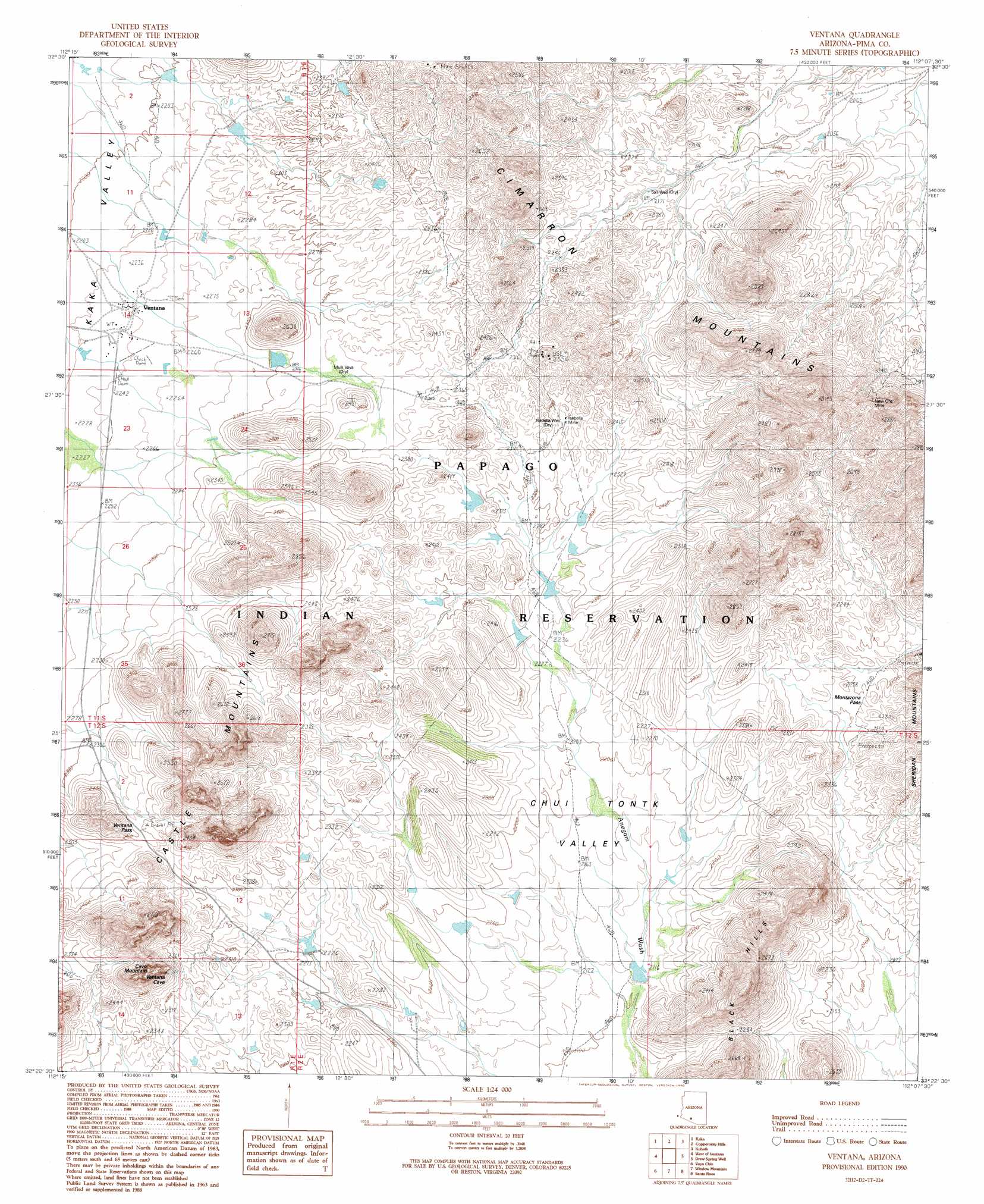
USGS Topo Quad 32112d2 - 1:24,000 scale
| Topo Map Name: | Ventana |
| USGS Topo Quad ID: | 32112d2 |
| Print Size: | ca. 21 1/4" wide x 27" high |
| Southeast Coordinates: | 32.375° N latitude / 112.125° W longitude |
| Map Center Coordinates: | 32.4375° N latitude / 112.1875° W longitude |
| U.S. State: | AZ |
| Filename: | o32112d2.jpg |
| Download Map JPG Image: | Ventana topo map 1:24,000 scale |
| Map Type: | Topographic |
| Topo Series: | 7.5´ |
| Map Scale: | 1:24,000 |
| Source of Map Images: | United States Geological Survey (USGS) |
| Alternate Map Versions: |
Ventana AZ 1990, updated 1990 Download PDF Buy paper map Ventana AZ 1996, updated 2003 Download PDF Buy paper map Ventana AZ 2011 Download PDF Buy paper map Ventana AZ 2014 Download PDF Buy paper map |
1:24,000 Topo Quads surrounding Ventana
Kaka Nw |
Johnson Well |
Little Table Top |
Vekol Mountains Ne |
Vaiva Vo |
Moi Vaya |
Kaka |
Copperosity Hills |
Kohatk |
North Komelik |
Cimarron Peak |
West Of Ventana |
Ventana |
Drew Spring Well |
Santa Rosa Mountains Nw |
Hickiwan |
Vaya Chin |
Window Mountain |
Gu Achi |
Santa Rosa Mountains Sw |
West Of Wahak Hotrontk |
Wahak Hotrontk |
Maish Vaya |
Gurli Put Vo |
Sand Wells |
> Back to 32112a1 at 1:100,000 scale
> Back to 32112a1 at 1:250,000 scale
> Back to U.S. Topo Maps home
Ventana topo map: Gazetteer
Ventana: Areas
Muik Vaya elevation 708m 2322′Ventana: Basins
Chui Tontk Valley elevation 664m 2178′Ventana: Gaps
Montazona Pass elevation 674m 2211′Ventana Pass elevation 719m 2358′
Ventana: Mines
Isabella Mine elevation 724m 2375′New Ore Mine elevation 821m 2693′
Ventana: Populated Places
Ventana elevation 682m 2237′Ventana: Summits
Black Hills elevation 888m 2913′Castle Mountains elevation 880m 2887′
Cave Mountain elevation 898m 2946′
Cimarron Mountains elevation 863m 2831′
Ventana: Wells
Isabella Well elevation 721m 2365′Ventana digital topo map on disk
Buy this Ventana topo map showing relief, roads, GPS coordinates and other geographical features, as a high-resolution digital map file on DVD: