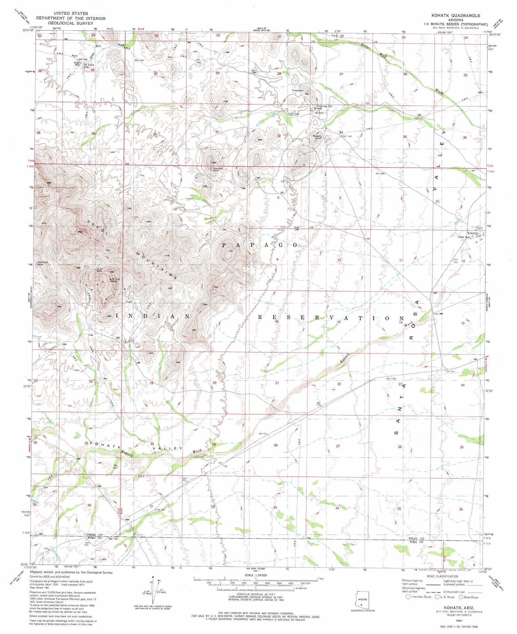
Kohatk Topo Map Arizona
To zoom in, hover over the map of Kohatk
USGS Topo Quad 32112e1 - 1:24,000 scale
| Topo Map Name: | Kohatk |
| USGS Topo Quad ID: | 32112e1 |
| Print Size: | ca. 21 1/4" wide x 27" high |
| Southeast Coordinates: | 32.5° N latitude / 112° W longitude |
| Map Center Coordinates: | 32.5625° N latitude / 112.0625° W longitude |
| U.S. State: | AZ |
| Filename: | o32112e1.jpg |
| Download Map JPG Image: | Kohatk topo map 1:24,000 scale |
| Map Type: | Topographic |
| Topo Series: | 7.5´ |
| Map Scale: | 1:24,000 |
| Source of Map Images: | United States Geological Survey (USGS) |
| Alternate Map Versions: |
Kohatk AZ 1981, updated 1981 Download PDF Buy paper map Kohatk AZ 1996, updated 2003 Download PDF Buy paper map Kohatk AZ 2011 Download PDF Buy paper map Kohatk AZ 2014 Download PDF Buy paper map |
1:24,000 Topo Quads surrounding Kohatk
Lost Horse Peak |
Antelope Peak |
Indian Butte |
Double Peak |
Chuichu |
Johnson Well |
Little Table Top |
Vekol Mountains Ne |
Vaiva Vo |
Silver Reef Mountains |
Kaka |
Copperosity Hills |
Kohatk |
North Komelik |
Silver Reef Mountains Se |
West Of Ventana |
Ventana |
Drew Spring Well |
Santa Rosa Mountains Nw |
Santa Rosa Mountains Ne |
Vaya Chin |
Window Mountain |
Gu Achi |
Santa Rosa Mountains Sw |
Santa Rosa Mountains Se |
> Back to 32112e1 at 1:100,000 scale
> Back to 32112a1 at 1:250,000 scale
> Back to U.S. Topo Maps home
Kohatk topo map: Gazetteer
Kohatk: Mines
Christmas Gift Mine elevation 543m 1781′Hill Top Mine elevation 957m 3139′
Le La Mine elevation 796m 2611′
Red Chief Mine elevation 661m 2168′
Reward Mine elevation 537m 1761′
Spundulic Mine elevation 685m 2247′
Kohatk: Populated Places
Kohatk elevation 500m 1640′Sif Vaya elevation 599m 1965′
Kohatk: Ranges
Vekol Mountains elevation 1018m 3339′Kohatk: Valleys
Kohatk Valley elevation 550m 1804′Kohatk: Wells
Bitter Well elevation 598m 1961′Kohatk Well elevation 498m 1633′
Kohatk digital topo map on disk
Buy this Kohatk topo map showing relief, roads, GPS coordinates and other geographical features, as a high-resolution digital map file on DVD: