Antelope Peak Ne Topo Map Arizona
To zoom in, hover over the map of Antelope Peak Ne
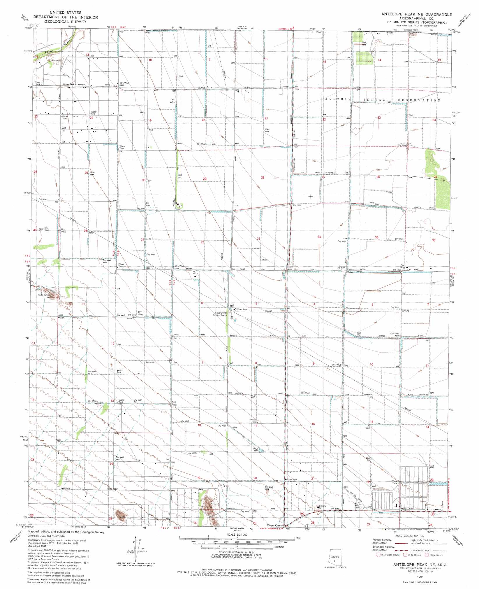
USGS Topo Quad 32112h1 - 1:24,000 scale
| Topo Map Name: | Antelope Peak Ne |
| USGS Topo Quad ID: | 32112h1 |
| Print Size: | ca. 21 1/4" wide x 27" high |
| Southeast Coordinates: | 32.875° N latitude / 112° W longitude |
| Map Center Coordinates: | 32.9375° N latitude / 112.0625° W longitude |
| U.S. State: | AZ |
| Filename: | o32112h1.jpg |
| Download Map JPG Image: | Antelope Peak Ne topo map 1:24,000 scale |
| Map Type: | Topographic |
| Topo Series: | 7.5´ |
| Map Scale: | 1:24,000 |
| Source of Map Images: | United States Geological Survey (USGS) |
| Alternate Map Versions: |
Antelope Peak NE AZ 1971, updated 1972 Download PDF Buy paper map Antelope Peak NE AZ 1981, updated 1982 Download PDF Buy paper map Antelope Peak NE AZ 1981, updated 1992 Download PDF Buy paper map Antelope Peak NE AZ 2011 Download PDF Buy paper map Antelope Peak NE AZ 2014 Download PDF Buy paper map |
1:24,000 Topo Quads surrounding Antelope Peak Ne
Mobile Ne |
Montezuma Peak |
Pima Butte |
Gila Butte Nw |
Gila Butte |
Mobile |
Enid |
Maricopa |
Sacaton Butte |
Gila Butte Se |
Conley Well |
Haley Hills |
Antelope Peak Ne |
Stanfield |
Casa Grande West |
Lost Horse Peak |
Antelope Peak |
Indian Butte |
Double Peak |
Chuichu |
Johnson Well |
Little Table Top |
Vekol Mountains Ne |
Vaiva Vo |
Silver Reef Mountains |
> Back to 32112e1 at 1:100,000 scale
> Back to 32112a1 at 1:250,000 scale
> Back to U.S. Topo Maps home
Antelope Peak Ne topo map: Gazetteer
Antelope Peak Ne: Airports
Ak Chin Community Airfield elevation 372m 1220′Ak Chin Community Airfield elevation 372m 1220′
Antelope Peak Ne: Populated Places
Peters Corner elevation 421m 1381′Antelope Peak Ne digital topo map on disk
Buy this Antelope Peak Ne topo map showing relief, roads, GPS coordinates and other geographical features, as a high-resolution digital map file on DVD: