Haley Hills Topo Map Arizona
To zoom in, hover over the map of Haley Hills
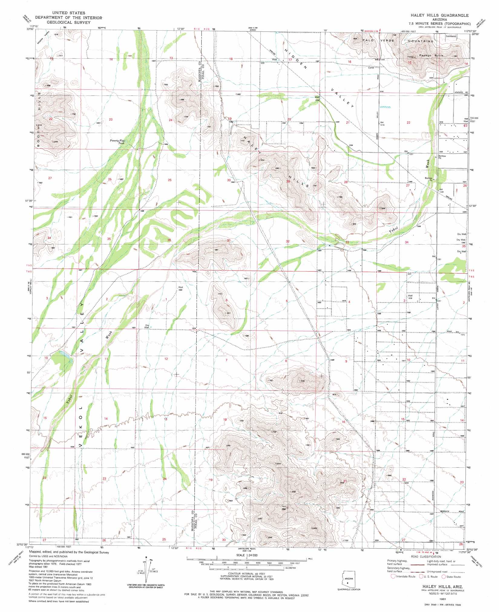
USGS Topo Quad 32112h2 - 1:24,000 scale
| Topo Map Name: | Haley Hills |
| USGS Topo Quad ID: | 32112h2 |
| Print Size: | ca. 21 1/4" wide x 27" high |
| Southeast Coordinates: | 32.875° N latitude / 112.125° W longitude |
| Map Center Coordinates: | 32.9375° N latitude / 112.1875° W longitude |
| U.S. State: | AZ |
| Filename: | o32112h2.jpg |
| Download Map JPG Image: | Haley Hills topo map 1:24,000 scale |
| Map Type: | Topographic |
| Topo Series: | 7.5´ |
| Map Scale: | 1:24,000 |
| Source of Map Images: | United States Geological Survey (USGS) |
| Alternate Map Versions: |
Haley Hills AZ 1981, updated 1981 Download PDF Buy paper map Haley Hills AZ 2011 Download PDF Buy paper map Haley Hills AZ 2014 Download PDF Buy paper map |
1:24,000 Topo Quads surrounding Haley Hills
Mobile Nw |
Mobile Ne |
Montezuma Peak |
Pima Butte |
Gila Butte Nw |
Butterfield Pass |
Mobile |
Enid |
Maricopa |
Sacaton Butte |
Estrella |
Conley Well |
Haley Hills |
Antelope Peak Ne |
Stanfield |
Big Horn |
Lost Horse Peak |
Antelope Peak |
Indian Butte |
Double Peak |
Kaka Nw |
Johnson Well |
Little Table Top |
Vekol Mountains Ne |
Vaiva Vo |
> Back to 32112e1 at 1:100,000 scale
> Back to 32112a1 at 1:250,000 scale
> Back to U.S. Topo Maps home
Haley Hills topo map: Gazetteer
Haley Hills: Airports
Donnelly Residence Airport elevation 460m 1509′G M Ranch Airport elevation 488m 1601′
Haley Hills: Reservoirs
Poverty Flat Tank elevation 445m 1459′Haley Hills: Summits
Booth Hills elevation 533m 1748′Haley Hills elevation 576m 1889′
Papago Butte elevation 481m 1578′
Haley Hills: Valleys
Hidden Valley elevation 403m 1322′Vekol Valley elevation 471m 1545′
Haley Hills: Wells
Dry Well elevation 467m 1532′Haley Hills digital topo map on disk
Buy this Haley Hills topo map showing relief, roads, GPS coordinates and other geographical features, as a high-resolution digital map file on DVD: