Antelope Hills Topo Map Arizona
To zoom in, hover over the map of Antelope Hills
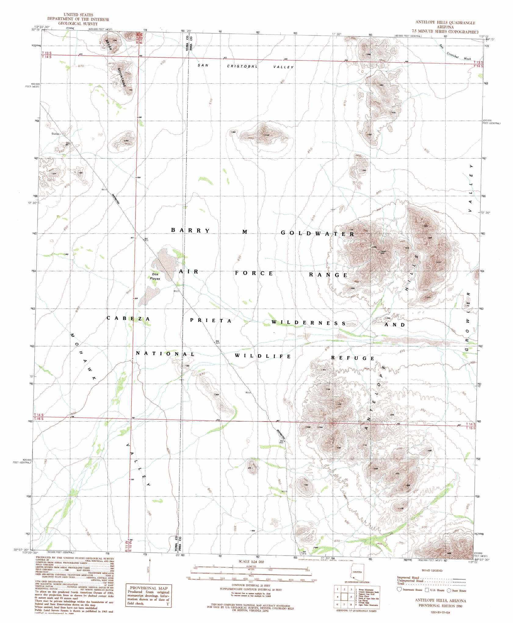
USGS Topo Quad 32113b3 - 1:24,000 scale
| Topo Map Name: | Antelope Hills |
| USGS Topo Quad ID: | 32113b3 |
| Print Size: | ca. 21 1/4" wide x 27" high |
| Southeast Coordinates: | 32.125° N latitude / 113.25° W longitude |
| Map Center Coordinates: | 32.1875° N latitude / 113.3125° W longitude |
| U.S. State: | AZ |
| Filename: | o32113b3.jpg |
| Download Map JPG Image: | Antelope Hills topo map 1:24,000 scale |
| Map Type: | Topographic |
| Topo Series: | 7.5´ |
| Map Scale: | 1:24,000 |
| Source of Map Images: | United States Geological Survey (USGS) |
| Alternate Map Versions: |
Antelope Hills AZ 1990, updated 1990 Download PDF Buy paper map Antelope Hills AZ 1996, updated 2000 Download PDF Buy paper map Antelope Hills AZ 2011 Download PDF Buy paper map Antelope Hills AZ 2014 Download PDF Buy paper map |
1:24,000 Topo Quads surrounding Antelope Hills
North Of Isla Pinta |
Monreal Well |
Granite Mountains North |
West Of Growler Peak |
Growler Peak |
Isla Pinta |
Bryan Mountains |
Granite Mountains South |
Saguaro Gap Well |
Temporal Pass |
Paradise Canyon |
Pinta Playa |
Antelope Hills |
North Of Agua Dulce Mountains |
Palo Verde Camp |
Monument Bluff |
Las Playas |
O'Neill Hills |
Agua Dulce Mountains |
Pozo Nuevo Well |
West Of Quitobaquito Springs |
Quitobaquito Springs |
> Back to 32113a1 at 1:100,000 scale
> Back to 32112a1 at 1:250,000 scale
> Back to U.S. Topo Maps home
Antelope Hills topo map: Gazetteer
Antelope Hills: Plains
Dos Playas elevation 247m 810′Antelope Hills: Summits
Antelope Hills elevation 426m 1397′Antelope Hills digital topo map on disk
Buy this Antelope Hills topo map showing relief, roads, GPS coordinates and other geographical features, as a high-resolution digital map file on DVD: