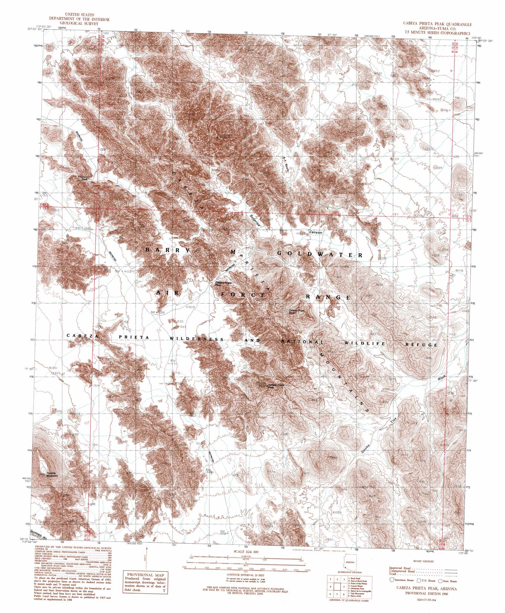
Cabeza Prieta Peak Topo Map Arizona
To zoom in, hover over the map of Cabeza Prieta Peak
USGS Topo Quad 32113c7 - 1:24,000 scale
| Topo Map Name: | Cabeza Prieta Peak |
| USGS Topo Quad ID: | 32113c7 |
| Print Size: | ca. 21 1/4" wide x 27" high |
| Southeast Coordinates: | 32.25° N latitude / 113.75° W longitude |
| Map Center Coordinates: | 32.3125° N latitude / 113.8125° W longitude |
| U.S. State: | AZ |
| Filename: | o32113c7.jpg |
| Download Map JPG Image: | Cabeza Prieta Peak topo map 1:24,000 scale |
| Map Type: | Topographic |
| Topo Series: | 7.5´ |
| Map Scale: | 1:24,000 |
| Source of Map Images: | United States Geological Survey (USGS) |
| Alternate Map Versions: |
Cabeza Prieta Peak AZ 1990 Download PDF Buy paper map Cabeza Prieta Peak AZ 1996, updated 2000 Download PDF Buy paper map Cabeza Prieta Peak AZ 2011 Download PDF Buy paper map Cabeza Prieta Peak AZ 2014 Download PDF Buy paper map |
1:24,000 Topo Quads surrounding Cabeza Prieta Peak
Wellton Se |
Mohawk Sw |
Mohawk Se |
Mohawk Mountains Sw |
Mohawk Mountains Se |
Raven Butte |
Buck Peak |
East Of Buck Peak |
Point Of The Pintas |
North Of Isla Pinta |
Tinajas Altas |
Coyote Water |
Cabeza Prieta Peak |
Christmas Pass |
Isla Pinta |
Sierra De La Lechuguilla |
Tule Mountains |
Sierra Arida |
Paradise Canyon |
|
Monument Bluff |
> Back to 32113a1 at 1:100,000 scale
> Back to 32112a1 at 1:250,000 scale
> Back to U.S. Topo Maps home
Cabeza Prieta Peak topo map: Gazetteer
Cabeza Prieta Peak: Basins
A-one Basin elevation 373m 1223′Halfway Tank elevation 435m 1427′
Cabeza Prieta Peak: Gaps
Cabeza Prieta Pass elevation 458m 1502′Cabeza Prieta Peak: Ranges
Cabeza Prieta Mountains elevation 826m 2709′Cabeza Prieta Peak: Reservoirs
Cabeza Prieta Tanks elevation 470m 1541′Cabeza Prieta Peak: Summits
Cabeza Prieta Peak elevation 752m 2467′Tordillo Mountain elevation 629m 2063′
Cabeza Prieta Peak: Valleys
Surprise Canyon elevation 353m 1158′Cabeza Prieta Peak digital topo map on disk
Buy this Cabeza Prieta Peak topo map showing relief, roads, GPS coordinates and other geographical features, as a high-resolution digital map file on DVD: