Aztec Hills Topo Map Arizona
To zoom in, hover over the map of Aztec Hills
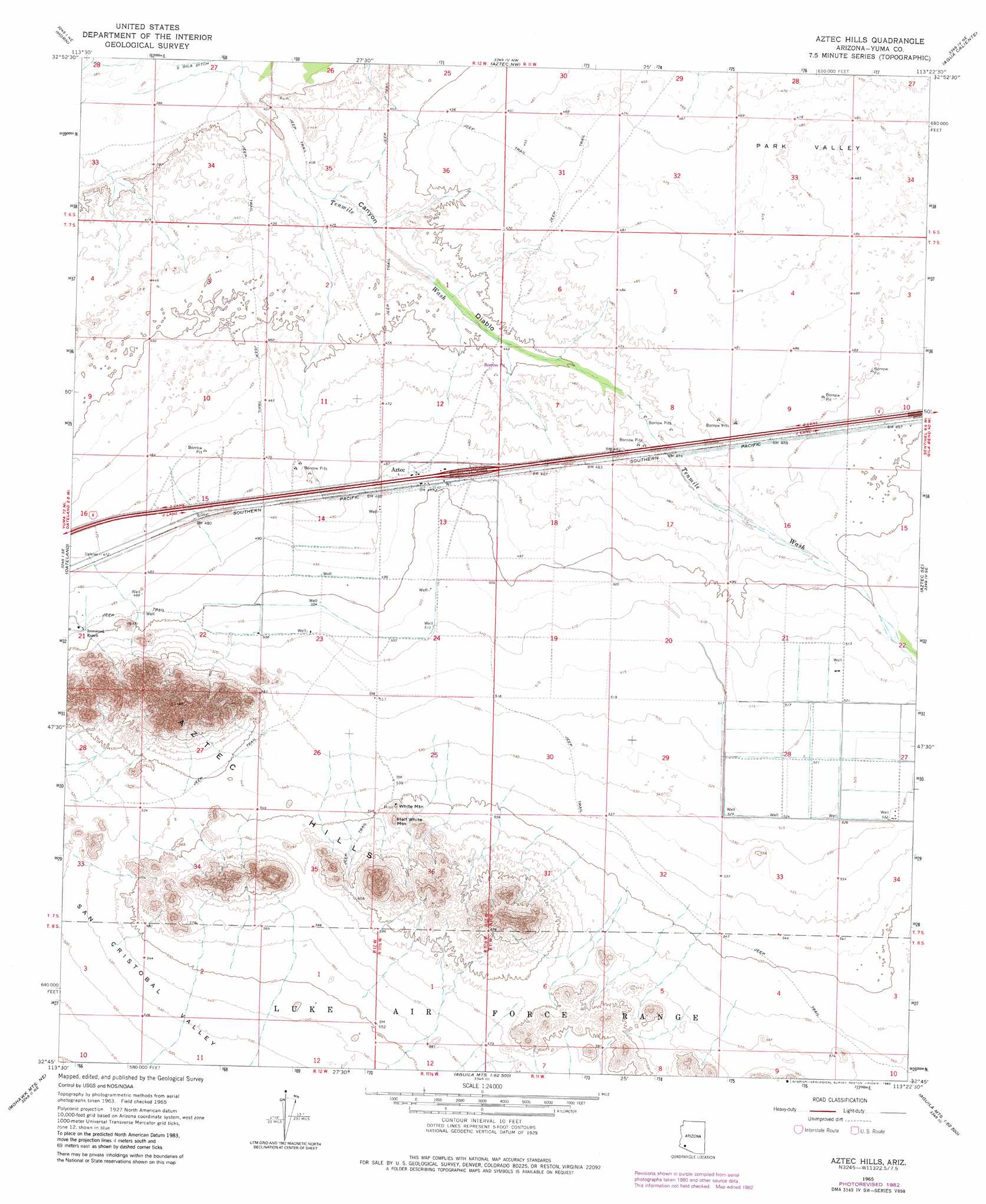
USGS Topo Quad 32113g4 - 1:24,000 scale
| Topo Map Name: | Aztec Hills |
| USGS Topo Quad ID: | 32113g4 |
| Print Size: | ca. 21 1/4" wide x 27" high |
| Southeast Coordinates: | 32.75° N latitude / 113.375° W longitude |
| Map Center Coordinates: | 32.8125° N latitude / 113.4375° W longitude |
| U.S. State: | AZ |
| Filename: | o32113g4.jpg |
| Download Map JPG Image: | Aztec Hills topo map 1:24,000 scale |
| Map Type: | Topographic |
| Topo Series: | 7.5´ |
| Map Scale: | 1:24,000 |
| Source of Map Images: | United States Geological Survey (USGS) |
| Alternate Map Versions: |
Aztec Hills AZ 1965, updated 1966 Download PDF Buy paper map Aztec Hills AZ 1965, updated 1982 Download PDF Buy paper map Aztec Hills AZ 2011 Download PDF Buy paper map Aztec Hills AZ 2014 Download PDF Buy paper map |
1:24,000 Topo Quads surrounding Aztec Hills
Palomas Mountains Sw |
Palomas Mountains Se |
Baragan Mountain |
Hyder |
Oatman Mountain |
Kofa |
Horn |
Aztec Nw |
Agua Caliente |
Sentinel Peak |
Texas Hill |
Dateland |
Aztec Hills |
Aztec Se |
Sentinel |
Mohawk Mountains Nw |
Hohawk Mountains Ne |
Aguila Mountains Nw |
Aguila Mountains Ne |
South Of Sentinel |
Mohawk Mountains Sw |
Mohawk Mountains Se |
Aguila Mountains Sw |
Aguila Mountains Se |
Okie Well |
> Back to 32113e1 at 1:100,000 scale
> Back to 32112a1 at 1:250,000 scale
> Back to U.S. Topo Maps home
Aztec Hills topo map: Gazetteer
Aztec Hills: Crossings
Aztec Interchange elevation 153m 501′Aztec Hills: Populated Places
Aztec elevation 151m 495′Aztec Hills: Streams
Tenmile Wash elevation 121m 396′Aztec Hills: Summits
Aztec Hills elevation 259m 849′Half White Mountain elevation 187m 613′
White Mountain elevation 177m 580′
Aztec Hills: Valleys
Canyon Diablo elevation 121m 396′Aztec Hills digital topo map on disk
Buy this Aztec Hills topo map showing relief, roads, GPS coordinates and other geographical features, as a high-resolution digital map file on DVD: