Growler Topo Map Arizona
To zoom in, hover over the map of Growler
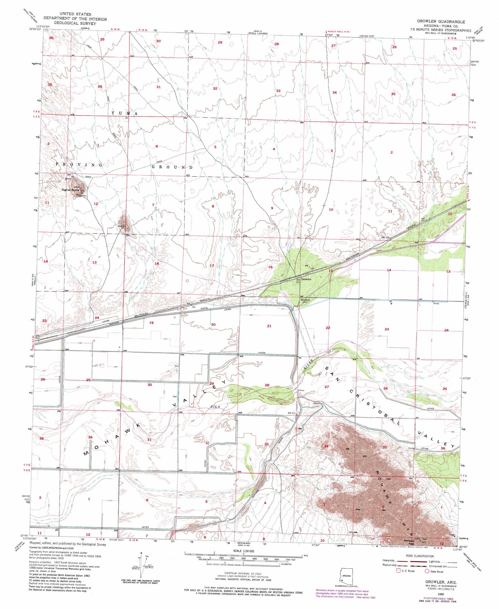
USGS Topo Quad 32113g7 - 1:24,000 scale
| Topo Map Name: | Growler |
| USGS Topo Quad ID: | 32113g7 |
| Print Size: | ca. 21 1/4" wide x 27" high |
| Southeast Coordinates: | 32.75° N latitude / 113.75° W longitude |
| Map Center Coordinates: | 32.8125° N latitude / 113.8125° W longitude |
| U.S. State: | AZ |
| Filename: | o32113g7.jpg |
| Download Map JPG Image: | Growler topo map 1:24,000 scale |
| Map Type: | Topographic |
| Topo Series: | 7.5´ |
| Map Scale: | 1:24,000 |
| Source of Map Images: | United States Geological Survey (USGS) |
| Alternate Map Versions: |
Growler AZ 1955, updated 1956 Download PDF Buy paper map Growler AZ 1955, updated 1975 Download PDF Buy paper map Growler AZ 1955, updated 1982 Download PDF Buy paper map Growler AZ 2011 Download PDF Buy paper map Growler AZ 2014 Download PDF Buy paper map |
1:24,000 Topo Quads surrounding Growler
Slumgullion Pass |
Engesser Pass Sw |
Neversweat Ridge |
Palomas Mountains Sw |
Palomas Mountains Se |
Salton Tanks |
North Of Roll |
Mesquite Jim Well |
Kofa |
Horn |
Red Bluff Mountain East |
Roll |
Growler |
Texas Hill |
Dateland |
Wellton Mesa |
Tacna |
Mohawk |
Mohawk Mountains Nw |
Hohawk Mountains Ne |
Wellton Se |
Mohawk Sw |
Mohawk Se |
Mohawk Mountains Sw |
Mohawk Mountains Se |
> Back to 32113e1 at 1:100,000 scale
> Back to 32112a1 at 1:250,000 scale
> Back to U.S. Topo Maps home
Growler topo map: Gazetteer
Growler: Mines
Ruby Mine elevation 155m 508′Growler: Populated Places
Growler elevation 98m 321′Norton elevation 96m 314′
Growler: Summits
Signal Butte elevation 0m 0′Growler digital topo map on disk
Buy this Growler topo map showing relief, roads, GPS coordinates and other geographical features, as a high-resolution digital map file on DVD: