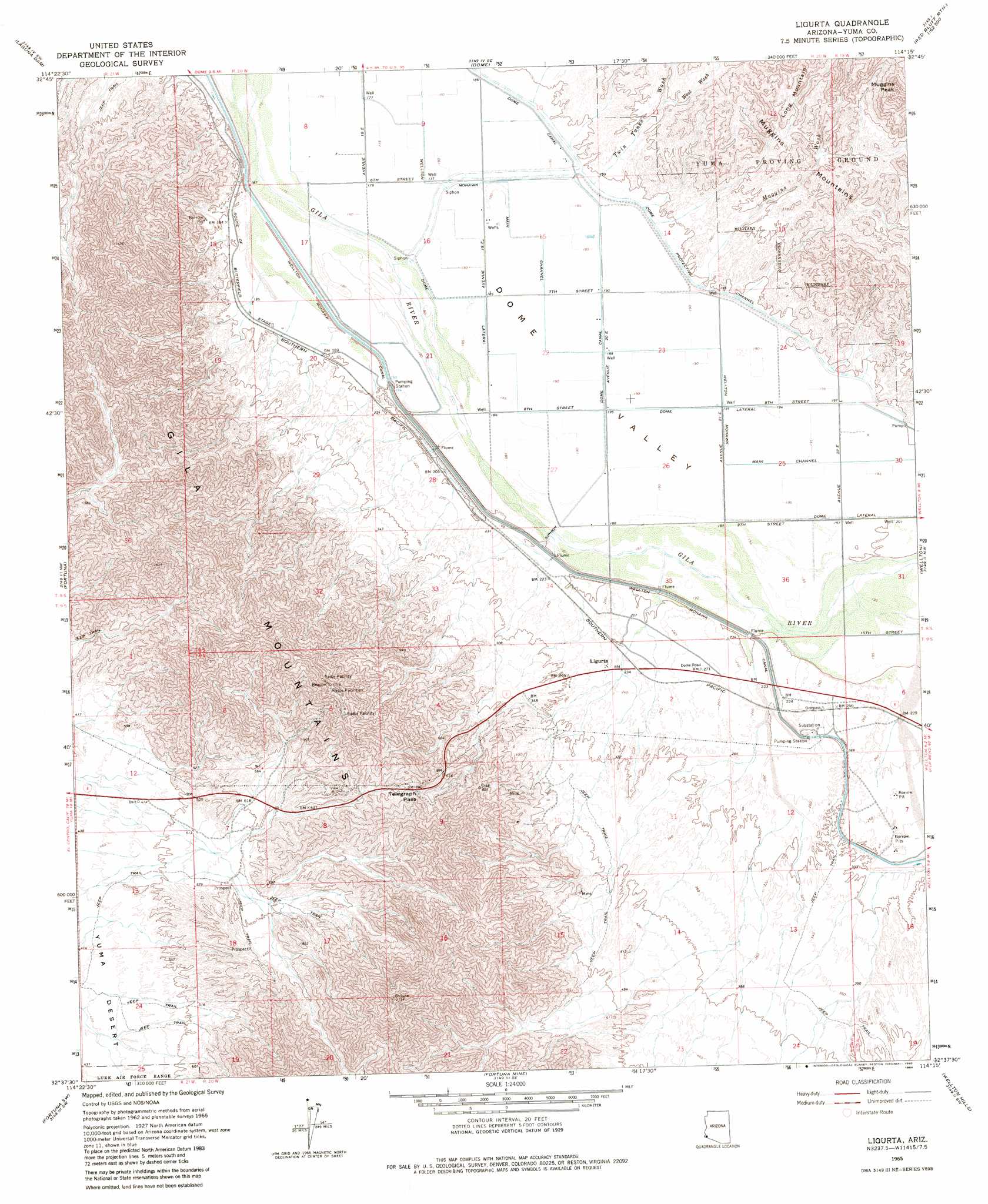
Ligurta Topo Map Arizona
To zoom in, hover over the map of Ligurta
USGS Topo Quad 32114f3 - 1:24,000 scale
| Topo Map Name: | Ligurta |
| USGS Topo Quad ID: | 32114f3 |
| Print Size: | ca. 21 1/4" wide x 27" high |
| Southeast Coordinates: | 32.625° N latitude / 114.25° W longitude |
| Map Center Coordinates: | 32.6875° N latitude / 114.3125° W longitude |
| U.S. State: | AZ |
| Filename: | o32114f3.jpg |
| Download Map JPG Image: | Ligurta topo map 1:24,000 scale |
| Map Type: | Topographic |
| Topo Series: | 7.5´ |
| Map Scale: | 1:24,000 |
| Source of Map Images: | United States Geological Survey (USGS) |
| Alternate Map Versions: |
Ligurta AZ 1965, updated 1966 Download PDF Buy paper map Ligurta AZ 1965, updated 1980 Download PDF Buy paper map Ligurta AZ 1965, updated 1984 Download PDF Buy paper map Ligurta AZ 2011 Download PDF Buy paper map Ligurta AZ 2014 Download PDF Buy paper map |
1:24,000 Topo Quads surrounding Ligurta
Little Picacho Peak |
Imperial Reservoir |
Middle Mountains South |
Red Bluff Mountain Nw |
Salton Tanks |
Bard |
Laguna Dam |
Dome |
Red Bluff Mountain West |
Red Bluff Mountain East |
Yuma East |
Fortuna |
Ligurta |
Wellton |
Wellton Mesa |
Yuma Se |
Fortuna Sw |
Fortuna Mine |
Wellton Hills |
Wellton Se |
Southeast Of Somerton |
West Of Vopoki Ridge |
Vopoki Ridge |
Cipriano Pass |
Raven Butte |
> Back to 32114e1 at 1:100,000 scale
> Back to 32114a1 at 1:250,000 scale
> Back to U.S. Topo Maps home
Ligurta topo map: Gazetteer
Ligurta: Canals
Dome Protective Channel elevation 60m 196′Ligurta: Gaps
Telegraph Pass elevation 240m 787′Ligurta: Populated Places
Ligurta elevation 71m 232′Ligurta: Streams
Muggins Wash elevation 60m 196′Twin Tanks Wash elevation 60m 196′
West Wash elevation 89m 291′
Ligurta: Summits
Muggins Peak elevation 410m 1345′Ligurta: Trails
Route of Butterfield Stage elevation 0m 0′Ligurta: Valleys
Dome Valley elevation 54m 177′Ligurta digital topo map on disk
Buy this Ligurta topo map showing relief, roads, GPS coordinates and other geographical features, as a high-resolution digital map file on DVD: