Fortuna Topo Map Arizona
To zoom in, hover over the map of Fortuna
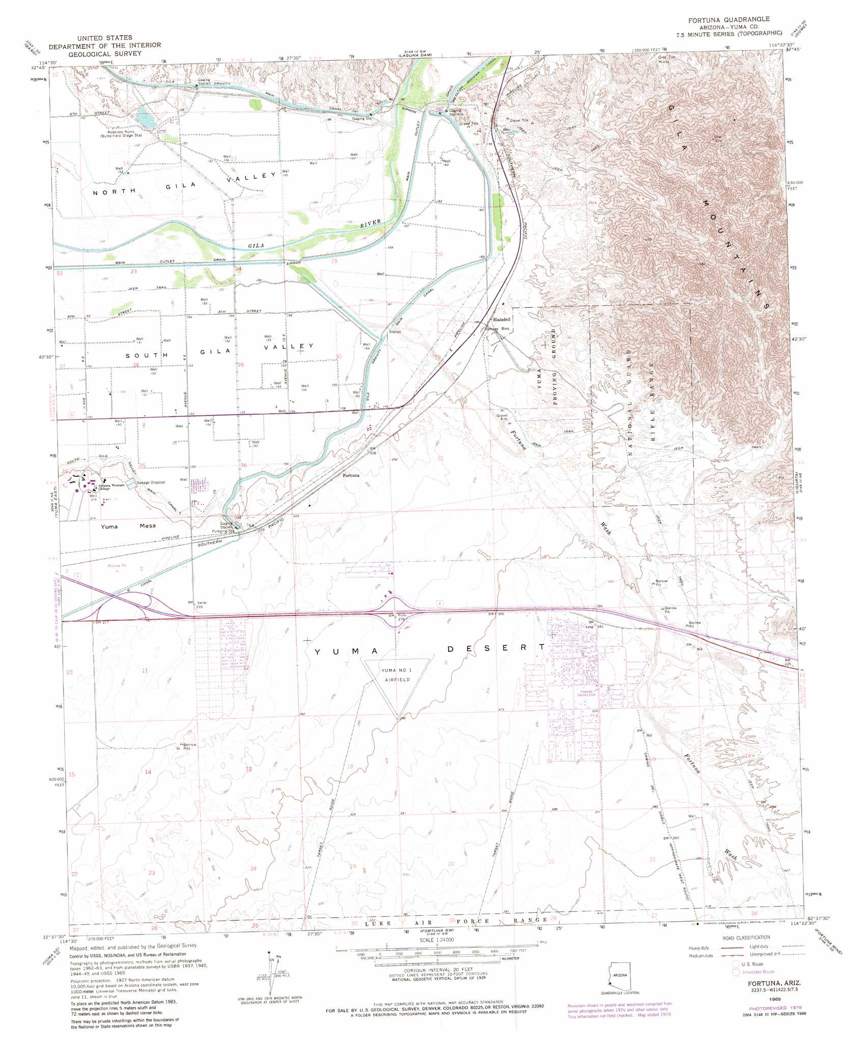
USGS Topo Quad 32114f4 - 1:24,000 scale
| Topo Map Name: | Fortuna |
| USGS Topo Quad ID: | 32114f4 |
| Print Size: | ca. 21 1/4" wide x 27" high |
| Southeast Coordinates: | 32.625° N latitude / 114.375° W longitude |
| Map Center Coordinates: | 32.6875° N latitude / 114.4375° W longitude |
| U.S. State: | AZ |
| Filename: | o32114f4.jpg |
| Download Map JPG Image: | Fortuna topo map 1:24,000 scale |
| Map Type: | Topographic |
| Topo Series: | 7.5´ |
| Map Scale: | 1:24,000 |
| Source of Map Images: | United States Geological Survey (USGS) |
| Alternate Map Versions: |
Fortuna AZ 1965, updated 1966 Download PDF Buy paper map Fortuna AZ 1965, updated 1975 Download PDF Buy paper map Fortuna AZ 1965, updated 1979 Download PDF Buy paper map Fortuna AZ 1965, updated 1979 Download PDF Buy paper map Fortuna AZ 2011 Download PDF Buy paper map Fortuna AZ 2014 Download PDF Buy paper map |
1:24,000 Topo Quads surrounding Fortuna
Picacho Peak |
Little Picacho Peak |
Imperial Reservoir |
Middle Mountains South |
Red Bluff Mountain Nw |
Araz |
Bard |
Laguna Dam |
Dome |
Red Bluff Mountain West |
Yuma West |
Yuma East |
Fortuna |
Ligurta |
Wellton |
Somerton |
Yuma Se |
Fortuna Sw |
Fortuna Mine |
Wellton Hills |
South Of Somerton |
Southeast Of Somerton |
West Of Vopoki Ridge |
Vopoki Ridge |
Cipriano Pass |
> Back to 32114e1 at 1:100,000 scale
> Back to 32114a1 at 1:250,000 scale
> Back to U.S. Topo Maps home
Fortuna topo map: Gazetteer
Fortuna: Airports
Yuma Number One Airfield elevation 92m 301′Fortuna: Canals
Main Outlet Drain elevation 45m 147′Fortuna: Crossings
East Yuma Interchange elevation 65m 213′Fortuna Interchange elevation 85m 278′
Fortuna: Mines
Grey Fox Mines elevation 69m 226′Fortuna: Populated Places
Blaisdell elevation 55m 180′Fortuna elevation 68m 223′
Fortuna Foothills elevation 102m 334′
Fortuna: Streams
Fortuna Wash elevation 51m 167′Fortuna: Wells
Imperial Well elevation 50m 164′Fortuna digital topo map on disk
Buy this Fortuna topo map showing relief, roads, GPS coordinates and other geographical features, as a high-resolution digital map file on DVD: