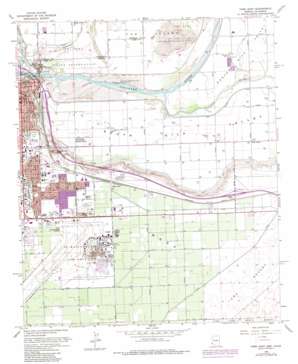
Yuma East Topo Map Arizona
To zoom in, hover over the map of Yuma East
USGS Topo Quad 32114f5 - 1:24,000 scale
| Topo Map Name: | Yuma East |
| USGS Topo Quad ID: | 32114f5 |
| Print Size: | ca. 21 1/4" wide x 27" high |
| Southeast Coordinates: | 32.625° N latitude / 114.5° W longitude |
| Map Center Coordinates: | 32.6875° N latitude / 114.5625° W longitude |
| U.S. States: | AZ, CA |
| Filename: | o32114f5.jpg |
| Download Map JPG Image: | Yuma East topo map 1:24,000 scale |
| Map Type: | Topographic |
| Topo Series: | 7.5´ |
| Map Scale: | 1:24,000 |
| Source of Map Images: | United States Geological Survey (USGS) |
| Alternate Map Versions: |
Yuma East AZ 1952, updated 1953 Download PDF Buy paper map Yuma East AZ 1965, updated 1966 Download PDF Buy paper map Yuma East AZ 1965, updated 1975 Download PDF Buy paper map Yuma East AZ 1965, updated 1979 Download PDF Buy paper map Yuma East AZ 1994, updated 1998 Download PDF Buy paper map Yuma East AZ 2011 Download PDF Buy paper map Yuma East AZ 2014 Download PDF Buy paper map |
1:24,000 Topo Quads surrounding Yuma East
> Back to 32114e1 at 1:100,000 scale
> Back to 32114a1 at 1:250,000 scale
> Back to U.S. Topo Maps home
Yuma East topo map: Gazetteer
Yuma East: Airports
Yuma Helicopters elevation 57m 187′Yuma International Airport elevation 57m 187′
Yuma East: Canals
B 3.7 Lateral elevation 65m 213′B 3.8 Lateral elevation 65m 213′
B 5.5 W Lateral elevation 65m 213′
B 6.2 E Lateral elevation 65m 213′
B 7.0 Lateral elevation 61m 200′
B 8.0 N Lateral elevation 61m 200′
B 8.55 Lateral elevation 60m 196′
B Canal elevation 64m 209′
Osage Canal elevation 40m 131′
South Gila Valley Main Canal elevation 46m 150′
Yuma Main Canal elevation 43m 141′
Yuma East: Crossings
Araby Road Overpass elevation 66m 216′Yuma East: Levees
Reservation Levee elevation 40m 131′Yuma East: Parks
Kennedy Memorial Park elevation 62m 203′Riverside Park elevation 38m 124′
Yuma East: Populated Places
Araby elevation 66m 216′Yuma elevation 43m 141′
Yuma East: Springs
Yuma Mineral Spring elevation 69m 226′Yuma East: Streams
Gila River elevation 36m 118′Yuma East: Summits
Prison Hill elevation 40m 131′Sierra Prieta elevation 0m 0′
Yuma Mesa elevation 65m 213′
Yuma East: Valleys
North Gila Valley elevation 41m 134′South Gila Valley elevation 37m 121′
Yuma East digital topo map on disk
Buy this Yuma East topo map showing relief, roads, GPS coordinates and other geographical features, as a high-resolution digital map file on DVD:


