Salton Tanks Topo Map Arizona
To zoom in, hover over the map of Salton Tanks
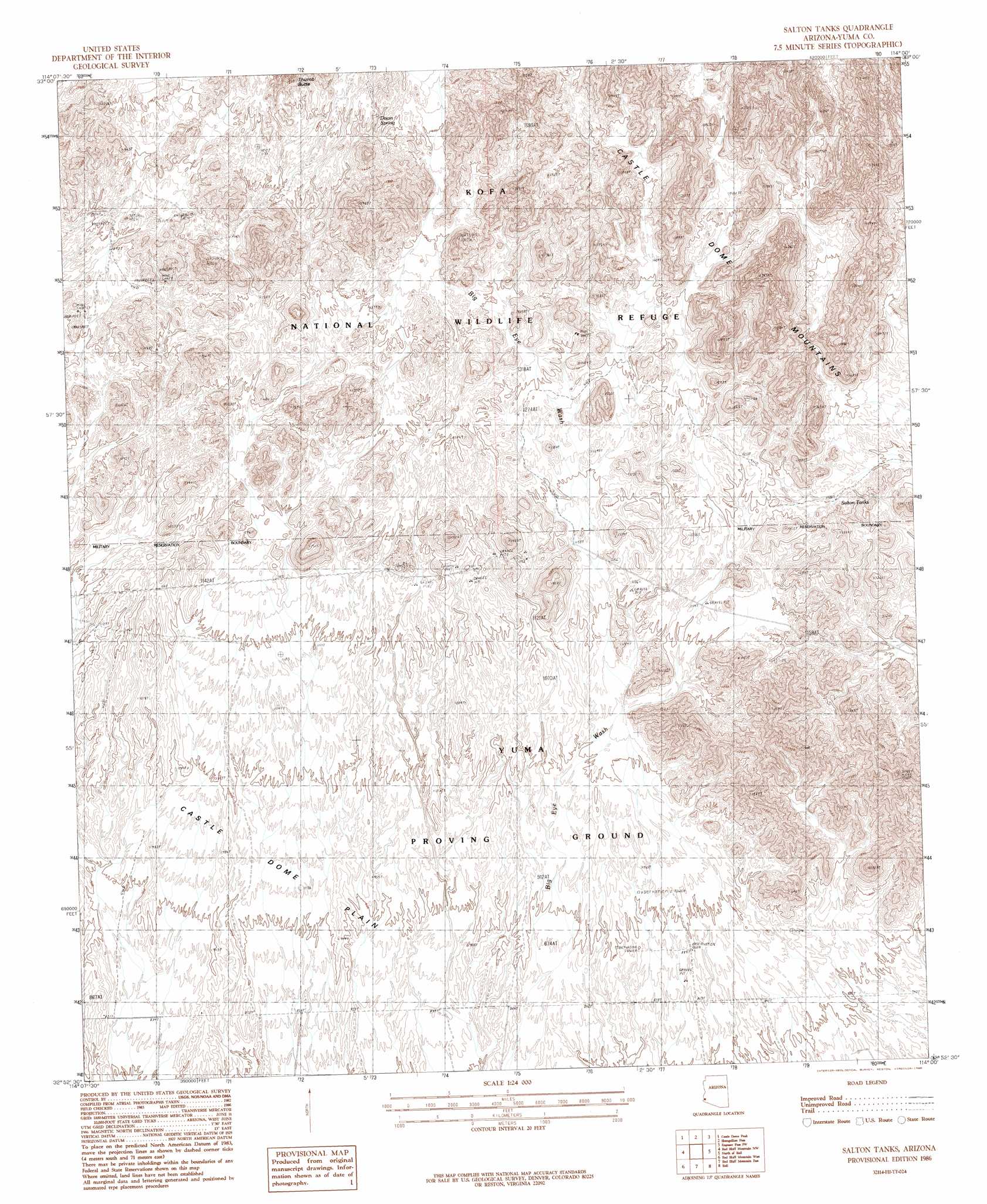
USGS Topo Quad 32114h1 - 1:24,000 scale
| Topo Map Name: | Salton Tanks |
| USGS Topo Quad ID: | 32114h1 |
| Print Size: | ca. 21 1/4" wide x 27" high |
| Southeast Coordinates: | 32.875° N latitude / 114° W longitude |
| Map Center Coordinates: | 32.9375° N latitude / 114.0625° W longitude |
| U.S. State: | AZ |
| Filename: | o32114h1.jpg |
| Download Map JPG Image: | Salton Tanks topo map 1:24,000 scale |
| Map Type: | Topographic |
| Topo Series: | 7.5´ |
| Map Scale: | 1:24,000 |
| Source of Map Images: | United States Geological Survey (USGS) |
| Alternate Map Versions: |
Salton Tanks AZ 1986, updated 1986 Download PDF Buy paper map Salton Tanks AZ 2011 Download PDF Buy paper map Salton Tanks AZ 2014 Download PDF Buy paper map |
1:24,000 Topo Quads surrounding Salton Tanks
Red Hill Ne |
Arch Tank |
Kofa Deep Well |
Charlie Died Tank |
Engesser Pass |
Middle Mountains North |
Castle Dome Peak |
Slumgullion Pass |
Engesser Pass Sw |
Neversweat Ridge |
Middle Mountains South |
Red Bluff Mountain Nw |
Salton Tanks |
North Of Roll |
Mesquite Jim Well |
Dome |
Red Bluff Mountain West |
Red Bluff Mountain East |
Roll |
Growler |
Ligurta |
Wellton |
Wellton Mesa |
Tacna |
Mohawk |
> Back to 32114e1 at 1:100,000 scale
> Back to 32114a1 at 1:250,000 scale
> Back to U.S. Topo Maps home
Salton Tanks topo map: Gazetteer
Salton Tanks: Arches
Natural Arch elevation 563m 1847′Natural Arch elevation 513m 1683′
Natural Arch elevation 451m 1479′
Natural Arch elevation 450m 1476′
Salton Tanks: Reservoirs
Salton Tanks elevation 0m 0′Salton Tanks: Springs
Dixon Spring elevation 490m 1607′Salton Tanks: Wells
Gurry Well elevation 344m 1128′Salton Tanks digital topo map on disk
Buy this Salton Tanks topo map showing relief, roads, GPS coordinates and other geographical features, as a high-resolution digital map file on DVD: