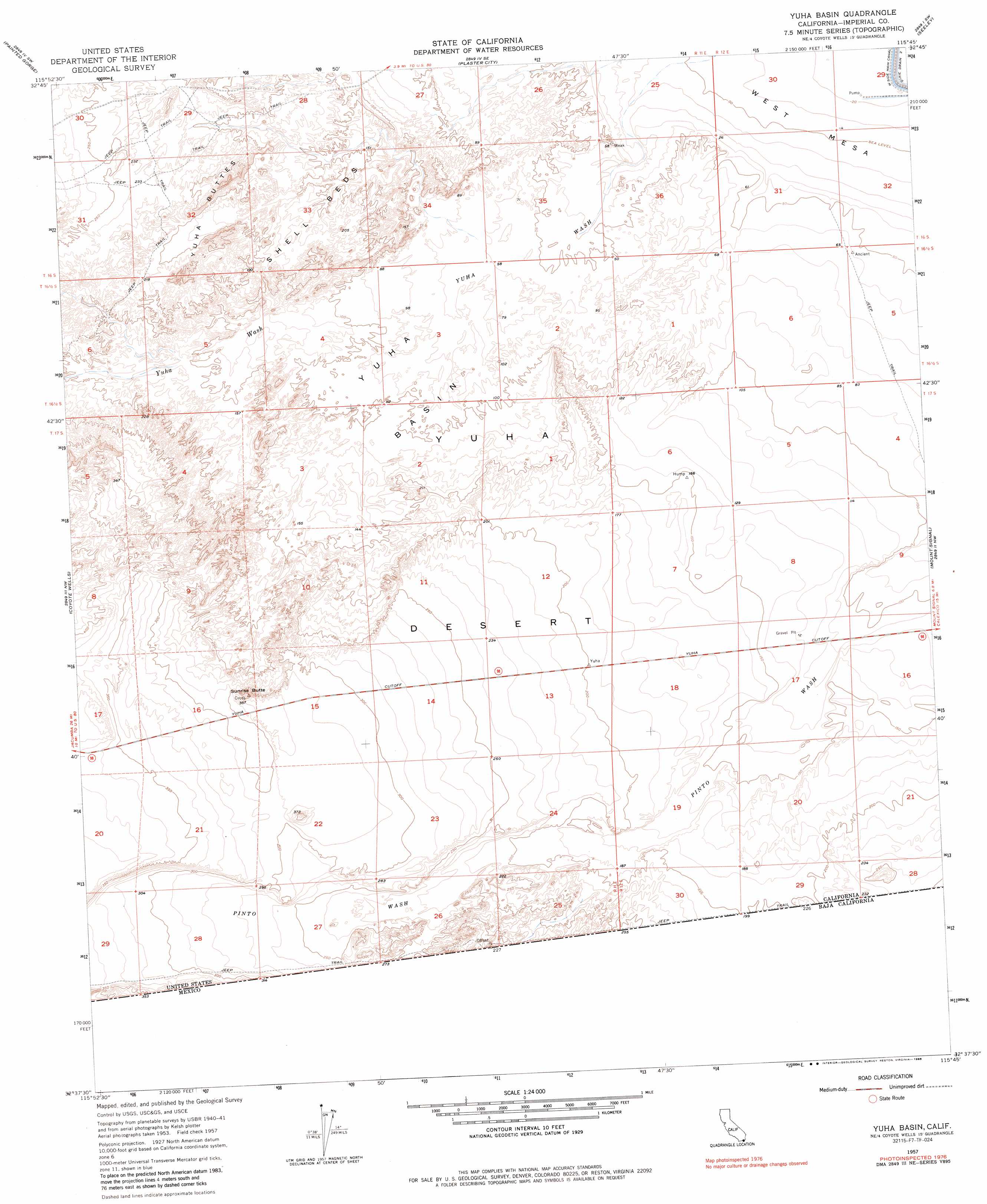
Yuha Basin Topo Map California
To zoom in, hover over the map of Yuha Basin
USGS Topo Quad 32115f7 - 1:24,000 scale
| Topo Map Name: | Yuha Basin |
| USGS Topo Quad ID: | 32115f7 |
| Print Size: | ca. 21 1/4" wide x 27" high |
| Southeast Coordinates: | 32.625° N latitude / 115.75° W longitude |
| Map Center Coordinates: | 32.6875° N latitude / 115.8125° W longitude |
| U.S. State: | CA |
| Filename: | o32115f7.jpg |
| Download Map JPG Image: | Yuha Basin topo map 1:24,000 scale |
| Map Type: | Topographic |
| Topo Series: | 7.5´ |
| Map Scale: | 1:24,000 |
| Source of Map Images: | United States Geological Survey (USGS) |
| Alternate Map Versions: |
Yuha Basin CA 1957, updated 1958 Download PDF Buy paper map Yuha Basin CA 1957, updated 1964 Download PDF Buy paper map Yuha Basin CA 1957, updated 1980 Download PDF Buy paper map Yuha Basin CA 1957, updated 1985 Download PDF Buy paper map Yuha Basin CA 2012 Download PDF Buy paper map Yuha Basin CA 2015 Download PDF Buy paper map |
1:24,000 Topo Quads surrounding Yuha Basin
Carrizo Mountain Ne |
Plaster City Nw |
Superstition Mountain |
Brawley Nw |
Brawley |
Carrizo Mountain |
Painted Gorge |
Plaster City |
Seeley |
El Centro |
In-Ko-Pah Gorge |
Coyote Wells |
Yuha Basin |
Mount Signal |
Heber |
> Back to 32115e1 at 1:100,000 scale
> Back to 32114a1 at 1:250,000 scale
> Back to U.S. Topo Maps home
Yuha Basin topo map: Gazetteer
Yuha Basin: Basins
Yuha Basin elevation 28m 91′Yuha Basin: Canals
Dixie Drain Two elevation -6m -20′Yuha Basin: Flats
Shell Beds elevation 47m 154′Yuha Basin: Plains
Yuha Desert elevation 61m 200′Yuha Basin: Ranges
Yuha Buttes elevation 93m 305′Yuha Basin: Summits
Sunrise Butte elevation 116m 380′Yuha Basin digital topo map on disk
Buy this Yuha Basin topo map showing relief, roads, GPS coordinates and other geographical features, as a high-resolution digital map file on DVD: