Carrizo Mountain Topo Map California
To zoom in, hover over the map of Carrizo Mountain
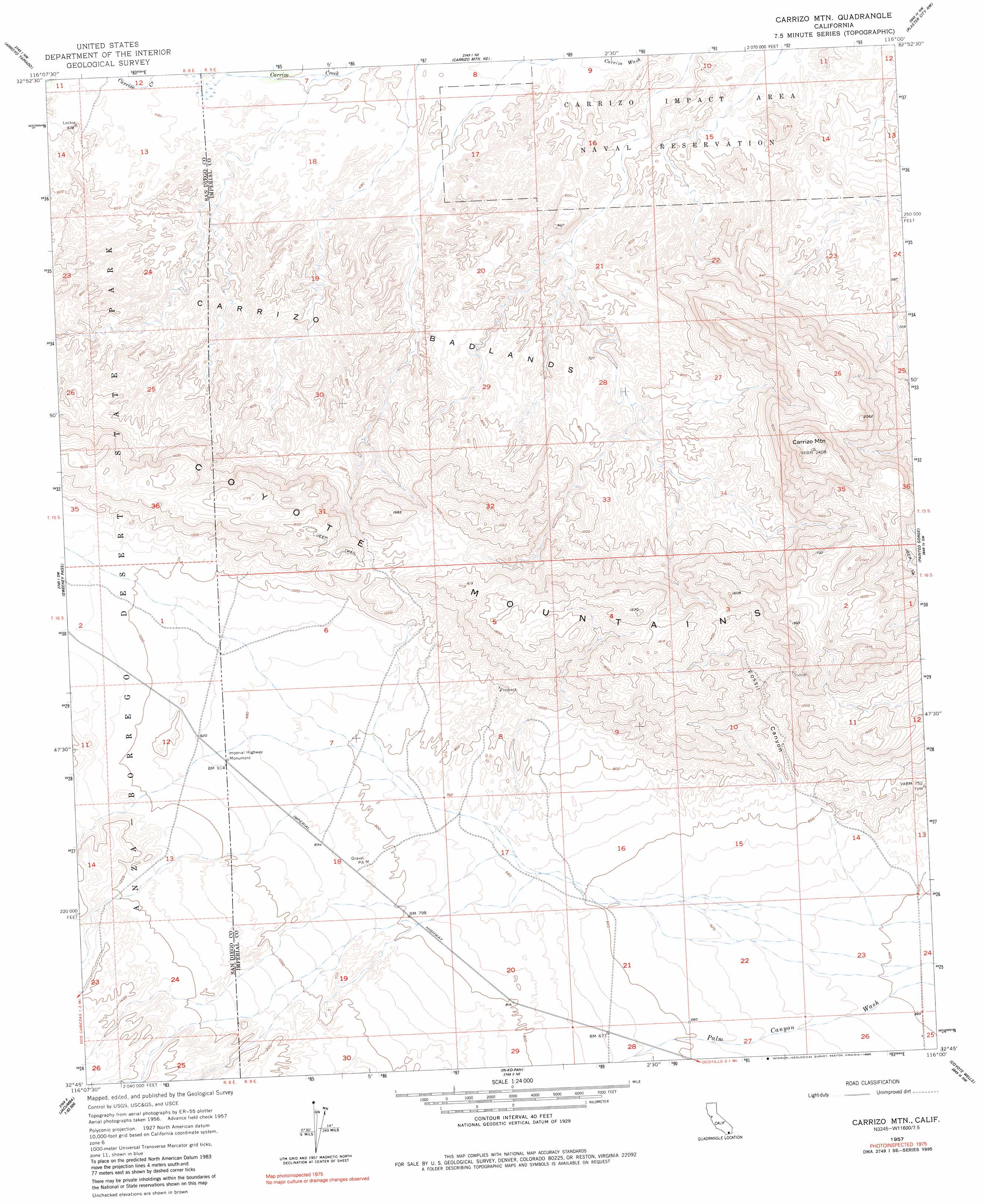
USGS Topo Quad 32116g1 - 1:24,000 scale
| Topo Map Name: | Carrizo Mountain |
| USGS Topo Quad ID: | 32116g1 |
| Print Size: | ca. 21 1/4" wide x 27" high |
| Southeast Coordinates: | 32.75° N latitude / 116° W longitude |
| Map Center Coordinates: | 32.8125° N latitude / 116.0625° W longitude |
| U.S. State: | CA |
| Filename: | o32116g1.jpg |
| Download Map JPG Image: | Carrizo Mountain topo map 1:24,000 scale |
| Map Type: | Topographic |
| Topo Series: | 7.5´ |
| Map Scale: | 1:24,000 |
| Source of Map Images: | United States Geological Survey (USGS) |
| Alternate Map Versions: |
Carrizo Mtn CA 1957, updated 1958 Download PDF Buy paper map Carrizo Mtn CA 1957, updated 1959 Download PDF Buy paper map Carrizo Mtn CA 1957, updated 1980 Download PDF Buy paper map Carrizo Mtn CA 1957, updated 1990 Download PDF Buy paper map Carrizo Mtn CA 1957, updated 1990 Download PDF Buy paper map Carrizo Mountain CA 2012 Download PDF Buy paper map Carrizo Mountain CA 2015 Download PDF Buy paper map |
1:24,000 Topo Quads surrounding Carrizo Mountain
Whale Peak |
Harper Canyon |
Borrego Mountain Se |
Harpers Well |
Kane Spring |
Agua Caliente Springs |
Arroyo Tapiado |
Carrizo Mountain Ne |
Plaster City Nw |
Superstition Mountain |
Sombrero Peak |
Sweeney Pass |
Carrizo Mountain |
Painted Gorge |
Plaster City |
Live Oak Springs |
Jacumba |
In-Ko-Pah Gorge |
Coyote Wells |
Yuha Basin |
Tierra Del Sol |
> Back to 32116e1 at 1:100,000 scale
> Back to 32116a1 at 1:250,000 scale
> Back to U.S. Topo Maps home
Carrizo Mountain topo map: Gazetteer
Carrizo Mountain: Areas
Carrizo Badlands elevation 229m 751′Carrizo Mountain: Parks
Imperial Highway Monument elevation 278m 912′Carrizo Mountain: Ranges
Coyote Mountains elevation 423m 1387′Carrizo Mountain: Summits
Carrizo Mountain elevation 734m 2408′Carrizo Mountain: Valleys
Fossil Canyon elevation 223m 731′Mortero Canyon elevation 328m 1076′
Carrizo Mountain digital topo map on disk
Buy this Carrizo Mountain topo map showing relief, roads, GPS coordinates and other geographical features, as a high-resolution digital map file on DVD: