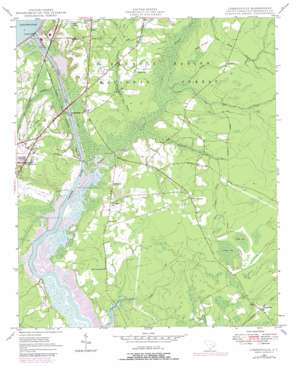
Cordesville Topo Map South Carolina
To zoom in, hover over the map of Cordesville
USGS Topo Quad 33079b8 - 1:24,000 scale
| Topo Map Name: | Cordesville |
| USGS Topo Quad ID: | 33079b8 |
| Print Size: | ca. 21 1/4" wide x 27" high |
| Southeast Coordinates: | 33.125° N latitude / 79.875° W longitude |
| Map Center Coordinates: | 33.1875° N latitude / 79.9375° W longitude |
| U.S. State: | SC |
| Filename: | o33079b8.jpg |
| Download Map JPG Image: | Cordesville topo map 1:24,000 scale |
| Map Type: | Topographic |
| Topo Series: | 7.5´ |
| Map Scale: | 1:24,000 |
| Source of Map Images: | United States Geological Survey (USGS) |
| Alternate Map Versions: |
Cordesville SC 1948, updated 1968 Download PDF Buy paper map Cordesville SC 1948, updated 1979 Download PDF Buy paper map Cordesville SC 1949 Download PDF Buy paper map Cordesville SC 2011 Download PDF Buy paper map Cordesville SC 2014 Download PDF Buy paper map |
| FStopo: | US Forest Service topo Cordesville is available: Download FStopo PDF Download FStopo TIF |
1:24,000 Topo Quads surrounding Cordesville
> Back to 33079a1 at 1:100,000 scale
> Back to 33078a1 at 1:250,000 scale
> Back to U.S. Topo Maps home
Cordesville topo map: Gazetteer
Cordesville: Bridges
Mepkin Bridge elevation 2m 6′Wadboo Bridge elevation 2m 6′
Cordesville: Canals
Old Santee Canal elevation 1m 3′Tailrace Canal elevation 1m 3′
Cordesville: Dams
Pinopolis Dam elevation 22m 72′Cordesville: Parks
Old Santee Canal State Park elevation 2m 6′Cordesville: Populated Places
Buck Hall (historical) elevation 9m 29′Cherry Hill elevation 10m 32′
Cordesville elevation 15m 49′
Kitfield (historical) elevation 16m 52′
Mittenlane elevation 16m 52′
Old Cordesville elevation 13m 42′
Santee Circle elevation 22m 72′
Simpson Crossing elevation 22m 72′
Stony Landing elevation 1m 3′
Wadboo elevation 12m 39′
Cordesville: Post Offices
Cordesville Post Office elevation 16m 52′Cordesville: Reservoirs
Lake Moultrie elevation 22m 72′Cordesville: Streams
Biggin Creek elevation 2m 6′Broad Ax Branch elevation 2m 6′
Bullhead Run elevation 2m 6′
California Branch elevation 3m 9′
Callum Branch elevation 2m 6′
Canady Branch elevation 7m 22′
Cane Gully Branch elevation 2m 6′
Mary Anne Branch elevation 6m 19′
Mingo Branch elevation 7m 22′
Wadboo Creek elevation 0m 0′
Cordesville: Swamps
Biggin Swamp elevation 3m 9′Middle Bay elevation 17m 55′
Vanilla Bay elevation 15m 49′
Wadboo Swamp elevation 2m 6′
Cordesville digital topo map on disk
Buy this Cordesville topo map showing relief, roads, GPS coordinates and other geographical features, as a high-resolution digital map file on DVD:
South Carolina, Western North Carolina & Northeastern Georgia
Buy digital topo maps: South Carolina, Western North Carolina & Northeastern Georgia


