Trio Topo Map South Carolina
To zoom in, hover over the map of Trio
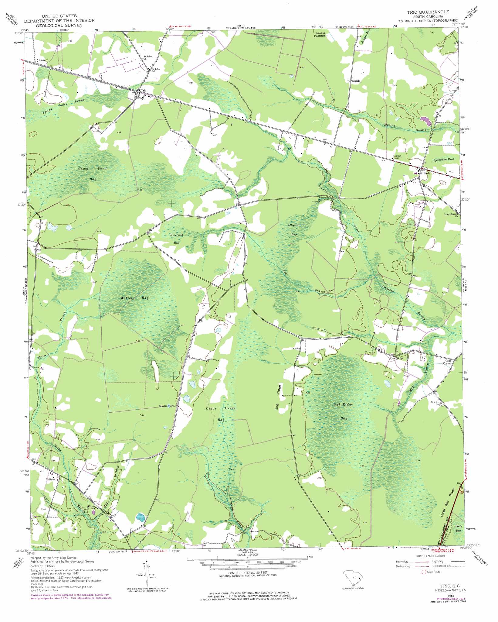
USGS Topo Quad 33079d6 - 1:24,000 scale
| Topo Map Name: | Trio |
| USGS Topo Quad ID: | 33079d6 |
| Print Size: | ca. 21 1/4" wide x 27" high |
| Southeast Coordinates: | 33.375° N latitude / 79.625° W longitude |
| Map Center Coordinates: | 33.4375° N latitude / 79.6875° W longitude |
| U.S. State: | SC |
| Filename: | o33079d6.jpg |
| Download Map JPG Image: | Trio topo map 1:24,000 scale |
| Map Type: | Topographic |
| Topo Series: | 7.5´ |
| Map Scale: | 1:24,000 |
| Source of Map Images: | United States Geological Survey (USGS) |
| Alternate Map Versions: |
Trio SC 1943, updated 1962 Download PDF Buy paper map Trio SC 1943, updated 1976 Download PDF Buy paper map Trio SC 2011 Download PDF Buy paper map Trio SC 2014 Download PDF Buy paper map |
1:24,000 Topo Quads surrounding Trio
Workman |
Kingstree |
Fowler |
Indiantown |
Henry |
Greeleyville |
Salters |
Kellehan Crossroads |
Warsaw |
Rhems |
Saint Stephens |
Blakely |
Trio |
Andrews |
Olin |
Bonneau |
Wedboo Creek |
Jamestown |
Cedar Creek |
Kilsock Bay |
Cordesville |
Bethera |
Shulerville |
Honey Hill |
Santee |
> Back to 33079a1 at 1:100,000 scale
> Back to 33078a1 at 1:250,000 scale
> Back to U.S. Topo Maps home
Trio topo map: Gazetteer
Trio: Dams
Ackerman Pond Dam D-3096 elevation 11m 36′Trio: Populated Places
Cook Corner elevation 12m 39′Earle elevation 12m 39′
Martin Corner elevation 18m 59′
Oak Ridge elevation 12m 39′
Suttons elevation 12m 39′
Tisdale elevation 13m 42′
Trio elevation 18m 59′
Trio: Reservoirs
Ackerman Pond elevation 11m 36′Trio: Ridges
Big Ridge elevation 14m 45′Trio: Streams
Flat Swamp elevation 12m 39′Log Branch elevation 12m 39′
Mill Branch elevation 12m 39′
Mill Creek elevation 6m 19′
Trio: Swamps
Alligator Bay elevation 14m 45′Camp Pond Bay elevation 17m 55′
Cedar Creek Bay elevation 16m 52′
Juniper Run elevation 15m 49′
Oak Ridge Bay elevation 12m 39′
Ricefield Bay elevation 15m 49′
Sportsman Pond elevation 11m 36′
Spring Valley Swamp elevation 18m 59′
Wittee Bay elevation 16m 52′
Trio digital topo map on disk
Buy this Trio topo map showing relief, roads, GPS coordinates and other geographical features, as a high-resolution digital map file on DVD:
South Carolina, Western North Carolina & Northeastern Georgia
Buy digital topo maps: South Carolina, Western North Carolina & Northeastern Georgia