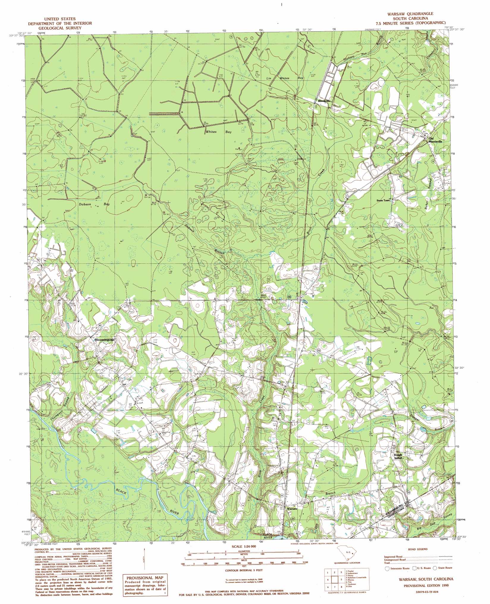
Warsaw Topo Map South Carolina
To zoom in, hover over the map of Warsaw
USGS Topo Quad 33079e5 - 1:24,000 scale
| Topo Map Name: | Warsaw |
| USGS Topo Quad ID: | 33079e5 |
| Print Size: | ca. 21 1/4" wide x 27" high |
| Southeast Coordinates: | 33.5° N latitude / 79.5° W longitude |
| Map Center Coordinates: | 33.5625° N latitude / 79.5625° W longitude |
| U.S. State: | SC |
| Filename: | o33079e5.jpg |
| Download Map JPG Image: | Warsaw topo map 1:24,000 scale |
| Map Type: | Topographic |
| Topo Series: | 7.5´ |
| Map Scale: | 1:24,000 |
| Source of Map Images: | United States Geological Survey (USGS) |
| Alternate Map Versions: |
Warsaw SC 1990, updated 1990 Download PDF Buy paper map Warsaw SC 2011 Download PDF Buy paper map Warsaw SC 2014 Download PDF Buy paper map |
1:24,000 Topo Quads surrounding Warsaw
Lake City West |
Lake City East |
Prospect Crossroads |
Johnsonville |
Snow Island |
Kingstree |
Fowler |
Indiantown |
Henry |
Outland |
Salters |
Kellehan Crossroads |
Warsaw |
Rhems |
Carvers Bay |
Blakely |
Trio |
Andrews |
Olin |
Georgetown North |
Wedboo Creek |
Jamestown |
Cedar Creek |
Kilsock Bay |
Georgetown South |
> Back to 33079e1 at 1:100,000 scale
> Back to 33078a1 at 1:250,000 scale
> Back to U.S. Topo Maps home
Warsaw topo map: Gazetteer
Warsaw: Basins
Big Bay elevation 10m 32′Burton Bay elevation 12m 39′
Dobson Bay elevation 15m 49′
Lin Whites Bay elevation 15m 49′
Whites Bay elevation 15m 49′
Wildcat Bay elevation 10m 32′
Wolf Bay elevation 10m 32′
Warsaw: Islands
Rough Island elevation 10m 32′Warsaw: Populated Places
Bloomingvale elevation 12m 39′Cooper elevation 15m 49′
Morrisville elevation 15m 49′
Old Morrisville elevation 15m 49′
Snow Town elevation 13m 42′
Warsaw elevation 12m 39′
Warsaw: Streams
Dobson Branch elevation 10m 32′Warsaw: Swamps
Baker Swamp elevation 11m 36′Warsaw digital topo map on disk
Buy this Warsaw topo map showing relief, roads, GPS coordinates and other geographical features, as a high-resolution digital map file on DVD:
South Carolina, Western North Carolina & Northeastern Georgia
Buy digital topo maps: South Carolina, Western North Carolina & Northeastern Georgia