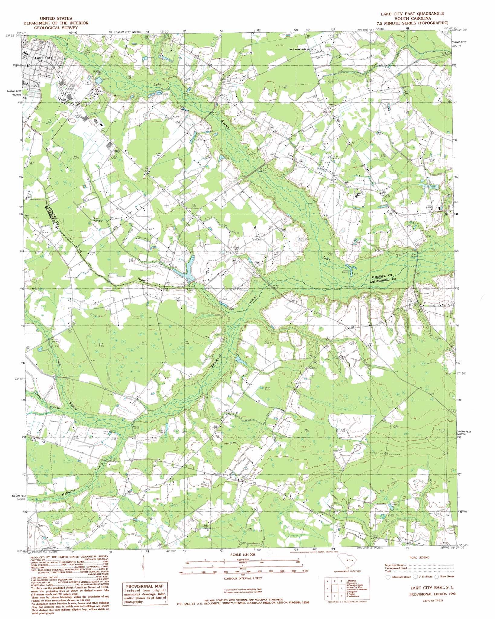
Lake City East Topo Map South Carolina
To zoom in, hover over the map of Lake City East
USGS Topo Quad 33079g6 - 1:24,000 scale
| Topo Map Name: | Lake City East |
| USGS Topo Quad ID: | 33079g6 |
| Print Size: | ca. 21 1/4" wide x 27" high |
| Southeast Coordinates: | 33.75° N latitude / 79.625° W longitude |
| Map Center Coordinates: | 33.8125° N latitude / 79.6875° W longitude |
| U.S. State: | SC |
| Filename: | o33079g6.jpg |
| Download Map JPG Image: | Lake City East topo map 1:24,000 scale |
| Map Type: | Topographic |
| Topo Series: | 7.5´ |
| Map Scale: | 1:24,000 |
| Source of Map Images: | United States Geological Survey (USGS) |
| Alternate Map Versions: |
Lake City East SC 1990, updated 1990 Download PDF Buy paper map Lake City East SC 2011 Download PDF Buy paper map Lake City East SC 2014 Download PDF Buy paper map |
1:24,000 Topo Quads surrounding Lake City East
Sardis |
Effingham |
Evergreen |
Pamplico North |
Friendship |
Olanta |
Mill Bay |
Scranton |
Pamplico South |
Gresham |
Hebron Crossroads |
Lake City West |
Lake City East |
Prospect Crossroads |
Johnsonville |
Workman |
Kingstree |
Fowler |
Indiantown |
Henry |
Greeleyville |
Salters |
Kellehan Crossroads |
Warsaw |
Rhems |
> Back to 33079e1 at 1:100,000 scale
> Back to 33078a1 at 1:250,000 scale
> Back to U.S. Topo Maps home
Lake City East topo map: Gazetteer
Lake City East: Bridges
Browns Bridge elevation 12m 39′Lake City East: Dams
Askins Pond Dam D-3574 elevation 18m 59′Eaddy Pond Dam D-3575 elevation 14m 45′
Lake City East: Parks
Lions Municipal PArk elevation 21m 68′Martha Law Municipal Park elevation 22m 72′
Wren Village Municipal Park elevation 22m 72′
Lake City East: Populated Places
Kelley Heights elevation 23m 75′Lee Crossroads elevation 21m 68′
Martha Law Estates elevation 22m 72′
Wren Village elevation 22m 72′
Lake City East: Reservoirs
Askins Pond elevation 18m 59′Eaddy Pond elevation 14m 45′
Lake City East: Streams
Grahams Mill Branch elevation 16m 52′Long Branch elevation 12m 39′
McNamee Swamp elevation 16m 52′
Singleton Swamp elevation 12m 39′
Smith Swamp elevation 15m 49′
Lake City East digital topo map on disk
Buy this Lake City East topo map showing relief, roads, GPS coordinates and other geographical features, as a high-resolution digital map file on DVD:
South Carolina, Western North Carolina & Northeastern Georgia
Buy digital topo maps: South Carolina, Western North Carolina & Northeastern Georgia