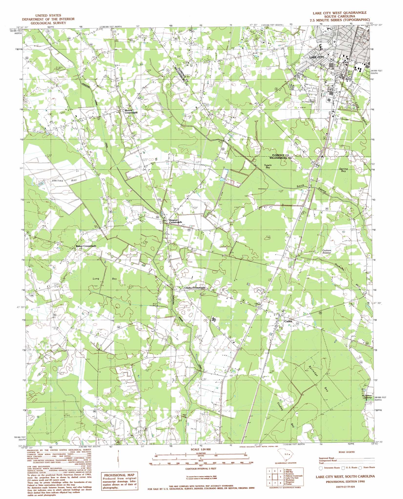
Lake City West Topo Map South Carolina
To zoom in, hover over the map of Lake City West
USGS Topo Quad 33079g7 - 1:24,000 scale
| Topo Map Name: | Lake City West |
| USGS Topo Quad ID: | 33079g7 |
| Print Size: | ca. 21 1/4" wide x 27" high |
| Southeast Coordinates: | 33.75° N latitude / 79.75° W longitude |
| Map Center Coordinates: | 33.8125° N latitude / 79.8125° W longitude |
| U.S. State: | SC |
| Filename: | o33079g7.jpg |
| Download Map JPG Image: | Lake City West topo map 1:24,000 scale |
| Map Type: | Topographic |
| Topo Series: | 7.5´ |
| Map Scale: | 1:24,000 |
| Source of Map Images: | United States Geological Survey (USGS) |
| Alternate Map Versions: |
Lake City West SC 1990, updated 1990 Download PDF Buy paper map Lake City West SC 2011 Download PDF Buy paper map Lake City West SC 2014 Download PDF Buy paper map |
1:24,000 Topo Quads surrounding Lake City West
Lynchburg |
Sardis |
Effingham |
Evergreen |
Pamplico North |
Turbeville |
Olanta |
Mill Bay |
Scranton |
Pamplico South |
Sardinia |
Hebron Crossroads |
Lake City West |
Lake City East |
Prospect Crossroads |
Foreston |
Workman |
Kingstree |
Fowler |
Indiantown |
Butlers Bay |
Greeleyville |
Salters |
Kellehan Crossroads |
Warsaw |
> Back to 33079e1 at 1:100,000 scale
> Back to 33078a1 at 1:250,000 scale
> Back to U.S. Topo Maps home
Lake City West topo map: Gazetteer
Lake City West: Airports
Lake City Municipal Airport elevation 24m 78′Lake City West: Basins
Rutledge Bay elevation 20m 65′Lake City West: Canals
Kingstree Swamp Canal elevation 23m 75′Lake City West: Parks
Dew Park elevation 24m 78′Ward Memorial Stadium elevation 24m 78′
Lake City West: Populated Places
Baker Crossroads elevation 24m 78′Cades elevation 22m 72′
Clarks Crossroads elevation 22m 72′
Greenbriar Estates elevation 25m 82′
Hogeye Crossroads elevation 23m 75′
Kennedy Park elevation 24m 78′
Lake City elevation 23m 75′
Moore Crossroads elevation 26m 85′
Palmetto Estates elevation 23m 75′
Wedgefield elevation 24m 78′
Lake City West: Post Offices
Lake City Post Office elevation 23m 75′Lake City West: Streams
Smiths Bay elevation 22m 72′Lake City West: Swamps
Graham Swamp elevation 21m 68′Long Bay elevation 23m 75′
Sandy Bay elevation 22m 72′
Spring Bay elevation 22m 72′
Tupelo Bay elevation 23m 75′
Lake City West digital topo map on disk
Buy this Lake City West topo map showing relief, roads, GPS coordinates and other geographical features, as a high-resolution digital map file on DVD:
South Carolina, Western North Carolina & Northeastern Georgia
Buy digital topo maps: South Carolina, Western North Carolina & Northeastern Georgia