Scranton Topo Map South Carolina
To zoom in, hover over the map of Scranton
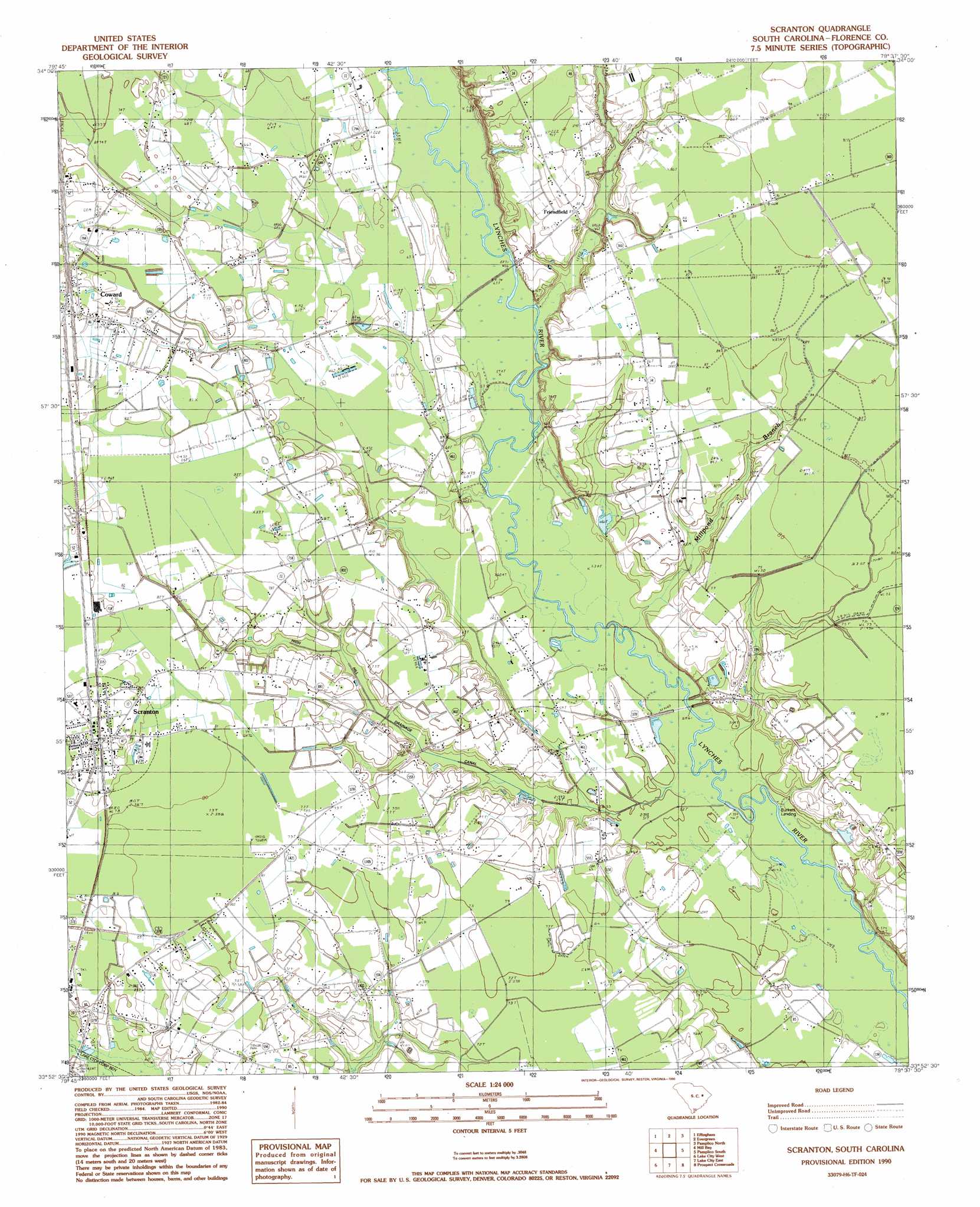
USGS Topo Quad 33079h6 - 1:24,000 scale
| Topo Map Name: | Scranton |
| USGS Topo Quad ID: | 33079h6 |
| Print Size: | ca. 21 1/4" wide x 27" high |
| Southeast Coordinates: | 33.875° N latitude / 79.625° W longitude |
| Map Center Coordinates: | 33.9375° N latitude / 79.6875° W longitude |
| U.S. State: | SC |
| Filename: | o33079h6.jpg |
| Download Map JPG Image: | Scranton topo map 1:24,000 scale |
| Map Type: | Topographic |
| Topo Series: | 7.5´ |
| Map Scale: | 1:24,000 |
| Source of Map Images: | United States Geological Survey (USGS) |
| Alternate Map Versions: |
Scranton SC 1990, updated 1990 Download PDF Buy paper map Scranton SC 2011 Download PDF Buy paper map Scranton SC 2014 Download PDF Buy paper map |
1:24,000 Topo Quads surrounding Scranton
Timmonsville |
Florence West |
Florence East |
Pee Dee |
Marion |
Sardis |
Effingham |
Evergreen |
Pamplico North |
Friendship |
Olanta |
Mill Bay |
Scranton |
Pamplico South |
Gresham |
Hebron Crossroads |
Lake City West |
Lake City East |
Prospect Crossroads |
Johnsonville |
Workman |
Kingstree |
Fowler |
Indiantown |
Henry |
> Back to 33079e1 at 1:100,000 scale
> Back to 33078a1 at 1:250,000 scale
> Back to U.S. Topo Maps home
Scranton topo map: Gazetteer
Scranton: Airports
Cockfield Aerodrome elevation 23m 75′Scranton: Basins
Nettles Bay elevation 19m 62′Sugarfoot Bay elevation 29m 95′
Scranton: Bridges
Anderson Bridge elevation 17m 55′Bass Bridge elevation 15m 49′
Scranton: Canals
High Hill Drainage Canal elevation 20m 65′Scranton: Dams
Matthews Pond Dam D-3568 elevation 16m 52′Scranton: Populated Places
Bass Crossroads elevation 21m 68′Burkett Landing elevation 13m 42′
Coward elevation 25m 82′
Friendfield elevation 26m 85′
Scranton elevation 29m 95′
Scranton: Post Offices
Coward Post Office elevation 27m 88′Scranton Post Office elevation 29m 95′
Scranton: Reservoirs
Matthews Pond elevation 16m 52′Scranton: Streams
Cypress Branch elevation 18m 59′Green Spring Branch elevation 16m 52′
Horse Branch elevation 20m 65′
Millpond Branch elevation 15m 49′
Scranton: Swamps
Big Bay elevation 24m 78′Scranton digital topo map on disk
Buy this Scranton topo map showing relief, roads, GPS coordinates and other geographical features, as a high-resolution digital map file on DVD:
South Carolina, Western North Carolina & Northeastern Georgia
Buy digital topo maps: South Carolina, Western North Carolina & Northeastern Georgia