Bowman Topo Map South Carolina
To zoom in, hover over the map of Bowman
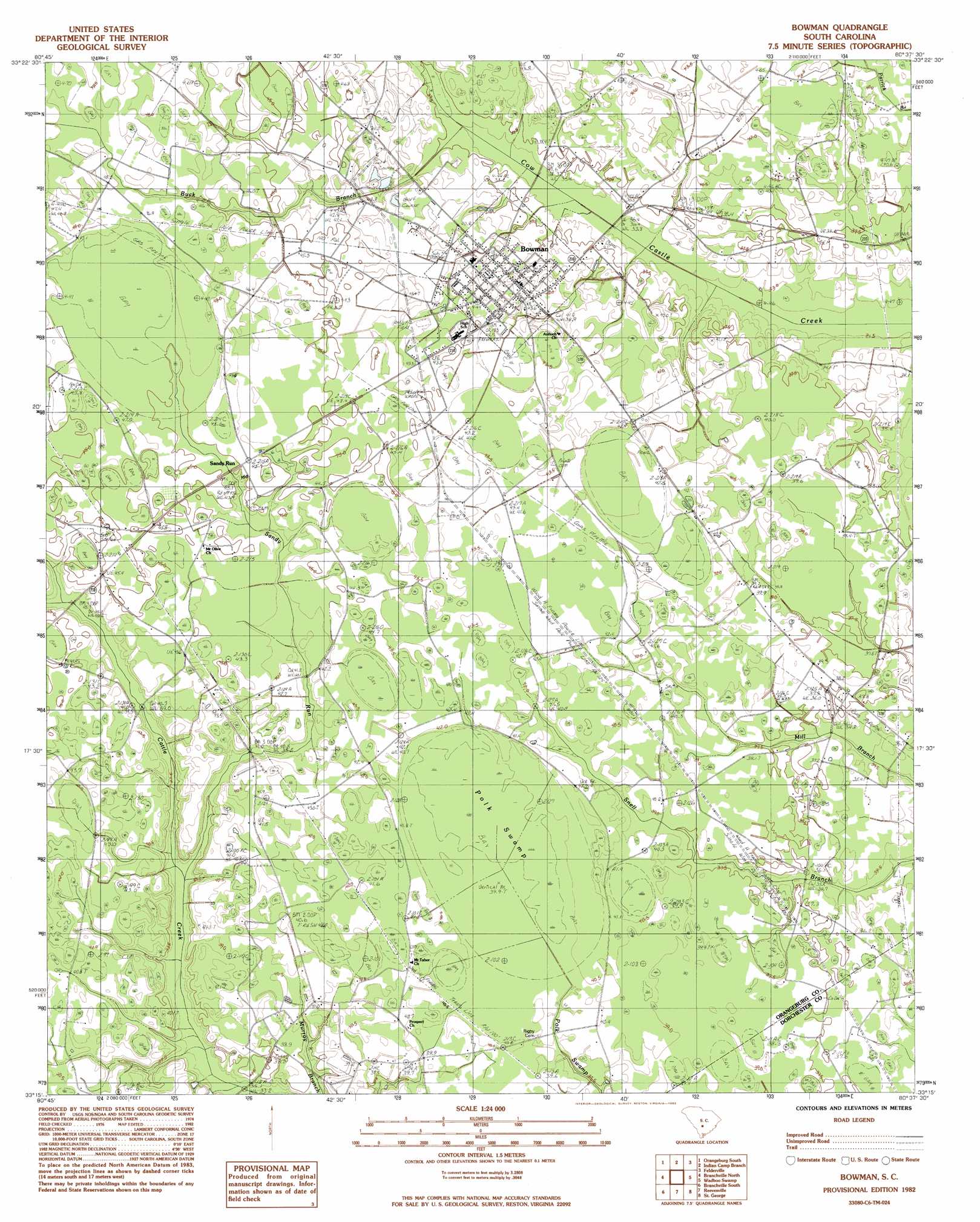
USGS Topo Quad 33080c6 - 1:24,000 scale
| Topo Map Name: | Bowman |
| USGS Topo Quad ID: | 33080c6 |
| Print Size: | ca. 21 1/4" wide x 27" high |
| Southeast Coordinates: | 33.25° N latitude / 80.625° W longitude |
| Map Center Coordinates: | 33.3125° N latitude / 80.6875° W longitude |
| U.S. State: | SC |
| Filename: | o33080c6.jpg |
| Download Map JPG Image: | Bowman topo map 1:24,000 scale |
| Map Type: | Topographic |
| Topo Series: | 7.5´ |
| Map Scale: | 1:24,000 |
| Source of Map Images: | United States Geological Survey (USGS) |
| Alternate Map Versions: |
Bowman SC 1982, updated 1983 Download PDF Buy paper map Bowman SC 2011 Download PDF Buy paper map Bowman SC 2014 Download PDF Buy paper map |
1:24,000 Topo Quads surrounding Bowman
Wolfton |
Orangeburg North |
Cameron |
Elloree |
Saint Paul |
Cordova |
Orangeburg South |
Indian Camp Branch |
Felderville |
Vance |
Midway |
Branchville North |
Bowman |
Wadboo Swamp |
Holly Hill |
Tony Hill Bay |
Branchville South |
Reevesville |
Saint George |
Harleyville |
Lodge |
Williams |
Saint George Sw |
Canadys |
Maple Cane Swamp |
> Back to 33080a1 at 1:100,000 scale
> Back to 33080a1 at 1:250,000 scale
> Back to U.S. Topo Maps home
Bowman topo map: Gazetteer
Bowman: Populated Places
Bowman elevation 43m 141′Lambrick elevation 43m 141′
Sandy Run elevation 45m 147′
Bowman: Post Offices
Bowman Post Office elevation 41m 134′Bowman: Streams
Buck Branch elevation 46m 150′Buck Branch elevation 37m 121′
Sandy Run elevation 36m 118′
Bowman: Swamps
Polk Swamp elevation 39m 127′Bowman digital topo map on disk
Buy this Bowman topo map showing relief, roads, GPS coordinates and other geographical features, as a high-resolution digital map file on DVD:
South Carolina, Western North Carolina & Northeastern Georgia
Buy digital topo maps: South Carolina, Western North Carolina & Northeastern Georgia