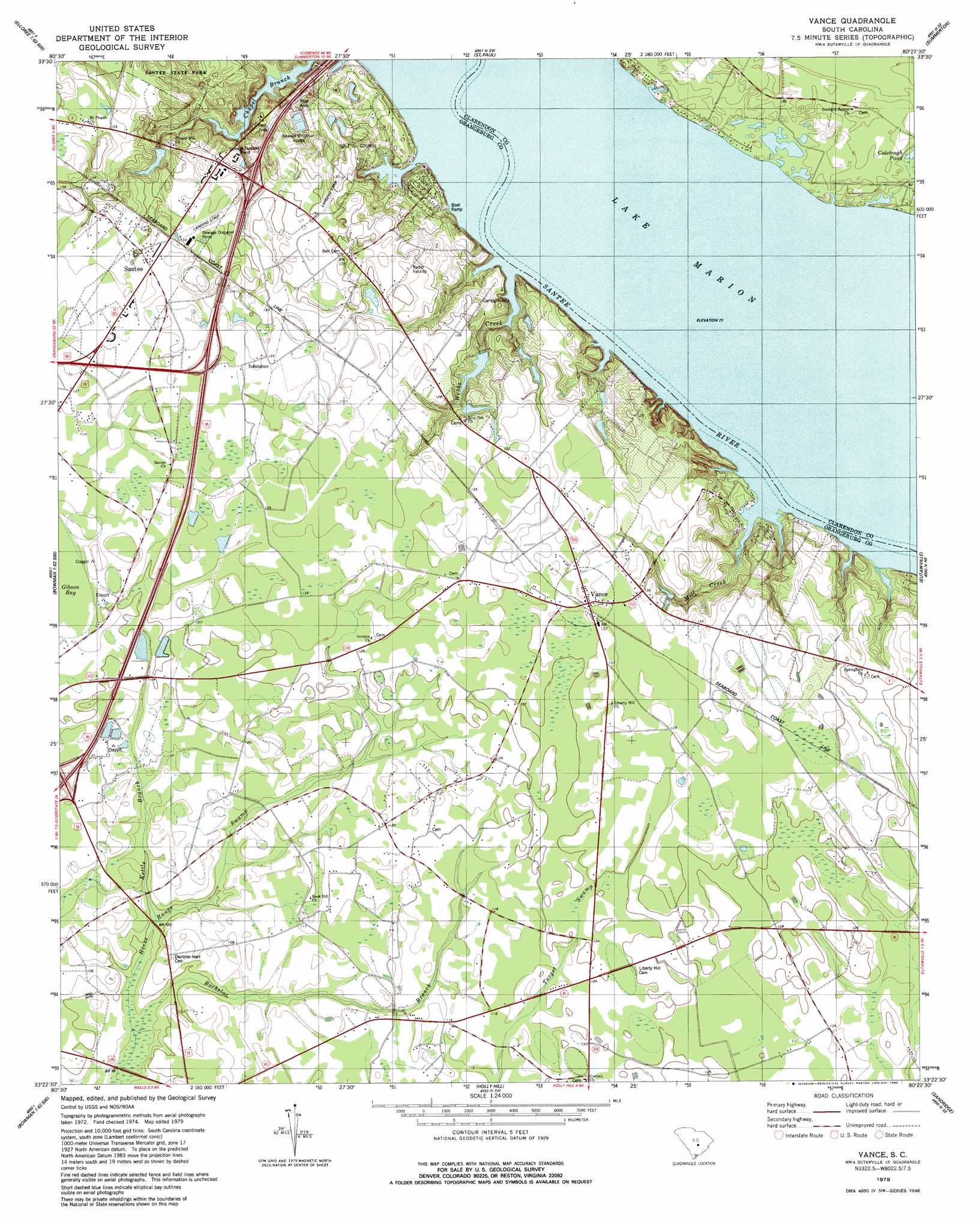
Vance Topo Map South Carolina
To zoom in, hover over the map of Vance
USGS Topo Quad 33080d4 - 1:24,000 scale
| Topo Map Name: | Vance |
| USGS Topo Quad ID: | 33080d4 |
| Print Size: | ca. 21 1/4" wide x 27" high |
| Southeast Coordinates: | 33.375° N latitude / 80.375° W longitude |
| Map Center Coordinates: | 33.4375° N latitude / 80.4375° W longitude |
| U.S. State: | SC |
| Filename: | o33080d4.jpg |
| Download Map JPG Image: | Vance topo map 1:24,000 scale |
| Map Type: | Topographic |
| Topo Series: | 7.5´ |
| Map Scale: | 1:24,000 |
| Source of Map Images: | United States Geological Survey (USGS) |
| Alternate Map Versions: |
Vance SC 1979, updated 1980 Download PDF Buy paper map Vance SC 1979, updated 1980 Download PDF Buy paper map Vance SC 2011 Download PDF Buy paper map Vance SC 2014 Download PDF Buy paper map |
1:24,000 Topo Quads surrounding Vance
Fort Motte |
Lone Star |
Pinewood |
Paxville |
Manning |
Cameron |
Elloree |
Saint Paul |
Summerton |
Jordan |
Indian Camp Branch |
Felderville |
Vance |
Eutawville |
Eadytown |
Bowman |
Wadboo Swamp |
Holly Hill |
Sandridge |
Cross |
Reevesville |
Saint George |
Harleyville |
Pringletown |
Summerville Nw |
> Back to 33080a1 at 1:100,000 scale
> Back to 33080a1 at 1:250,000 scale
> Back to U.S. Topo Maps home
Vance topo map: Gazetteer
Vance: Airports
Santee Golf Air Strip elevation 37m 121′Vance: Crossings
Interchange 93 elevation 37m 121′Interchange 97 elevation 42m 137′
Interchange 98 elevation 37m 121′
Vance: Dams
Millers Pond Dam D-3763 elevation 36m 118′Santee Shores Pond Dam D-3746 elevation 30m 98′
South Carolina Noname 38020 D-3762 Dam elevation 32m 104′
Vance: Lakes
Prince Pond (historical) elevation 23m 75′Vance: Populated Places
Bull Station elevation 39m 127′Mill Creek elevation 24m 78′
Milligans elevation 41m 134′
Santee elevation 42m 137′
Vance elevation 40m 131′
Vance: Post Offices
Santee Post Office elevation 41m 134′Vance Post Office elevation 41m 134′
Vance: Reservoirs
Lakewood Lodge Pond elevation 32m 104′Vance: Streams
Batchelor Branch elevation 27m 88′Kettle Branch elevation 30m 98′
Mill Creek elevation 23m 75′
Webbs Creek elevation 23m 75′
Vance: Swamps
Gibson Bay elevation 38m 124′Vance digital topo map on disk
Buy this Vance topo map showing relief, roads, GPS coordinates and other geographical features, as a high-resolution digital map file on DVD:
South Carolina, Western North Carolina & Northeastern Georgia
Buy digital topo maps: South Carolina, Western North Carolina & Northeastern Georgia