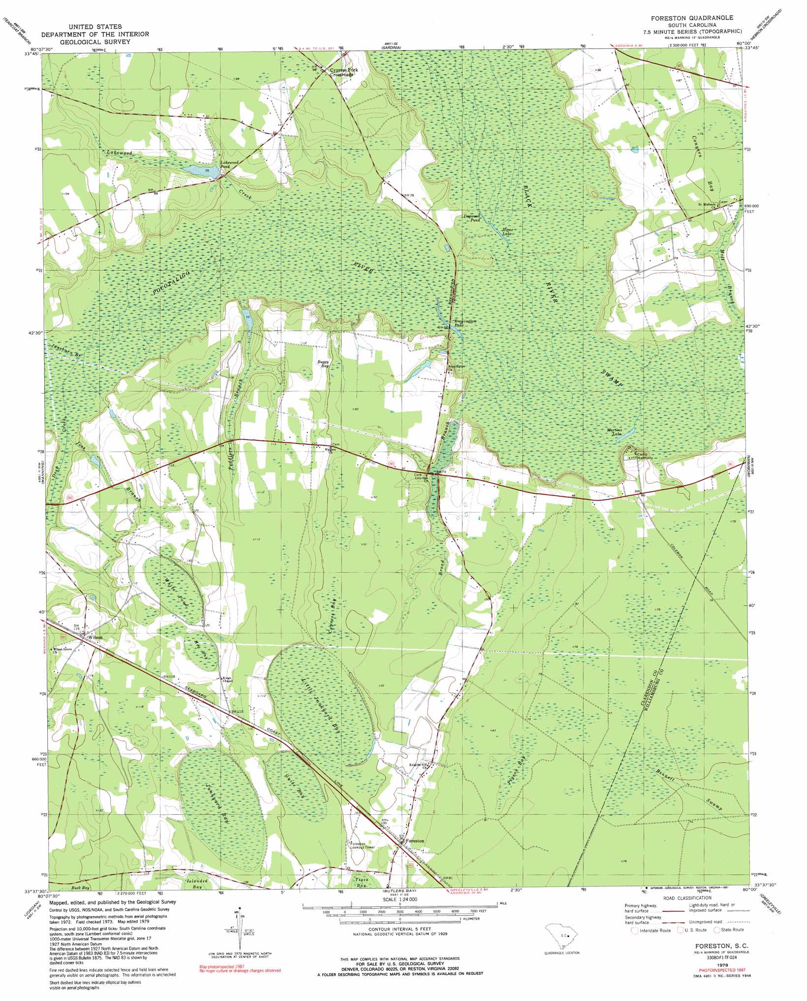
Foreston Topo Map South Carolina
To zoom in, hover over the map of Foreston
USGS Topo Quad 33080f1 - 1:24,000 scale
| Topo Map Name: | Foreston |
| USGS Topo Quad ID: | 33080f1 |
| Print Size: | ca. 21 1/4" wide x 27" high |
| Southeast Coordinates: | 33.625° N latitude / 80° W longitude |
| Map Center Coordinates: | 33.6875° N latitude / 80.0625° W longitude |
| U.S. State: | SC |
| Filename: | o33080f1.jpg |
| Download Map JPG Image: | Foreston topo map 1:24,000 scale |
| Map Type: | Topographic |
| Topo Series: | 7.5´ |
| Map Scale: | 1:24,000 |
| Source of Map Images: | United States Geological Survey (USGS) |
| Alternate Map Versions: |
Foreston SC 1979, updated 1980 Download PDF Buy paper map Foreston SC 1979, updated 1991 Download PDF Buy paper map Foreston SC 2011 Download PDF Buy paper map Foreston SC 2014 Download PDF Buy paper map |
1:24,000 Topo Quads surrounding Foreston
Sumter East |
Mayesville |
Turbeville |
Olanta |
Mill Bay |
Brogdon |
Tearcoat Branch |
Sardinia |
Hebron Crossroads |
Lake City West |
Paxville |
Manning |
Foreston |
Workman |
Kingstree |
Summerton |
Jordan |
Butlers Bay |
Greeleyville |
Salters |
Eutawville |
Eadytown |
Pineville |
Saint Stephens |
Blakely |
> Back to 33080e1 at 1:100,000 scale
> Back to 33080a1 at 1:250,000 scale
> Back to U.S. Topo Maps home
Foreston topo map: Gazetteer
Foreston: Bridges
Brewington Crossing elevation 19m 62′Foreston: Dams
Plowden Pond Dam D-3493 elevation 24m 78′South Carolina Noname 14015 D-3490 Dam elevation 23m 75′
South Carolina Noname 14017 D-3494 Dam elevation 24m 78′
Foreston: Lakes
Brewington Lake elevation 17m 55′Home Lake elevation 18m 59′
Jordan Pond (historical) elevation 16m 52′
Martins Lake elevation 17m 55′
Foreston: Populated Places
Brewington (historical) elevation 27m 88′Cypress Fork Crossroads elevation 29m 95′
Foreston elevation 28m 91′
Wilson elevation 36m 118′
Foreston: Reservoirs
Hardy Pond elevation 24m 78′Lakewood elevation 29m 95′
Lakewood Pond elevation 23m 75′
Foreston: Streams
Broad Branch elevation 18m 59′Brunson Branch elevation 26m 85′
Deep Creek elevation 20m 65′
Joes Branch elevation 21m 68′
Juneburn Branch elevation 20m 65′
Lakewood Creek elevation 21m 68′
Mill Branch elevation 16m 52′
Peddlers Branch elevation 19m 62′
Pocotaligo River elevation 17m 55′
Foreston: Swamps
Boggy Bay elevation 29m 95′Conyers Bay elevation 22m 72′
Cypress Bay elevation 30m 98′
Dogwood Pond elevation 19m 62′
Guise Bay elevation 30m 98′
Hog Bay elevation 36m 118′
Junkyard Bay elevation 31m 101′
Little Junkyard Bay elevation 30m 98′
Pigeon Bay elevation 24m 78′
White Pond elevation 37m 121′
Foreston digital topo map on disk
Buy this Foreston topo map showing relief, roads, GPS coordinates and other geographical features, as a high-resolution digital map file on DVD:
South Carolina, Western North Carolina & Northeastern Georgia
Buy digital topo maps: South Carolina, Western North Carolina & Northeastern Georgia