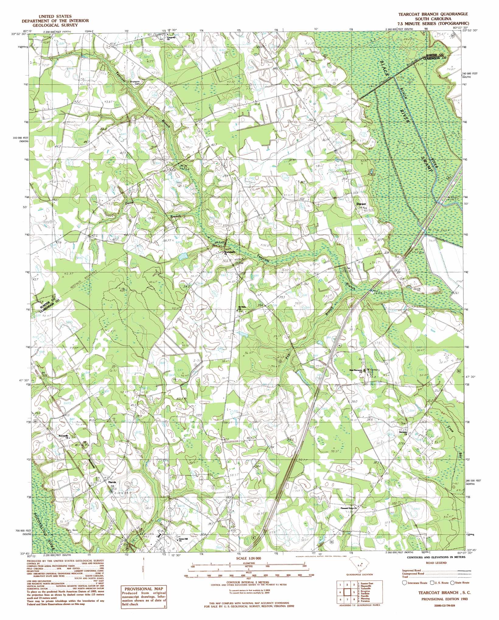
Tearcoat Branch Topo Map South Carolina
To zoom in, hover over the map of Tearcoat Branch
USGS Topo Quad 33080g2 - 1:24,000 scale
| Topo Map Name: | Tearcoat Branch |
| USGS Topo Quad ID: | 33080g2 |
| Print Size: | ca. 21 1/4" wide x 27" high |
| Southeast Coordinates: | 33.75° N latitude / 80.125° W longitude |
| Map Center Coordinates: | 33.8125° N latitude / 80.1875° W longitude |
| U.S. State: | SC |
| Filename: | o33080g2.jpg |
| Download Map JPG Image: | Tearcoat Branch topo map 1:24,000 scale |
| Map Type: | Topographic |
| Topo Series: | 7.5´ |
| Map Scale: | 1:24,000 |
| Source of Map Images: | United States Geological Survey (USGS) |
| Alternate Map Versions: |
Tearcoat Branch SC 1983, updated 1983 Download PDF Buy paper map Tearcoat Branch SC 2011 Download PDF Buy paper map Tearcoat Branch SC 2014 Download PDF Buy paper map |
1:24,000 Topo Quads surrounding Tearcoat Branch
Dalzell |
Oswego |
Elliott |
Lynchburg |
Sardis |
Sumter West |
Sumter East |
Mayesville |
Turbeville |
Olanta |
Privateer |
Brogdon |
Tearcoat Branch |
Sardinia |
Hebron Crossroads |
Pinewood |
Paxville |
Manning |
Foreston |
Workman |
Saint Paul |
Summerton |
Jordan |
Butlers Bay |
Greeleyville |
> Back to 33080e1 at 1:100,000 scale
> Back to 33080a1 at 1:250,000 scale
> Back to U.S. Topo Maps home
Tearcoat Branch topo map: Gazetteer
Tearcoat Branch: Dams
Alderman Pond Dam D-3486 elevation 30m 98′Cuttinumber Pond Dam D-3482 elevation 36m 118′
Tearcoat Branch: Populated Places
Alcolu elevation 37m 121′Durant elevation 32m 104′
Harvin elevation 38m 124′
Tearcoat Branch: Post Offices
Alcolu Post Office elevation 35m 114′Tearcoat Branch: Reservoirs
Alderman Pond elevation 30m 98′Cuttinumber Pond elevation 36m 118′
Tearcoat Branch: Streams
Davis Branch elevation 31m 101′Pen Branch elevation 26m 85′
Tearcoat Branch elevation 25m 82′
Tearcoat Branch: Swamps
Black River Swamp elevation 27m 88′Crow Bay elevation 30m 98′
Tearcoat Branch digital topo map on disk
Buy this Tearcoat Branch topo map showing relief, roads, GPS coordinates and other geographical features, as a high-resolution digital map file on DVD:
South Carolina, Western North Carolina & Northeastern Georgia
Buy digital topo maps: South Carolina, Western North Carolina & Northeastern Georgia