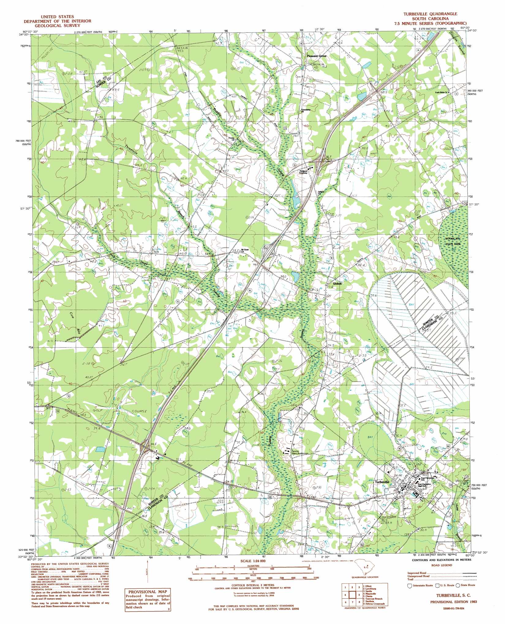
Turbeville Topo Map South Carolina
To zoom in, hover over the map of Turbeville
USGS Topo Quad 33080h1 - 1:24,000 scale
| Topo Map Name: | Turbeville |
| USGS Topo Quad ID: | 33080h1 |
| Print Size: | ca. 21 1/4" wide x 27" high |
| Southeast Coordinates: | 33.875° N latitude / 80° W longitude |
| Map Center Coordinates: | 33.9375° N latitude / 80.0625° W longitude |
| U.S. State: | SC |
| Filename: | o33080h1.jpg |
| Download Map JPG Image: | Turbeville topo map 1:24,000 scale |
| Map Type: | Topographic |
| Topo Series: | 7.5´ |
| Map Scale: | 1:24,000 |
| Source of Map Images: | United States Geological Survey (USGS) |
| Alternate Map Versions: |
Turbeville SC 1983, updated 1983 Download PDF Buy paper map Turbeville SC 2011 Download PDF Buy paper map Turbeville SC 2014 Download PDF Buy paper map |
1:24,000 Topo Quads surrounding Turbeville
Bishopville West |
Bishopville East |
Lamar |
Timmonsville |
Florence West |
Oswego |
Elliott |
Lynchburg |
Sardis |
Effingham |
Sumter East |
Mayesville |
Turbeville |
Olanta |
Mill Bay |
Brogdon |
Tearcoat Branch |
Sardinia |
Hebron Crossroads |
Lake City West |
Paxville |
Manning |
Foreston |
Workman |
Kingstree |
> Back to 33080e1 at 1:100,000 scale
> Back to 33080a1 at 1:250,000 scale
> Back to U.S. Topo Maps home
Turbeville topo map: Gazetteer
Turbeville: Crossings
Interchange 135 elevation 41m 134′Interchange 141 elevation 41m 134′
Turbeville: Dams
South Carolina Noname 14006 D-3481 Dam elevation 29m 95′Turbeville: Populated Places
Pleasant Grove elevation 40m 131′Seloc elevation 28m 91′
Shiloh elevation 37m 121′
Trinity Cross Roads elevation 40m 131′
Turbeville elevation 38m 124′
Turbeville: Post Offices
Turbeville Post Office elevation 40m 131′Turbeville: Streams
Hope Swamp elevation 31m 101′Threemile Branch elevation 34m 111′
Turbeville: Swamps
Cowbay Swamp elevation 40m 131′Dial Bay elevation 34m 111′
Turbeville digital topo map on disk
Buy this Turbeville topo map showing relief, roads, GPS coordinates and other geographical features, as a high-resolution digital map file on DVD:
South Carolina, Western North Carolina & Northeastern Georgia
Buy digital topo maps: South Carolina, Western North Carolina & Northeastern Georgia