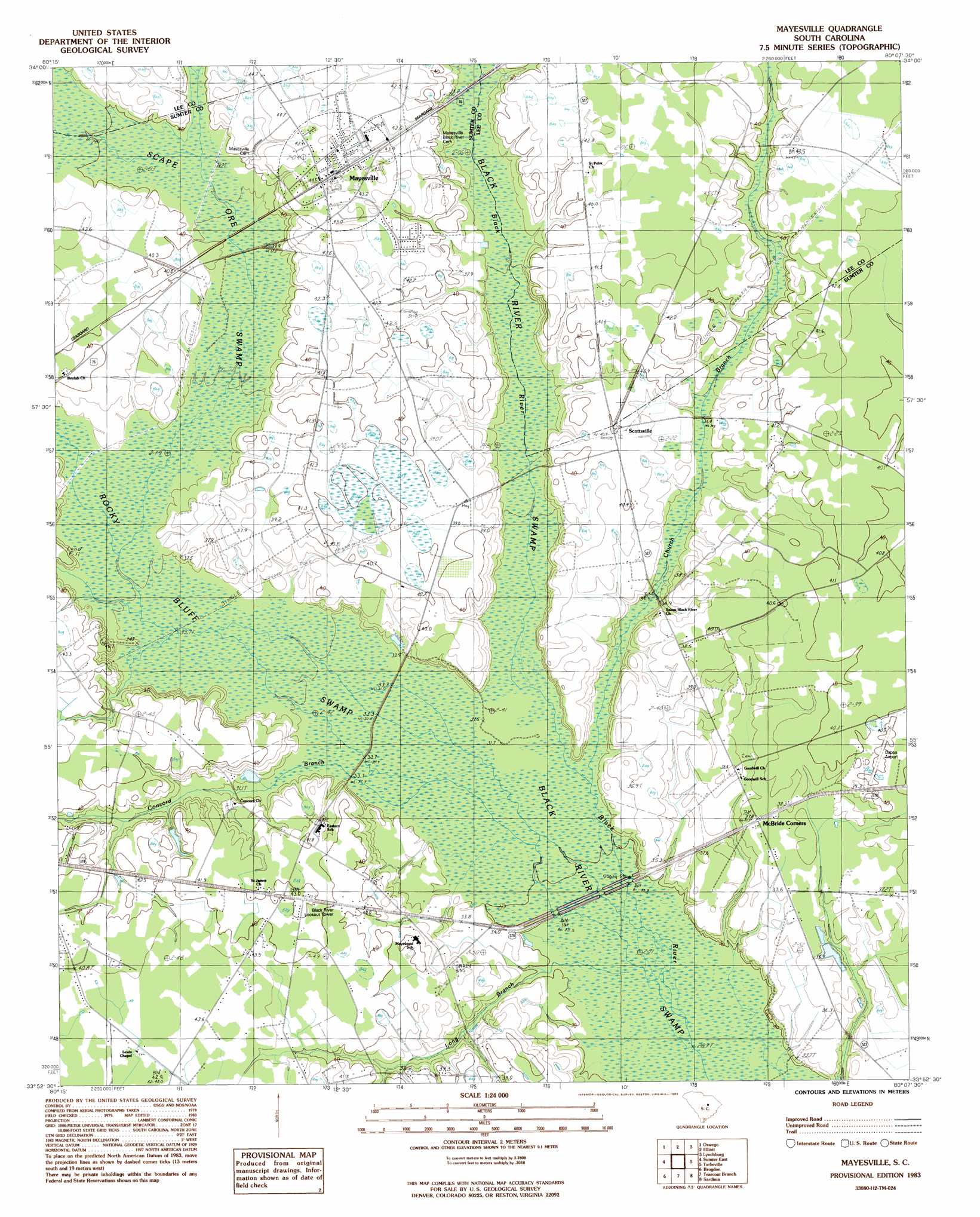
Mayesville Topo Map South Carolina
To zoom in, hover over the map of Mayesville
USGS Topo Quad 33080h2 - 1:24,000 scale
| Topo Map Name: | Mayesville |
| USGS Topo Quad ID: | 33080h2 |
| Print Size: | ca. 21 1/4" wide x 27" high |
| Southeast Coordinates: | 33.875° N latitude / 80.125° W longitude |
| Map Center Coordinates: | 33.9375° N latitude / 80.1875° W longitude |
| U.S. State: | SC |
| Filename: | o33080h2.jpg |
| Download Map JPG Image: | Mayesville topo map 1:24,000 scale |
| Map Type: | Topographic |
| Topo Series: | 7.5´ |
| Map Scale: | 1:24,000 |
| Source of Map Images: | United States Geological Survey (USGS) |
| Alternate Map Versions: |
Mayesville SC 1983, updated 1983 Download PDF Buy paper map Mayesville SC 2011 Download PDF Buy paper map Mayesville SC 2014 Download PDF Buy paper map |
1:24,000 Topo Quads surrounding Mayesville
Spring Hill |
Bishopville West |
Bishopville East |
Lamar |
Timmonsville |
Dalzell |
Oswego |
Elliott |
Lynchburg |
Sardis |
Sumter West |
Sumter East |
Mayesville |
Turbeville |
Olanta |
Privateer |
Brogdon |
Tearcoat Branch |
Sardinia |
Hebron Crossroads |
Pinewood |
Paxville |
Manning |
Foreston |
Workman |
> Back to 33080e1 at 1:100,000 scale
> Back to 33080a1 at 1:250,000 scale
> Back to U.S. Topo Maps home
Mayesville topo map: Gazetteer
Mayesville: Airports
Dabbs Airport elevation 38m 124′Mayesville: Bridges
McBride Crossing elevation 31m 101′Muldrows Crossing elevation 32m 104′
Mayesville: Populated Places
Brunsons Store elevation 43m 141′Mayesville elevation 42m 137′
Mayesville East Subdivision elevation 42m 137′
Scottsville elevation 40m 131′
Mayesville: Post Offices
Mayesville Post Office elevation 44m 144′Mayesville: Streams
Alligator Branch elevation 35m 114′Church Branch elevation 30m 98′
Concord Branch elevation 31m 101′
Little Long Branch elevation 40m 131′
Long Branch elevation 39m 127′
Rocky Bluff Swamp elevation 35m 114′
Scape Ore Swamp elevation 31m 101′
Mayesville digital topo map on disk
Buy this Mayesville topo map showing relief, roads, GPS coordinates and other geographical features, as a high-resolution digital map file on DVD:
South Carolina, Western North Carolina & Northeastern Georgia
Buy digital topo maps: South Carolina, Western North Carolina & Northeastern Georgia