Girard Ne Topo Map South Carolina
To zoom in, hover over the map of Girard Ne
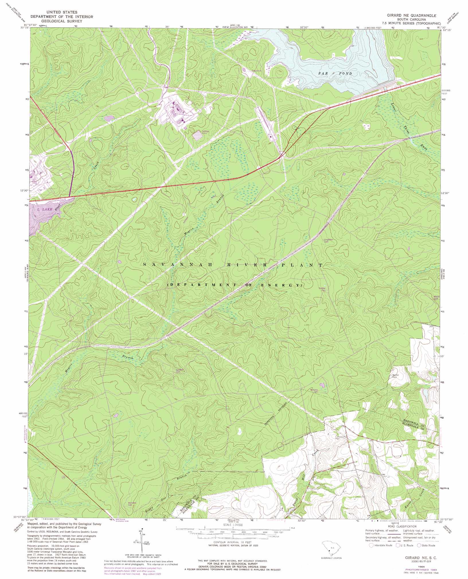
USGS Topo Quad 33081b5 - 1:24,000 scale
| Topo Map Name: | Girard Ne |
| USGS Topo Quad ID: | 33081b5 |
| Print Size: | ca. 21 1/4" wide x 27" high |
| Southeast Coordinates: | 33.125° N latitude / 81.5° W longitude |
| Map Center Coordinates: | 33.1875° N latitude / 81.5625° W longitude |
| U.S. State: | SC |
| Filename: | o33081b5.jpg |
| Download Map JPG Image: | Girard Ne topo map 1:24,000 scale |
| Map Type: | Topographic |
| Topo Series: | 7.5´ |
| Map Scale: | 1:24,000 |
| Source of Map Images: | United States Geological Survey (USGS) |
| Alternate Map Versions: |
Girard NE SC 1964, updated 1967 Download PDF Buy paper map Girard NE SC 1964, updated 1981 Download PDF Buy paper map Girard NE SC 1964, updated 1989 Download PDF Buy paper map Girard NE SC 2011 Download PDF Buy paper map Girard NE SC 2014 Download PDF Buy paper map |
| FStopo: | US Forest Service topo Girard NE is available: Download FStopo PDF Download FStopo TIF |
1:24,000 Topo Quads surrounding Girard Ne
Hollow Creek |
New Ellenton |
Windsor |
Williston |
Springfield |
Jackson |
New Ellenton Sw |
New Ellenton Se |
Long Branch |
Blackville |
Shell Bluff Landing |
Girard Nw |
Girard Ne |
Snelling |
Barnwell |
Alexander |
Girard |
Millett |
Martin |
Allendale |
Sardis |
Hilltonia |
Burtons Ferry Landing |
Bull Pond |
Barton |
> Back to 33081a1 at 1:100,000 scale
> Back to 33080a1 at 1:250,000 scale
> Back to U.S. Topo Maps home
Girard Ne topo map: Gazetteer
Girard Ne: Populated Places
Donora (historical) elevation 54m 177′Dunbarton (historical) elevation 85m 278′
Girard Ne: Reservoirs
Par Pond elevation 63m 206′Girard Ne digital topo map on disk
Buy this Girard Ne topo map showing relief, roads, GPS coordinates and other geographical features, as a high-resolution digital map file on DVD:
South Carolina, Western North Carolina & Northeastern Georgia
Buy digital topo maps: South Carolina, Western North Carolina & Northeastern Georgia