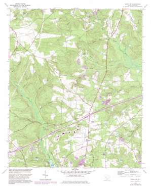
Aiken Nw Topo Map South Carolina
To zoom in, hover over the map of Aiken Nw
USGS Topo Quad 33081f6 - 1:24,000 scale
| Topo Map Name: | Aiken Nw |
| USGS Topo Quad ID: | 33081f6 |
| Print Size: | ca. 21 1/4" wide x 27" high |
| Southeast Coordinates: | 33.625° N latitude / 81.625° W longitude |
| Map Center Coordinates: | 33.6875° N latitude / 81.6875° W longitude |
| U.S. State: | SC |
| Filename: | o33081f6.jpg |
| Download Map JPG Image: | Aiken Nw topo map 1:24,000 scale |
| Map Type: | Topographic |
| Topo Series: | 7.5´ |
| Map Scale: | 1:24,000 |
| Source of Map Images: | United States Geological Survey (USGS) |
| Alternate Map Versions: |
Aiken NW SC 1964, updated 1965 Download PDF Buy paper map Aiken NW SC 1964, updated 1982 Download PDF Buy paper map Aiken NW SC 2011 Download PDF Buy paper map Aiken NW SC 2014 Download PDF Buy paper map |
1:24,000 Topo Quads surrounding Aiken Nw
> Back to 33081e1 at 1:100,000 scale
> Back to 33080a1 at 1:250,000 scale
> Back to U.S. Topo Maps home
Aiken Nw topo map: Gazetteer
Aiken Nw: Airports
Aiken Municipal Airport elevation 155m 508′Aiken Nw: Bridges
Hicks Bridge elevation 107m 351′Aiken Nw: Crossings
Interchange 18 elevation 160m 524′Interchange 22 elevation 156m 511′
Aiken Nw: Dams
Holmes Long Branch Dam D-2047 elevation 139m 456′Holmes Pond Dam D-2026 elevation 153m 501′
South Carolina Noname 02002 D-0710 Dam elevation 131m 429′
South Carolina Noname 02039 Dam elevation 131m 429′
South Carolina Noname 02108 D-2045 Dam elevation 117m 383′
Aiken Nw: Lakes
Lake Josephine elevation 120m 393′Aiken Nw: Populated Places
Seiglers Crossroads elevation 153m 501′Aiken Nw: Reservoirs
Givens Pond (historical) elevation 103m 337′Holmes Long Branch Pond elevation 139m 456′
Holmes Pond elevation 153m 501′
Morris Lake elevation 117m 383′
Morris Pond elevation 113m 370′
Nobles Lake elevation 119m 390′
Reynolds Pond elevation 131m 429′
Aiken Nw: Streams
Boggy Branch elevation 108m 354′Bridge Creek elevation 93m 305′
Brogdon Branch elevation 106m 347′
Curry Branch elevation 111m 364′
Dairy Branch elevation 105m 344′
Jumping Gut Creek elevation 105m 344′
Kalop Branch elevation 100m 328′
Long Branch elevation 109m 357′
Long Branch elevation 103m 337′
Mason Branch elevation 110m 360′
Melton Branch elevation 115m 377′
Mile Branch elevation 101m 331′
Mill Branch elevation 105m 344′
Reedy Fork elevation 109m 357′
Aiken Nw digital topo map on disk
Buy this Aiken Nw topo map showing relief, roads, GPS coordinates and other geographical features, as a high-resolution digital map file on DVD:
South Carolina, Western North Carolina & Northeastern Georgia
Buy digital topo maps: South Carolina, Western North Carolina & Northeastern Georgia


