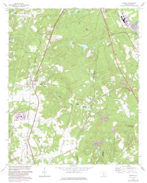
Gaston Topo Map South Carolina
To zoom in, hover over the map of Gaston
USGS Topo Quad 33081g1 - 1:24,000 scale
| Topo Map Name: | Gaston |
| USGS Topo Quad ID: | 33081g1 |
| Print Size: | ca. 21 1/4" wide x 27" high |
| Southeast Coordinates: | 33.75° N latitude / 81° W longitude |
| Map Center Coordinates: | 33.8125° N latitude / 81.0625° W longitude |
| U.S. State: | SC |
| Filename: | o33081g1.jpg |
| Download Map JPG Image: | Gaston topo map 1:24,000 scale |
| Map Type: | Topographic |
| Topo Series: | 7.5´ |
| Map Scale: | 1:24,000 |
| Source of Map Images: | United States Geological Survey (USGS) |
| Alternate Map Versions: |
Gaston SC 1972, updated 1975 Download PDF Buy paper map Gaston SC 1972, updated 1983 Download PDF Buy paper map Gaston SC 2011 Download PDF Buy paper map Gaston SC 2014 Download PDF Buy paper map |
1:24,000 Topo Quads surrounding Gaston
> Back to 33081e1 at 1:100,000 scale
> Back to 33080a1 at 1:250,000 scale
> Back to U.S. Topo Maps home
Gaston topo map: Gazetteer
Gaston: Airports
Lexington County Airport elevation 145m 475′Gaston: Crossings
Interchange 125 elevation 86m 282′Gaston: Dams
Boozer Lower Pond Dam D-2922 elevation 62m 203′Calmont Pond Dam D-2672 elevation 68m 223′
Dixon Pond Dam D-0996 elevation 61m 200′
Hill Number One Pond Dam D-2669 elevation 88m 288′
Hills Number Two Pond Dam D-2667 elevation 91m 298′
Lackland Pond Dam D-2670 elevation 55m 180′
South Carolina Noname 09045 D-2924 Dam elevation 45m 147′
South Carolina Noname 32001 D-0993 Dam elevation 49m 160′
South Carolina Noname 32016 D-0988 Dam elevation 65m 213′
South Carolina Noname 32017 D-0989 Dam elevation 76m 249′
South Carolina Noname 32037 D-0995 Dam elevation 62m 203′
South Carolina Noname 32039 D-0992 Dam elevation 62m 203′
South Carolina Noname 32082 D-1295 Dam elevation 93m 305′
Sulton Pond Dam D-2671 elevation 61m 200′
Gaston: Lakes
Geiger Pond elevation 53m 173′Moores Millpond elevation 65m 213′
Gaston: Populated Places
Enos elevation 70m 229′Gaston elevation 152m 498′
Gaston: Reservoirs
Acres Pond elevation 52m 170′Boozer Lower Pond elevation 62m 203′
Calmont Pond elevation 68m 223′
Carolina Eastman Waste Pond elevation 35m 114′
Dixon Pond elevation 61m 200′
Hill Number One Pond elevation 88m 288′
Hills Number Two Pond elevation 91m 298′
Huckabaas Millpond elevation 62m 203′
Hutto Pond elevation 65m 213′
Lackland Pond elevation 55m 180′
Lexington Acres Pond elevation 49m 160′
Sharpes Pond elevation 93m 305′
State-Record Pond elevation 62m 203′
Sulton Pond elevation 61m 200′
Urquhart Pond elevation 77m 252′
Gaston: Streams
Little Sandy Run elevation 44m 144′North Fork Sandy Run elevation 44m 144′
Gaston: Summits
Sand Mountain elevation 125m 410′Gaston digital topo map on disk
Buy this Gaston topo map showing relief, roads, GPS coordinates and other geographical features, as a high-resolution digital map file on DVD:
South Carolina, Western North Carolina & Northeastern Georgia
Buy digital topo maps: South Carolina, Western North Carolina & Northeastern Georgia


