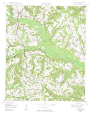
Keysville Topo Map Georgia
To zoom in, hover over the map of Keysville
USGS Topo Quad 33082b2 - 1:24,000 scale
| Topo Map Name: | Keysville |
| USGS Topo Quad ID: | 33082b2 |
| Print Size: | ca. 21 1/4" wide x 27" high |
| Southeast Coordinates: | 33.125° N latitude / 82.125° W longitude |
| Map Center Coordinates: | 33.1875° N latitude / 82.1875° W longitude |
| U.S. State: | GA |
| Filename: | o33082b2.jpg |
| Download Map JPG Image: | Keysville topo map 1:24,000 scale |
| Map Type: | Topographic |
| Topo Series: | 7.5´ |
| Map Scale: | 1:24,000 |
| Source of Map Images: | United States Geological Survey (USGS) |
| Alternate Map Versions: |
Keysville GA 1950 Download PDF Buy paper map Keysville GA 2011 Download PDF Buy paper map Keysville GA 2014 Download PDF Buy paper map |
1:24,000 Topo Quads surrounding Keysville
> Back to 33082a1 at 1:100,000 scale
> Back to 33082a1 at 1:250,000 scale
> Back to U.S. Topo Maps home
Keysville topo map: Gazetteer
Keysville: Bridges
Farmers Bridge elevation 70m 229′Keysville: Dams
Davis Pond Dam elevation 75m 246′Keys Pond Dam elevation 77m 252′
Keysville: Populated Places
Brushy Creek (historical) elevation 78m 255′Dyes Crossroad elevation 103m 337′
Keysville elevation 79m 259′
Le Roy (historical) elevation 96m 314′
Saint Clair elevation 118m 387′
Walker Grove Settlement elevation 109m 357′
Keysville: Post Offices
Keysville Post Office elevation 81m 265′Keysville: Reservoirs
Davis Pond elevation 75m 246′Keys Pond elevation 77m 252′
Marks Mill Pond elevation 78m 255′
Timmons Pond elevation 72m 236′
Keysville: Streams
Brushy Creek elevation 69m 226′Camp Branch elevation 74m 242′
Little Brushy Creek elevation 74m 242′
Little Creek elevation 65m 213′
Mill Creek elevation 66m 216′
Palmer Branch elevation 72m 236′
Reedy Creek elevation 74m 242′
Stocking Branch elevation 71m 232′
Tarvers Branch elevation 71m 232′
Travers Branch elevation 71m 232′
Keysville digital topo map on disk
Buy this Keysville topo map showing relief, roads, GPS coordinates and other geographical features, as a high-resolution digital map file on DVD:
South Carolina, Western North Carolina & Northeastern Georgia
Buy digital topo maps: South Carolina, Western North Carolina & Northeastern Georgia


