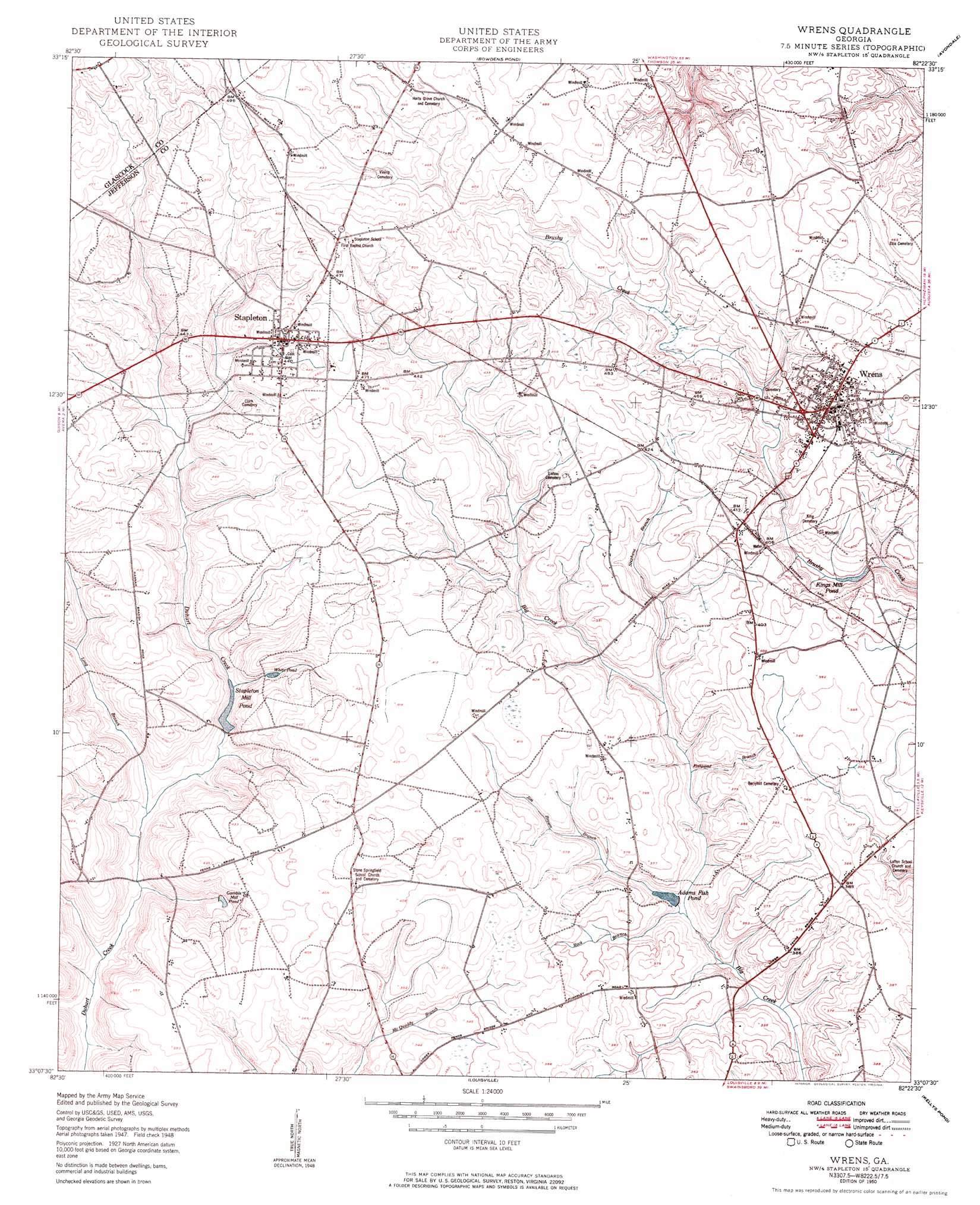
Wrens Topo Map Georgia
To zoom in, hover over the map of Wrens
USGS Topo Quad 33082b4 - 1:24,000 scale
| Topo Map Name: | Wrens |
| USGS Topo Quad ID: | 33082b4 |
| Print Size: | ca. 21 1/4" wide x 27" high |
| Southeast Coordinates: | 33.125° N latitude / 82.375° W longitude |
| Map Center Coordinates: | 33.1875° N latitude / 82.4375° W longitude |
| U.S. State: | GA |
| Filename: | o33082b4.jpg |
| Download Map JPG Image: | Wrens topo map 1:24,000 scale |
| Map Type: | Topographic |
| Topo Series: | 7.5´ |
| Map Scale: | 1:24,000 |
| Source of Map Images: | United States Geological Survey (USGS) |
| Alternate Map Versions: |
Wrens GA 1950 Download PDF Buy paper map Wrens GA 1950 Download PDF Buy paper map Wrens GA 2011 Download PDF Buy paper map Wrens GA 2014 Download PDF Buy paper map |
1:24,000 Topo Quads surrounding Wrens
Warrenton |
Thomson West |
Thompson East |
Harlem |
Grovetown |
Beall Springs |
Bastonville |
Bowdens Pond |
Avondale |
Blythe |
Mitchell |
Gibson |
Wrens |
Matthews |
Keysville |
Downs |
Grange |
Louisville |
Kellys Pond |
Gough |
Riddleville |
Davisboro |
Louisville South |
Old Town |
Scotts Corner |
> Back to 33082a1 at 1:100,000 scale
> Back to 33082a1 at 1:250,000 scale
> Back to U.S. Topo Maps home
Wrens topo map: Gazetteer
Wrens: Airports
Wrens Memorial Airport elevation 136m 446′Wrens: Dams
Adams Lake Dam elevation 94m 308′Stapleton Millpond Dam elevation 96m 314′
Wrens: Lakes
Oliphant Pond (historical) elevation 118m 387′Wrens: Populated Places
Stapleton elevation 134m 439′Wrens elevation 123m 403′
Wrens Station elevation 125m 410′
Wrens: Reservoirs
Adams Fish Pond elevation 96m 314′Adams Lake elevation 94m 308′
Gamble Mill Pond elevation 100m 328′
Kings Mill Pond elevation 106m 347′
Stapleton Mill Pond elevation 96m 314′
Stapleton Millpond elevation 100m 328′
White Pond elevation 111m 364′
Wrens: Streams
Fishpond Branch elevation 95m 311′Hannah Branch elevation 85m 278′
Jim Brown Branch elevation 96m 314′
Long Branch elevation 92m 301′
Rock Branch elevation 93m 305′
Stephens Branch elevation 98m 321′
Wrens digital topo map on disk
Buy this Wrens topo map showing relief, roads, GPS coordinates and other geographical features, as a high-resolution digital map file on DVD:
South Carolina, Western North Carolina & Northeastern Georgia
Buy digital topo maps: South Carolina, Western North Carolina & Northeastern Georgia