Bastonville Topo Map Georgia
To zoom in, hover over the map of Bastonville
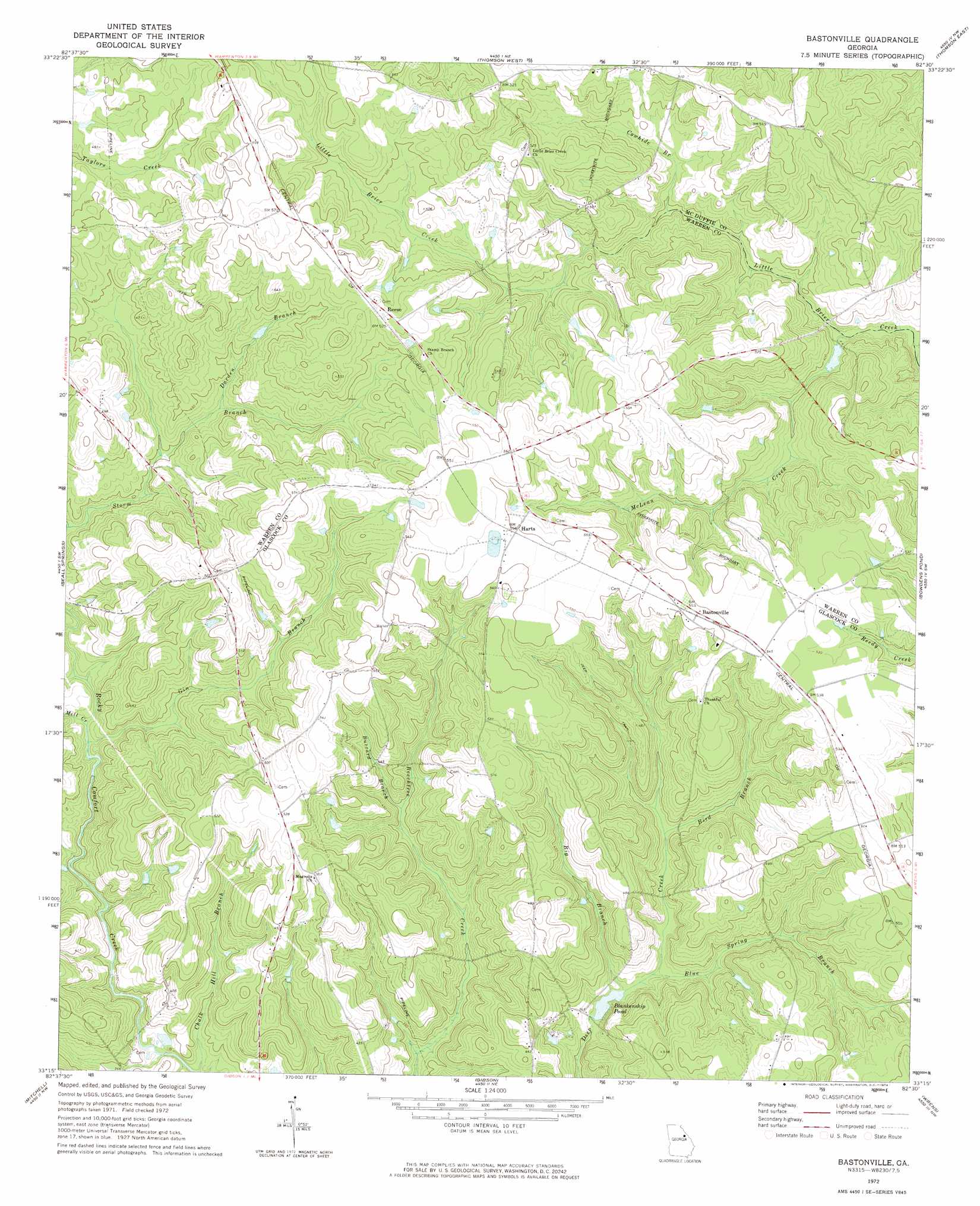
USGS Topo Quad 33082c5 - 1:24,000 scale
| Topo Map Name: | Bastonville |
| USGS Topo Quad ID: | 33082c5 |
| Print Size: | ca. 21 1/4" wide x 27" high |
| Southeast Coordinates: | 33.25° N latitude / 82.5° W longitude |
| Map Center Coordinates: | 33.3125° N latitude / 82.5625° W longitude |
| U.S. State: | GA |
| Filename: | o33082c5.jpg |
| Download Map JPG Image: | Bastonville topo map 1:24,000 scale |
| Map Type: | Topographic |
| Topo Series: | 7.5´ |
| Map Scale: | 1:24,000 |
| Source of Map Images: | United States Geological Survey (USGS) |
| Alternate Map Versions: |
Bastonville GA 1972, updated 1974 Download PDF Buy paper map Bastonville GA 2011 Download PDF Buy paper map Bastonville GA 2014 Download PDF Buy paper map |
1:24,000 Topo Quads surrounding Bastonville
Sharon |
Cadley |
Wrightsboro |
Winfield |
Appling |
Sparta Ne |
Warrenton |
Thomson West |
Thompson East |
Harlem |
Jewell |
Beall Springs |
Bastonville |
Bowdens Pond |
Avondale |
Warthen Ne |
Mitchell |
Gibson |
Wrens |
Matthews |
Warthen |
Downs |
Grange |
Louisville |
Kellys Pond |
> Back to 33082a1 at 1:100,000 scale
> Back to 33082a1 at 1:250,000 scale
> Back to U.S. Topo Maps home
Bastonville topo map: Gazetteer
Bastonville: Crossings
Munns Ford elevation 127m 416′Bastonville: Dams
Blankenship Pond Dam elevation 108m 354′Reese Lake Dam elevation 127m 416′
Bastonville: Populated Places
Bastonville elevation 168m 551′Harts elevation 167m 547′
Reese elevation 158m 518′
Bastonville: Reservoirs
Blankenship Pond elevation 108m 354′Reese Lake elevation 127m 416′
Bastonville: Streams
Big Branch elevation 108m 354′Bird Branch elevation 116m 380′
Blue Spring Branch elevation 109m 357′
Buzzard Branch elevation 121m 396′
Cowhide Branch elevation 121m 396′
Darden Branch elevation 126m 413′
Gin Branch elevation 108m 354′
McLean Creek elevation 112m 367′
Mill Creek elevation 109m 357′
Bastonville digital topo map on disk
Buy this Bastonville topo map showing relief, roads, GPS coordinates and other geographical features, as a high-resolution digital map file on DVD:
South Carolina, Western North Carolina & Northeastern Georgia
Buy digital topo maps: South Carolina, Western North Carolina & Northeastern Georgia