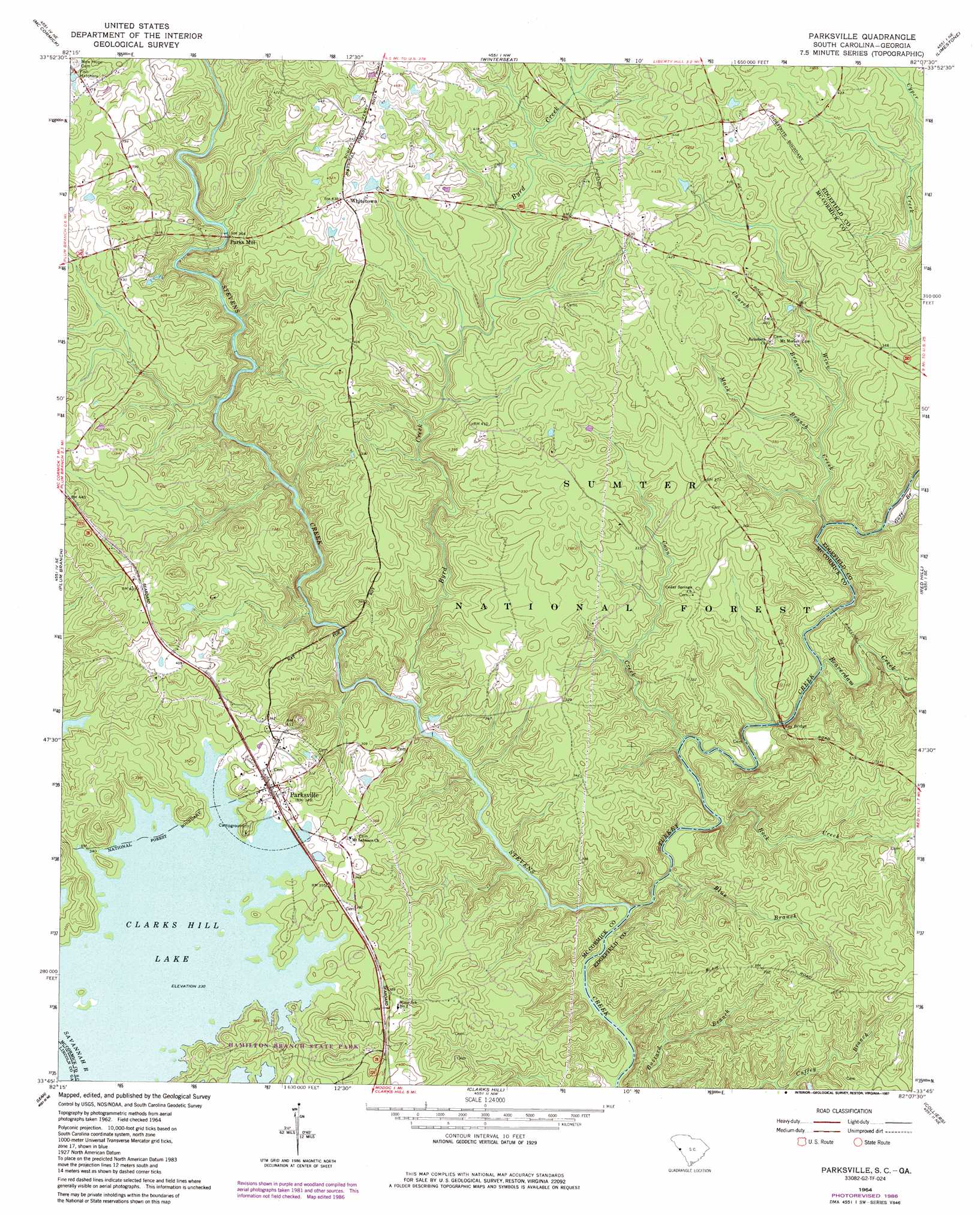
Parksville Topo Map South Carolina
To zoom in, hover over the map of Parksville
USGS Topo Quad 33082g2 - 1:24,000 scale
| Topo Map Name: | Parksville |
| USGS Topo Quad ID: | 33082g2 |
| Print Size: | ca. 21 1/4" wide x 27" high |
| Southeast Coordinates: | 33.75° N latitude / 82.125° W longitude |
| Map Center Coordinates: | 33.8125° N latitude / 82.1875° W longitude |
| U.S. States: | SC, GA |
| Filename: | o33082g2.jpg |
| Download Map JPG Image: | Parksville topo map 1:24,000 scale |
| Map Type: | Topographic |
| Topo Series: | 7.5´ |
| Map Scale: | 1:24,000 |
| Source of Map Images: | United States Geological Survey (USGS) |
| Alternate Map Versions: |
Parksville SC 1964, updated 1967 Download PDF Buy paper map Parksville SC 1964, updated 1987 Download PDF Buy paper map Parksville SC 2011 Download PDF Buy paper map Parksville SC 2014 Download PDF Buy paper map |
| FStopo: | US Forest Service topo Parksville is available: Download FStopo PDF Download FStopo TIF |
1:24,000 Topo Quads surrounding Parksville
Calhoun Creek |
Verdery |
Bradley |
Kirksey |
Good Hope |
Willington |
Mccormick |
Winterseat |
Limestone |
Owdoms |
Lincolnton |
Plum Branch |
Parksville |
Red Hill |
Edgefield |
Woodlawn |
Leah |
Clarks Hill |
Colliers |
Ropers Crossroads |
Winfield |
Appling |
Evans |
Martinez |
North Augusta |
> Back to 33082e1 at 1:100,000 scale
> Back to 33082a1 at 1:250,000 scale
> Back to U.S. Topo Maps home
Parksville topo map: Gazetteer
Parksville: Bridges
Key Bridge elevation 68m 223′Parksville: Crossings
Busseys Ferry (historical) elevation 100m 328′Busseys Ferry (historical) elevation 100m 328′
Parksville: Parks
Hamilton Branch State Park elevation 109m 357′Parksville Recreation Area elevation 102m 334′
Parksville Wayside Park elevation 125m 410′
Parksville: Populated Places
Bethany (historical) elevation 126m 413′Parks Mill elevation 110m 360′
Parksville elevation 106m 347′
Whitetown elevation 132m 433′
Parksville: Streams
Beaverdam Creek elevation 68m 223′Blue Branch elevation 69m 226′
Byrd Creek elevation 72m 236′
Church Branch elevation 84m 275′
Coon Creek elevation 69m 226′
Goff Branch elevation 68m 223′
Mack Branch elevation 82m 269′
Rock Creek elevation 68m 223′
Turkey Creek elevation 68m 223′
Wine Creek elevation 68m 223′
Parksville: Trails
Turkey Creek Hiking Trail elevation 74m 242′Parksville digital topo map on disk
Buy this Parksville topo map showing relief, roads, GPS coordinates and other geographical features, as a high-resolution digital map file on DVD:
South Carolina, Western North Carolina & Northeastern Georgia
Buy digital topo maps: South Carolina, Western North Carolina & Northeastern Georgia