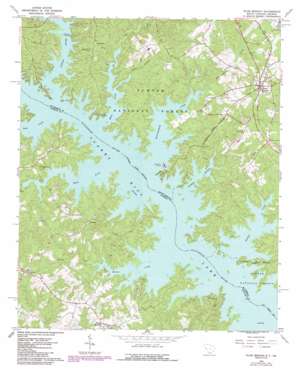
Plum Branch Topo Map South Carolina
To zoom in, hover over the map of Plum Branch
USGS Topo Quad 33082g3 - 1:24,000 scale
| Topo Map Name: | Plum Branch |
| USGS Topo Quad ID: | 33082g3 |
| Print Size: | ca. 21 1/4" wide x 27" high |
| Southeast Coordinates: | 33.75° N latitude / 82.25° W longitude |
| Map Center Coordinates: | 33.8125° N latitude / 82.3125° W longitude |
| U.S. States: | SC, GA |
| Filename: | o33082g3.jpg |
| Download Map JPG Image: | Plum Branch topo map 1:24,000 scale |
| Map Type: | Topographic |
| Topo Series: | 7.5´ |
| Map Scale: | 1:24,000 |
| Source of Map Images: | United States Geological Survey (USGS) |
| Alternate Map Versions: |
Plum Branch SC 1964, updated 1967 Download PDF Buy paper map Plum Branch SC 1964, updated 1987 Download PDF Buy paper map Plum Branch SC 2011 Download PDF Buy paper map Plum Branch SC 2014 Download PDF Buy paper map |
| FStopo: | US Forest Service topo Plum Branch is available: Download FStopo PDF Download FStopo TIF |
1:24,000 Topo Quads surrounding Plum Branch
> Back to 33082e1 at 1:100,000 scale
> Back to 33082a1 at 1:250,000 scale
> Back to U.S. Topo Maps home
Plum Branch topo map: Gazetteer
Plum Branch: Crossings
Chamberlains Ferry (historical) elevation 100m 328′Chamberlains Ferry (historical) elevation 100m 328′
McCoys Ferry (historical) elevation 100m 328′
McCoys Ferry (historical) elevation 100m 328′
Sturkeys Ferry (historical) elevation 100m 328′
Sturkeys Ferry (historical) elevation 100m 328′
Plum Branch: Islands
Ferguson Island (historical) elevation 100m 328′Martin Island (historical) elevation 100m 328′
Searle Island (historical) elevation 100m 328′
Plum Branch: Parks
Chamberlain Ferry Picnic Area elevation 115m 377′Plum Branch: Populated Places
Double Branches elevation 128m 419′Little River Subdivision elevation 111m 364′
Martins Crossroads elevation 144m 472′
Maxim elevation 130m 426′
Plum Branch elevation 140m 459′
Plum Branch: Streams
Benningsfield Creek elevation 100m 328′Camp Creek elevation 100m 328′
Dordon Creek elevation 100m 328′
Hawe Creek elevation 100m 328′
Jester Branch elevation 101m 331′
Landam Branch elevation 100m 328′
Little River elevation 100m 328′
Shriver Creek elevation 100m 328′
Soap Creek elevation 100m 328′
Wells Creek elevation 100m 328′
Plum Branch digital topo map on disk
Buy this Plum Branch topo map showing relief, roads, GPS coordinates and other geographical features, as a high-resolution digital map file on DVD:
South Carolina, Western North Carolina & Northeastern Georgia
Buy digital topo maps: South Carolina, Western North Carolina & Northeastern Georgia


