Browns Crossing Topo Map Georgia
To zoom in, hover over the map of Browns Crossing
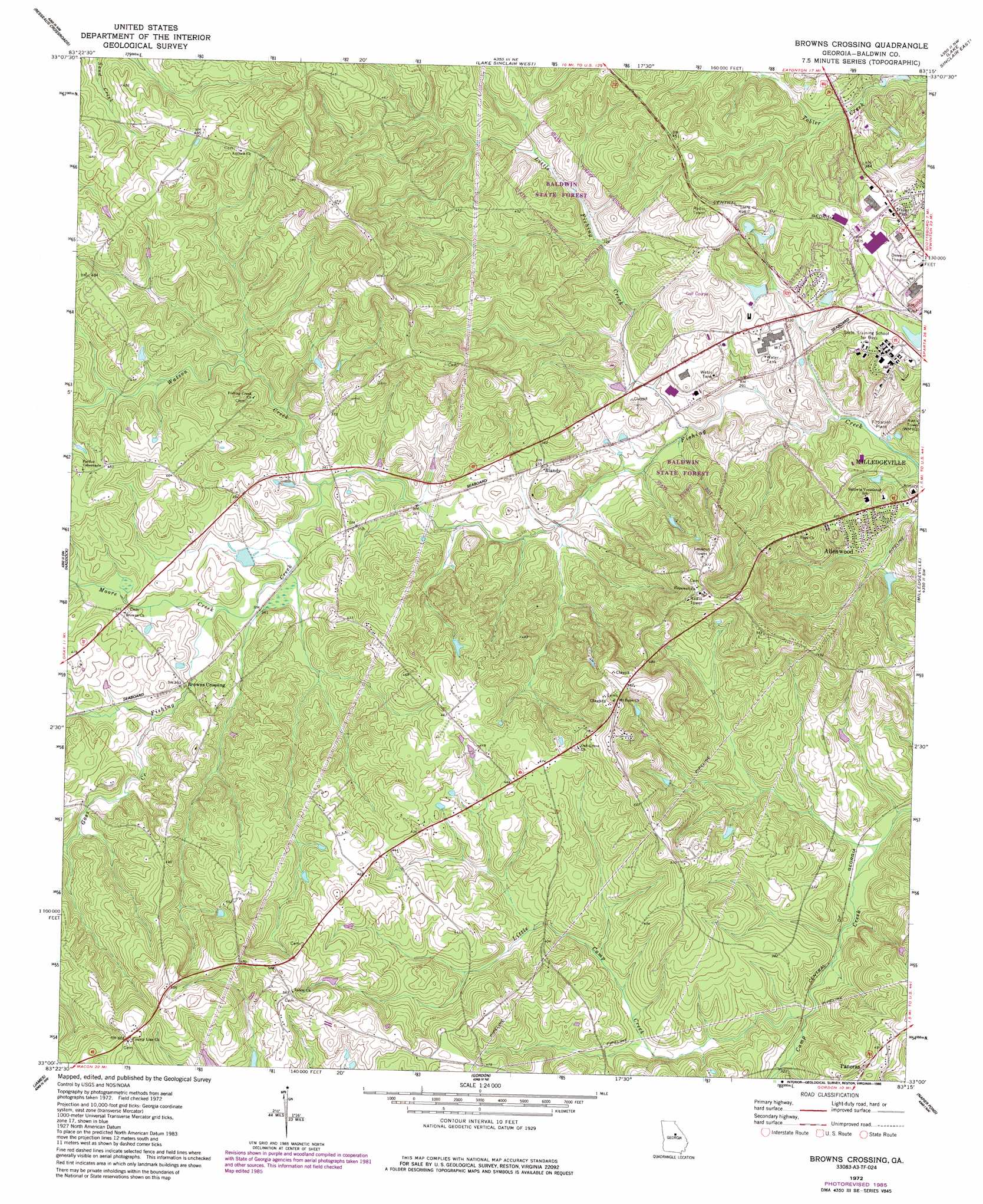
USGS Topo Quad 33083a3 - 1:24,000 scale
| Topo Map Name: | Browns Crossing |
| USGS Topo Quad ID: | 33083a3 |
| Print Size: | ca. 21 1/4" wide x 27" high |
| Southeast Coordinates: | 33° N latitude / 83.25° W longitude |
| Map Center Coordinates: | 33.0625° N latitude / 83.3125° W longitude |
| U.S. State: | GA |
| Filename: | o33083a3.jpg |
| Download Map JPG Image: | Browns Crossing topo map 1:24,000 scale |
| Map Type: | Topographic |
| Topo Series: | 7.5´ |
| Map Scale: | 1:24,000 |
| Source of Map Images: | United States Geological Survey (USGS) |
| Alternate Map Versions: |
Browns Crossing GA 1972, updated 1975 Download PDF Buy paper map Browns Crossing GA 1972, updated 1986 Download PDF Buy paper map Browns Crossing GA 2011 Download PDF Buy paper map Browns Crossing GA 2014 Download PDF Buy paper map |
1:24,000 Topo Quads surrounding Browns Crossing
Smithboro |
Eatonton |
Meda |
Rockville |
Shoulderbone |
Stanfordville |
Resseaus Crossroads |
Lake Sinclair West |
Lake Sinclair East |
Devereux |
Gray |
Haddock |
Browns Crossing |
Milledgeville |
Friendship |
Macon Ne |
James |
Gordon |
Napier Pond |
Gumm Pond |
Macon East |
Dry Branch |
Massey Hill |
Irwinton |
Toomsboro |
> Back to 33083a1 at 1:100,000 scale
> Back to 33082a1 at 1:250,000 scale
> Back to U.S. Topo Maps home
Browns Crossing topo map: Gazetteer
Browns Crossing: Dams
Ashfield Lake Dam elevation 102m 334′Baldwin County Recreation Lake Dam elevation 115m 377′
Fountain Lake Dam elevation 133m 436′
Browns Crossing: Forests
Baldwin State Forest elevation 109m 357′Browns Crossing: Parks
Walter B Williams Junior Park elevation 103m 337′Browns Crossing: Populated Places
Allenwood elevation 118m 387′Blandy elevation 107m 351′
Browns Crossing elevation 110m 360′
Browns Crossing: Reservoirs
Ashfield Lake elevation 102m 334′Baldwin County Recreation Lake elevation 115m 377′
Fountain Lake elevation 133m 436′
Browns Crossing: Streams
Goss Creek elevation 106m 347′Little Camp Creek elevation 91m 298′
Little Fishing Creek elevation 85m 278′
Moore Creek elevation 101m 331′
Watson Creek elevation 96m 314′
Browns Crossing digital topo map on disk
Buy this Browns Crossing topo map showing relief, roads, GPS coordinates and other geographical features, as a high-resolution digital map file on DVD:
South Carolina, Western North Carolina & Northeastern Georgia
Buy digital topo maps: South Carolina, Western North Carolina & Northeastern Georgia