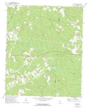
Smithboro Topo Map Georgia
To zoom in, hover over the map of Smithboro
USGS Topo Quad 33083c5 - 1:24,000 scale
| Topo Map Name: | Smithboro |
| USGS Topo Quad ID: | 33083c5 |
| Print Size: | ca. 21 1/4" wide x 27" high |
| Southeast Coordinates: | 33.25° N latitude / 83.5° W longitude |
| Map Center Coordinates: | 33.3125° N latitude / 83.5625° W longitude |
| U.S. State: | GA |
| Filename: | o33083c5.jpg |
| Download Map JPG Image: | Smithboro topo map 1:24,000 scale |
| Map Type: | Topographic |
| Topo Series: | 7.5´ |
| Map Scale: | 1:24,000 |
| Source of Map Images: | United States Geological Survey (USGS) |
| Alternate Map Versions: |
Smithboro GA 1972, updated 1974 Download PDF Buy paper map Smithboro GA 1972, updated 1991 Download PDF Buy paper map Smithboro GA 2011 Download PDF Buy paper map Smithboro GA 2014 Download PDF Buy paper map |
| FStopo: | US Forest Service topo Smithboro is available: Download FStopo PDF Download FStopo TIF |
1:24,000 Topo Quads surrounding Smithboro
> Back to 33083a1 at 1:100,000 scale
> Back to 33082a1 at 1:250,000 scale
> Back to U.S. Topo Maps home
Smithboro topo map: Gazetteer
Smithboro: Bridges
Gammon Bridge (historical) elevation 127m 416′Smithboro: Forests
Oconee National Forest elevation 174m 570′Smithboro: Populated Places
Aikenton elevation 192m 629′Apollo (historical) elevation 188m 616′
Piedmont (historical) elevation 169m 554′
Smithboro elevation 158m 518′
Smithboro: Streams
Broddus Creek elevation 128m 419′Howard Branch elevation 126m 413′
Jack Creek elevation 134m 439′
Little Creek elevation 122m 400′
North Fork Wolf Creek elevation 132m 433′
Shoal Creek elevation 136m 446′
South Fork Wolf Creek elevation 130m 426′
White Oak Creek elevation 133m 436′
Whitehouse Branch elevation 135m 442′
Wolf Creek elevation 124m 406′
Smithboro digital topo map on disk
Buy this Smithboro topo map showing relief, roads, GPS coordinates and other geographical features, as a high-resolution digital map file on DVD:
South Carolina, Western North Carolina & Northeastern Georgia
Buy digital topo maps: South Carolina, Western North Carolina & Northeastern Georgia


