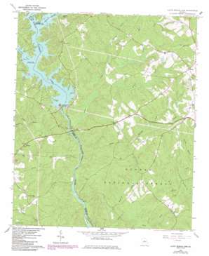
Lloyd Shoals Dam Topo Map Georgia
To zoom in, hover over the map of Lloyd Shoals Dam
USGS Topo Quad 33083c7 - 1:24,000 scale
| Topo Map Name: | Lloyd Shoals Dam |
| USGS Topo Quad ID: | 33083c7 |
| Print Size: | ca. 21 1/4" wide x 27" high |
| Southeast Coordinates: | 33.25° N latitude / 83.75° W longitude |
| Map Center Coordinates: | 33.3125° N latitude / 83.8125° W longitude |
| U.S. State: | GA |
| Filename: | o33083c7.jpg |
| Download Map JPG Image: | Lloyd Shoals Dam topo map 1:24,000 scale |
| Map Type: | Topographic |
| Topo Series: | 7.5´ |
| Map Scale: | 1:24,000 |
| Source of Map Images: | United States Geological Survey (USGS) |
| Alternate Map Versions: |
Lloyd Shoals Dam GA 1964, updated 1965 Download PDF Buy paper map Lloyd Shoals Dam GA 1964, updated 1976 Download PDF Buy paper map Lloyd Shoals Dam GA 1964, updated 1986 Download PDF Buy paper map Lloyd Shoals Dam GA 2011 Download PDF Buy paper map Lloyd Shoals Dam GA 2014 Download PDF Buy paper map |
| FStopo: | US Forest Service topo Lloyd Shoals Dam is available: Download FStopo PDF Download FStopo TIF |
1:24,000 Topo Quads surrounding Lloyd Shoals Dam
> Back to 33083a1 at 1:100,000 scale
> Back to 33082a1 at 1:250,000 scale
> Back to U.S. Topo Maps home
Lloyd Shoals Dam topo map: Gazetteer
Lloyd Shoals Dam: Bays
Leverette Neck elevation 161m 528′Lloyd Shoals Dam: Crossings
Giles Ferry (historical) elevation 122m 400′Old Dempsey Ferry (historical) elevation 161m 528′
Old Keys Ferry (historical) elevation 161m 528′
Pittman Ferry (historical) elevation 122m 400′
Smith Ferry (historical) elevation 122m 400′
Thomas Ferry (historical) elevation 122m 400′
Lloyd Shoals Dam: Dams
Lloyd Shoals Dam elevation 161m 528′Lloyd Shoals Dam: Populated Places
Bethel elevation 223m 731′Mechanicsville (historical) elevation 201m 659′
Smiths Mill (historical) elevation 139m 456′
Lloyd Shoals Dam: Reservoirs
Jackson Lake elevation 161m 528′Lloyd Shoals Dam: Streams
Alcovy River elevation 161m 528′Hardys Creek elevation 144m 472′
Harmon Pye Branch elevation 133m 436′
Herds Creek elevation 151m 495′
Kinnard Creek elevation 121m 396′
Panther Creek elevation 147m 482′
Persons Creek elevation 140m 459′
Rush Creek elevation 125m 410′
South River elevation 161m 528′
Spring Branch elevation 138m 452′
Tussahaw Creek elevation 161m 528′
Yellow Water Creek elevation 122m 400′
Lloyd Shoals Dam: Trails
Kinnard Horse Trail elevation 138m 452′Lloyd Shoals Dam digital topo map on disk
Buy this Lloyd Shoals Dam topo map showing relief, roads, GPS coordinates and other geographical features, as a high-resolution digital map file on DVD:
South Carolina, Western North Carolina & Northeastern Georgia
Buy digital topo maps: South Carolina, Western North Carolina & Northeastern Georgia


