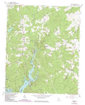
Stewart Topo Map Georgia
To zoom in, hover over the map of Stewart
USGS Topo Quad 33083d7 - 1:24,000 scale
| Topo Map Name: | Stewart |
| USGS Topo Quad ID: | 33083d7 |
| Print Size: | ca. 21 1/4" wide x 27" high |
| Southeast Coordinates: | 33.375° N latitude / 83.75° W longitude |
| Map Center Coordinates: | 33.4375° N latitude / 83.8125° W longitude |
| U.S. State: | GA |
| Filename: | o33083d7.jpg |
| Download Map JPG Image: | Stewart topo map 1:24,000 scale |
| Map Type: | Topographic |
| Topo Series: | 7.5´ |
| Map Scale: | 1:24,000 |
| Source of Map Images: | United States Geological Survey (USGS) |
| Alternate Map Versions: |
Stewart GA 1964, updated 1965 Download PDF Buy paper map Stewart GA 1964, updated 1985 Download PDF Buy paper map Stewart GA 2011 Download PDF Buy paper map Stewart GA 2014 Download PDF Buy paper map |
1:24,000 Topo Quads surrounding Stewart
> Back to 33083a1 at 1:100,000 scale
> Back to 33082a1 at 1:250,000 scale
> Back to U.S. Topo Maps home
Stewart topo map: Gazetteer
Stewart: Bars
Factory Shoals elevation 175m 574′White Shoals elevation 162m 531′
Stewart: Bays
Connally Cove elevation 161m 528′Hardy Neck elevation 162m 531′
Kitchen Neck elevation 161m 528′
Lewis Neck elevation 161m 528′
Parker Neck elevation 161m 528′
Plunkett Neck elevation 161m 528′
Pope Neck elevation 161m 528′
Price Neck elevation 161m 528′
Will White Neck elevation 161m 528′
Stewart: Bridges
Waters Bridge elevation 161m 528′Stewart: Dams
Bert Adams Dam elevation 178m 583′Richardson Lake Dam elevation 196m 643′
Stewart: Pillars
Dows Pulpit Historical Rock elevation 233m 764′Stewart: Populated Places
Alcovy Shores elevation 169m 554′Avalon elevation 212m 695′
Fincher Farms elevation 194m 636′
Hardys Crossroads elevation 195m 639′
Idlewood elevation 188m 616′
Kitchens Store (historical) elevation 211m 692′
Lakeside Grove elevation 178m 583′
Long Acres elevation 177m 580′
Malcolm Woods elevation 178m 583′
Prospect elevation 224m 734′
Rocky Creek elevation 200m 656′
Saddle Acres elevation 190m 623′
Sherwood Forest elevation 175m 574′
Stewart elevation 204m 669′
Turtles Cove elevation 208m 682′
Stewart: Reservoirs
Lake Bulow Campbell elevation 178m 583′Richardson Lake elevation 196m 643′
Stewart: Streams
Barnes Branch elevation 164m 538′Bear Creek elevation 162m 531′
East Bear Creek elevation 188m 616′
Gaithers Branch elevation 183m 600′
Rocky Creek elevation 161m 528′
West Bear Creek elevation 188m 616′
Whitehead Creek elevation 191m 626′
Stewart digital topo map on disk
Buy this Stewart topo map showing relief, roads, GPS coordinates and other geographical features, as a high-resolution digital map file on DVD:
South Carolina, Western North Carolina & Northeastern Georgia
Buy digital topo maps: South Carolina, Western North Carolina & Northeastern Georgia


