Union Point Topo Map Georgia
To zoom in, hover over the map of Union Point
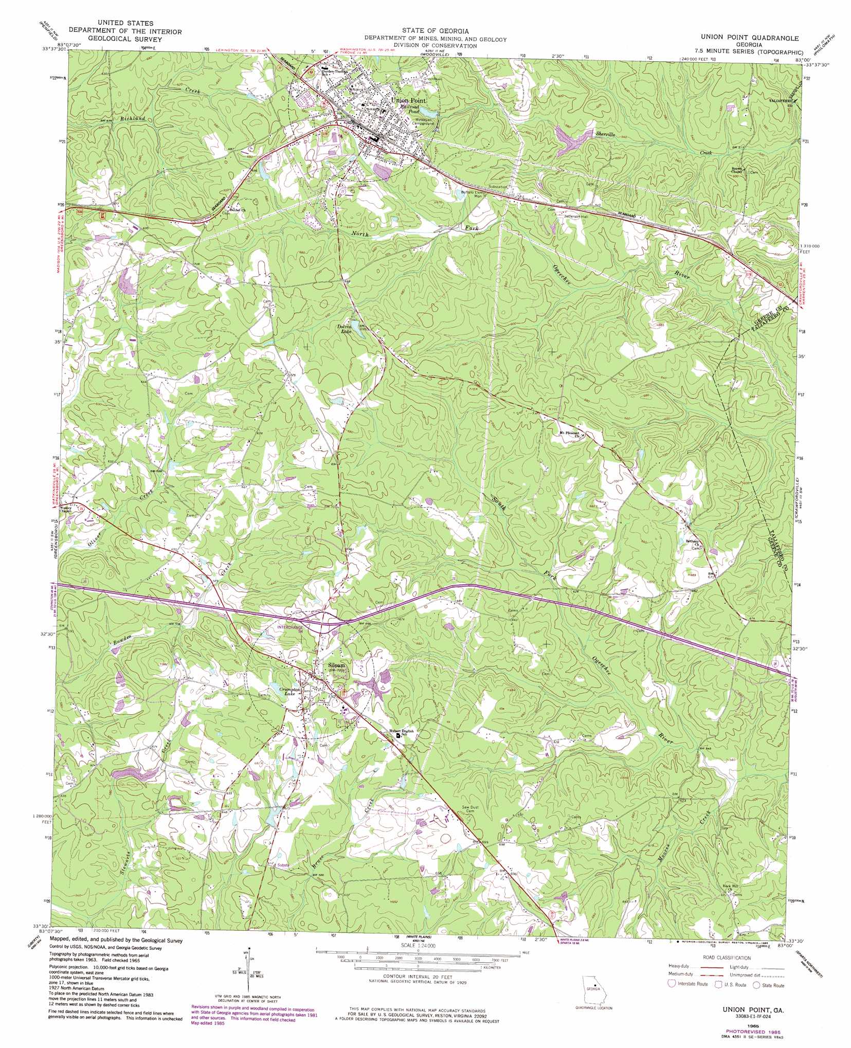
USGS Topo Quad 33083e1 - 1:24,000 scale
| Topo Map Name: | Union Point |
| USGS Topo Quad ID: | 33083e1 |
| Print Size: | ca. 21 1/4" wide x 27" high |
| Southeast Coordinates: | 33.5° N latitude / 83° W longitude |
| Map Center Coordinates: | 33.5625° N latitude / 83.0625° W longitude |
| U.S. State: | GA |
| Filename: | o33083e1.jpg |
| Download Map JPG Image: | Union Point topo map 1:24,000 scale |
| Map Type: | Topographic |
| Topo Series: | 7.5´ |
| Map Scale: | 1:24,000 |
| Source of Map Images: | United States Geological Survey (USGS) |
| Alternate Map Versions: |
Union Point GA 1965, updated 1966 Download PDF Buy paper map Union Point GA 1965, updated 1975 Download PDF Buy paper map Union Point GA 2011 Download PDF Buy paper map Union Point GA 2014 Download PDF Buy paper map |
1:24,000 Topo Quads surrounding Union Point
Barnett Shoals |
Maxeys |
Lexington |
Rayle |
Celeste |
Greshamville |
Penfield |
Woodville |
Philomath |
Washington West |
Buckhead |
Greensboro |
Union Point |
Crawfordville |
Sharon |
Harmony |
Liberty |
White Plains |
Sparta Nw |
Sparta Ne |
Meda |
Rockville |
Shoulderbone |
Sparta |
Jewell |
> Back to 33083e1 at 1:100,000 scale
> Back to 33082a1 at 1:250,000 scale
> Back to U.S. Topo Maps home
Union Point topo map: Gazetteer
Union Point: Crossings
Exit 54 elevation 213m 698′Union Point: Dams
Credille Lake Dam elevation 186m 610′Edmonds Lake Dam elevation 189m 620′
George Lake Dam elevation 207m 679′
Union Point: Mines
Siloam Quarry elevation 209m 685′Union Point: Parks
Buffalo Lick Monument elevation 195m 639′Union Point Historic District elevation 198m 649′
Union Point: Populated Places
Siloam elevation 214m 702′Union Point elevation 206m 675′
Union Point: Post Offices
Union Point Post Office elevation 195m 639′Union Point: Reservoirs
Credille Lake elevation 186m 610′Crumpton Lake elevation 201m 659′
Dolvin Lake elevation 199m 652′
Edmonds Lake elevation 189m 620′
George Lake elevation 207m 679′
Railroad Pond elevation 183m 600′
Union Point: Streams
Moores Creek elevation 165m 541′Union Point digital topo map on disk
Buy this Union Point topo map showing relief, roads, GPS coordinates and other geographical features, as a high-resolution digital map file on DVD:
South Carolina, Western North Carolina & Northeastern Georgia
Buy digital topo maps: South Carolina, Western North Carolina & Northeastern Georgia