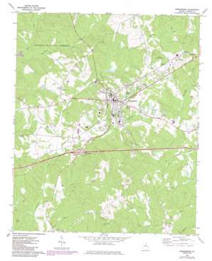
Greensboro Topo Map Georgia
To zoom in, hover over the map of Greensboro
USGS Topo Quad 33083e2 - 1:24,000 scale
| Topo Map Name: | Greensboro |
| USGS Topo Quad ID: | 33083e2 |
| Print Size: | ca. 21 1/4" wide x 27" high |
| Southeast Coordinates: | 33.5° N latitude / 83.125° W longitude |
| Map Center Coordinates: | 33.5625° N latitude / 83.1875° W longitude |
| U.S. State: | GA |
| Filename: | o33083e2.jpg |
| Download Map JPG Image: | Greensboro topo map 1:24,000 scale |
| Map Type: | Topographic |
| Topo Series: | 7.5´ |
| Map Scale: | 1:24,000 |
| Source of Map Images: | United States Geological Survey (USGS) |
| Alternate Map Versions: |
Greensboro GA 1972, updated 1974 Download PDF Buy paper map Greensboro GA 1972, updated 1985 Download PDF Buy paper map Greensboro GA 2011 Download PDF Buy paper map Greensboro GA 2014 Download PDF Buy paper map |
| FStopo: | US Forest Service topo Greensboro is available: Download FStopo PDF Download FStopo TIF |
1:24,000 Topo Quads surrounding Greensboro
> Back to 33083e1 at 1:100,000 scale
> Back to 33082a1 at 1:250,000 scale
> Back to U.S. Topo Maps home
Greensboro topo map: Gazetteer
Greensboro: Airports
Greene County Airpark elevation 207m 679′Greensboro: Crossings
Exit 53 elevation 179m 587′Interchange Fifty-three elevation 171m 561′
Greensboro: Dams
Boswell Lake Dam elevation 162m 531′Greensboro Water Reservoir Dam elevation 177m 580′
Lassiter Lake Dam elevation 157m 515′
Lick Skillet Lake Dam elevation 151m 495′
Parker Lake Dam elevation 158m 518′
Roper Lake Dam elevation 161m 528′
Small Agresearch Lake Dam elevation 186m 610′
Webb Lake Dam elevation 189m 620′
Greensboro: Parks
Greensboro Commercial Historic District elevation 195m 639′North Street-East Street Historic District elevation 188m 616′
Robinson Park elevation 169m 554′
South Street-Broad Street-Main Street-Laurel Street Historic District elevation 187m 613′
South Walnut Street Historic District elevation 195m 639′
Greensboro: Populated Places
Allens Trailer Park elevation 171m 561′Darwin Subdivision elevation 194m 636′
Greensboro elevation 195m 639′
Thurston elevation 164m 538′
Veazey elevation 170m 557′
Webb Trailer Park elevation 198m 649′
Greensboro: Post Offices
Greensboro Post Office elevation 195m 639′Greensboro: Reservoirs
Boswell Lake elevation 162m 531′Greensboro Lake elevation 200m 656′
Lassiter Lake elevation 157m 515′
Lick Skillet Lake elevation 151m 495′
Parker Lake elevation 158m 518′
Phelps Lake elevation 170m 557′
Roper Lake elevation 161m 528′
Small Agresearch Lake elevation 186m 610′
Webb Lake elevation 189m 620′
Greensboro: Streams
Beaverdam Creek elevation 133m 436′Bowden Creek elevation 144m 472′
Oliver Creek elevation 148m 485′
Rocky Branch elevation 137m 449′
Rush Creek elevation 165m 541′
Town Creek elevation 143m 469′
Greensboro: Summits
Cemetery Hill elevation 196m 643′Greensboro digital topo map on disk
Buy this Greensboro topo map showing relief, roads, GPS coordinates and other geographical features, as a high-resolution digital map file on DVD:
South Carolina, Western North Carolina & Northeastern Georgia
Buy digital topo maps: South Carolina, Western North Carolina & Northeastern Georgia


