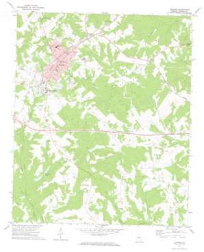
Madison Topo Map Georgia
To zoom in, hover over the map of Madison
USGS Topo Quad 33083e4 - 1:24,000 scale
| Topo Map Name: | Madison |
| USGS Topo Quad ID: | 33083e4 |
| Print Size: | ca. 21 1/4" wide x 27" high |
| Southeast Coordinates: | 33.5° N latitude / 83.375° W longitude |
| Map Center Coordinates: | 33.5625° N latitude / 83.4375° W longitude |
| U.S. State: | GA |
| Filename: | o33083e4.jpg |
| Download Map JPG Image: | Madison topo map 1:24,000 scale |
| Map Type: | Topographic |
| Topo Series: | 7.5´ |
| Map Scale: | 1:24,000 |
| Source of Map Images: | United States Geological Survey (USGS) |
| Alternate Map Versions: |
Madison GA 1972, updated 1974 Download PDF Buy paper map Madison GA 1972, updated 1986 Download PDF Buy paper map Madison GA 2011 Download PDF Buy paper map Madison GA 2014 Download PDF Buy paper map |
1:24,000 Topo Quads surrounding Madison
> Back to 33083e1 at 1:100,000 scale
> Back to 33082a1 at 1:250,000 scale
> Back to U.S. Topo Maps home
Madison topo map: Gazetteer
Madison: Airports
Holiday Inn Heliport elevation 201m 659′Madison Municipal Airport elevation 201m 659′
Madison: Crossings
Exit 50 elevation 196m 643′Exit 51 elevation 207m 679′
Madison: Dams
Lower Carmichael Lake Dam elevation 167m 547′Mason Lake Dam elevation 191m 626′
Mathews Dam elevation 175m 574′
Mathews Dam elevation 158m 518′
McGuery Dam elevation 172m 564′
Pennington Lake Dam elevation 198m 649′
Strange Lake Dam elevation 165m 541′
Upper Carmichael Lake Dam elevation 168m 551′
Walker Dam elevation 156m 511′
Wilson Lake Dam elevation 172m 564′
Madison: Parks
Hill Park elevation 201m 659′Madison Historic District elevation 213m 698′
Walton Park elevation 218m 715′
Madison: Populated Places
Aqua (historical) elevation 158m 518′Beacon Heights elevation 213m 698′
Bethany elevation 189m 620′
Canaan elevation 207m 679′
Madison elevation 207m 679′
Smyrna elevation 188m 616′
Sugar Creek elevation 183m 600′
Madison: Post Offices
Madison Post Office elevation 207m 679′Madison: Reservoirs
Carmichael Lake elevation 171m 561′Lower Carmichael Lake elevation 167m 547′
Mason Lake elevation 191m 626′
Mathews Lake elevation 175m 574′
Mathews Lake elevation 158m 518′
McGuery Lake elevation 172m 564′
Pennington Lake elevation 198m 649′
Strange Lake elevation 165m 541′
Upper Carmichael Lake elevation 168m 551′
Walker Lake elevation 156m 511′
Wilson Lake elevation 172m 564′
Madison: Streams
Fourmile Branch elevation 159m 521′Horse Branch elevation 160m 524′
Little Sugar Creek elevation 146m 479′
Madison digital topo map on disk
Buy this Madison topo map showing relief, roads, GPS coordinates and other geographical features, as a high-resolution digital map file on DVD:
South Carolina, Western North Carolina & Northeastern Georgia
Buy digital topo maps: South Carolina, Western North Carolina & Northeastern Georgia


