Penfield Topo Map Georgia
To zoom in, hover over the map of Penfield
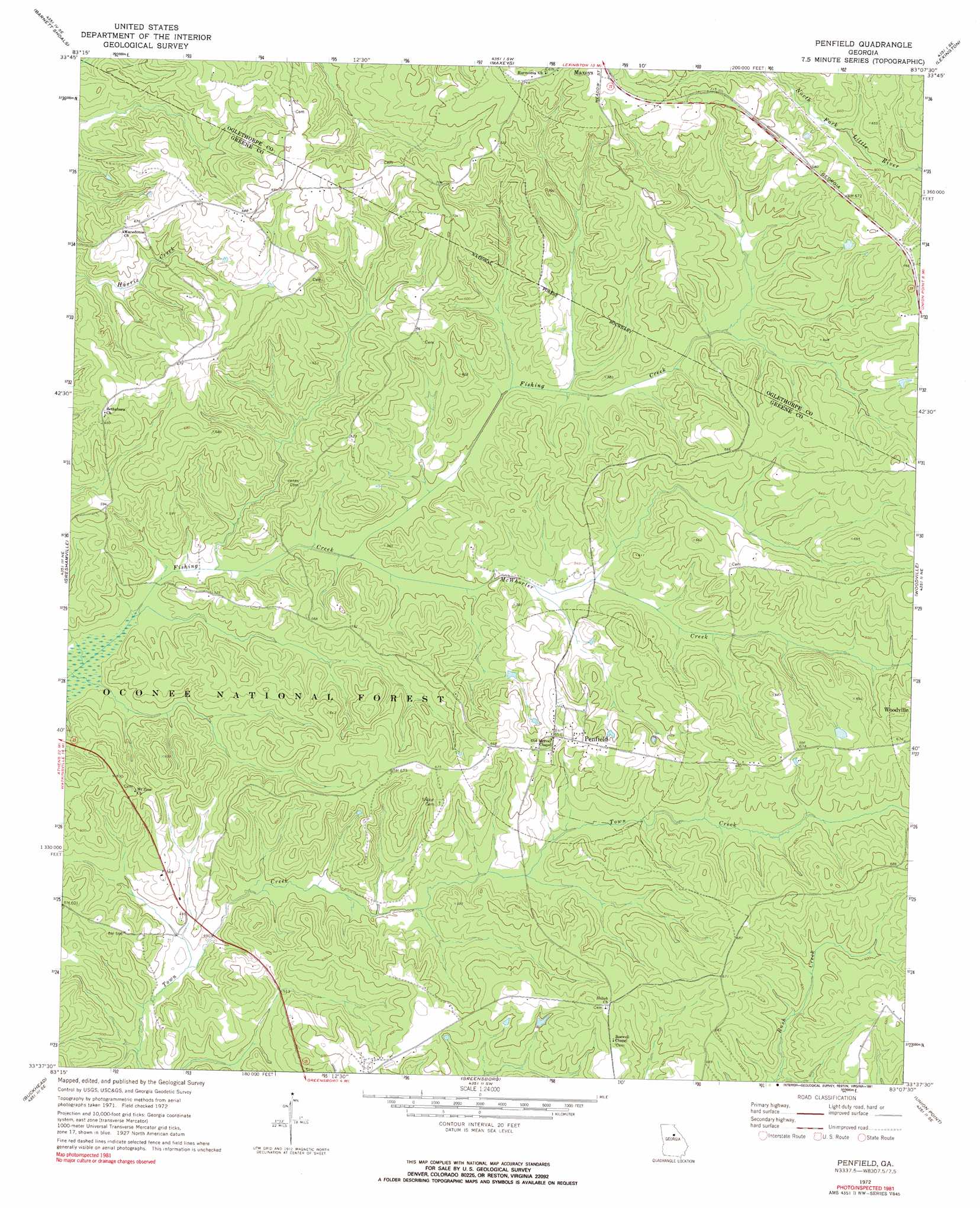
USGS Topo Quad 33083f2 - 1:24,000 scale
| Topo Map Name: | Penfield |
| USGS Topo Quad ID: | 33083f2 |
| Print Size: | ca. 21 1/4" wide x 27" high |
| Southeast Coordinates: | 33.625° N latitude / 83.125° W longitude |
| Map Center Coordinates: | 33.6875° N latitude / 83.1875° W longitude |
| U.S. State: | GA |
| Filename: | o33083f2.jpg |
| Download Map JPG Image: | Penfield topo map 1:24,000 scale |
| Map Type: | Topographic |
| Topo Series: | 7.5´ |
| Map Scale: | 1:24,000 |
| Source of Map Images: | United States Geological Survey (USGS) |
| Alternate Map Versions: |
Penfield GA 1972, updated 1973 Download PDF Buy paper map Penfield GA 1972, updated 1991 Download PDF Buy paper map Penfield GA 2011 Download PDF Buy paper map Penfield GA 2014 Download PDF Buy paper map |
| FStopo: | US Forest Service topo Penfield is available: Download FStopo PDF Download FStopo TIF |
1:24,000 Topo Quads surrounding Penfield
Athens West |
Athens East |
Crawford |
Sandy Cross |
Vesta |
Watkinsville |
Barnett Shoals |
Maxeys |
Lexington |
Rayle |
Apalachee |
Greshamville |
Penfield |
Woodville |
Philomath |
Madison |
Buckhead |
Greensboro |
Union Point |
Crawfordville |
Rock Eagle Lake |
Harmony |
Liberty |
White Plains |
Sparta Nw |
> Back to 33083e1 at 1:100,000 scale
> Back to 33082a1 at 1:250,000 scale
> Back to U.S. Topo Maps home
Penfield topo map: Gazetteer
Penfield: Parks
Penfield Historic District elevation 200m 656′Penfield: Populated Places
Penfield elevation 200m 656′Penfield: Streams
McWhorter Creek elevation 146m 479′Penfield: Trails
Town Creek Bike Trail elevation 179m 587′Penfield digital topo map on disk
Buy this Penfield topo map showing relief, roads, GPS coordinates and other geographical features, as a high-resolution digital map file on DVD:
South Carolina, Western North Carolina & Northeastern Georgia
Buy digital topo maps: South Carolina, Western North Carolina & Northeastern Georgia