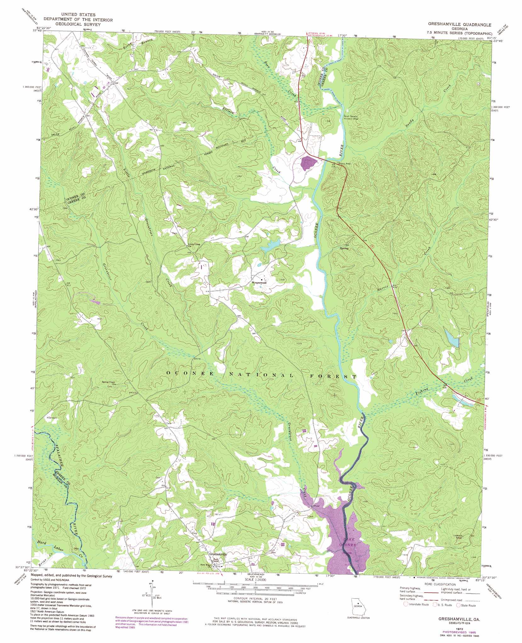
Greshamville Topo Map Georgia
To zoom in, hover over the map of Greshamville
USGS Topo Quad 33083f3 - 1:24,000 scale
| Topo Map Name: | Greshamville |
| USGS Topo Quad ID: | 33083f3 |
| Print Size: | ca. 21 1/4" wide x 27" high |
| Southeast Coordinates: | 33.625° N latitude / 83.25° W longitude |
| Map Center Coordinates: | 33.6875° N latitude / 83.3125° W longitude |
| U.S. State: | GA |
| Filename: | o33083f3.jpg |
| Download Map JPG Image: | Greshamville topo map 1:24,000 scale |
| Map Type: | Topographic |
| Topo Series: | 7.5´ |
| Map Scale: | 1:24,000 |
| Source of Map Images: | United States Geological Survey (USGS) |
| Alternate Map Versions: |
Greshamville GA 1972, updated 1974 Download PDF Buy paper map Greshamville GA 1972, updated 1986 Download PDF Buy paper map Greshamville GA 2011 Download PDF Buy paper map Greshamville GA 2014 Download PDF Buy paper map |
| FStopo: | US Forest Service topo Greshamville is available: Download FStopo PDF Download FStopo TIF |
1:24,000 Topo Quads surrounding Greshamville
Statham |
Athens West |
Athens East |
Crawford |
Sandy Cross |
High Shoals |
Watkinsville |
Barnett Shoals |
Maxeys |
Lexington |
Rutledge North |
Apalachee |
Greshamville |
Penfield |
Woodville |
Rutledge South |
Madison |
Buckhead |
Greensboro |
Union Point |
Shady Dale |
Rock Eagle Lake |
Harmony |
Liberty |
White Plains |
> Back to 33083e1 at 1:100,000 scale
> Back to 33082a1 at 1:250,000 scale
> Back to U.S. Topo Maps home
Greshamville topo map: Gazetteer
Greshamville: Dams
Ashley Lake Dam elevation 152m 498′Toombs Lake Dam elevation 145m 475′
W S Ashley Dam elevation 158m 518′
Greshamville: Populated Places
Greshamville elevation 190m 623′Scull Shoals (historical) elevation 137m 449′
Wrayswood elevation 170m 557′
Greshamville: Reservoirs
Ashley Lake elevation 152m 498′Bear Lake elevation 146m 479′
Toombs Lake elevation 145m 475′
Greshamville: Springs
Watson Spring elevation 138m 452′Greshamville: Streams
Briar Creek elevation 133m 436′Ellison Creek elevation 135m 442′
Fishing Creek elevation 133m 436′
Fishing Creek elevation 133m 436′
Greenbrier Creek elevation 142m 465′
Hard Labor Creek elevation 133m 436′
Harris Creek elevation 134m 439′
Little Greenbrier Creek elevation 133m 436′
Rose Creek elevation 136m 446′
Sandy Creek elevation 136m 446′
Greshamville: Trails
Scull Shoals Trail elevation 136m 446′Greshamville digital topo map on disk
Buy this Greshamville topo map showing relief, roads, GPS coordinates and other geographical features, as a high-resolution digital map file on DVD:
South Carolina, Western North Carolina & Northeastern Georgia
Buy digital topo maps: South Carolina, Western North Carolina & Northeastern Georgia