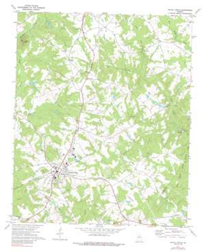
Social Circle Topo Map Georgia
To zoom in, hover over the map of Social Circle
USGS Topo Quad 33083f6 - 1:24,000 scale
| Topo Map Name: | Social Circle |
| USGS Topo Quad ID: | 33083f6 |
| Print Size: | ca. 21 1/4" wide x 27" high |
| Southeast Coordinates: | 33.625° N latitude / 83.625° W longitude |
| Map Center Coordinates: | 33.6875° N latitude / 83.6875° W longitude |
| U.S. State: | GA |
| Filename: | o33083f6.jpg |
| Download Map JPG Image: | Social Circle topo map 1:24,000 scale |
| Map Type: | Topographic |
| Topo Series: | 7.5´ |
| Map Scale: | 1:24,000 |
| Source of Map Images: | United States Geological Survey (USGS) |
| Alternate Map Versions: |
Social Circle GA 1971, updated 1974 Download PDF Buy paper map Social Circle GA 1971, updated 1988 Download PDF Buy paper map Social Circle GA 2011 Download PDF Buy paper map Social Circle GA 2014 Download PDF Buy paper map |
1:24,000 Topo Quads surrounding Social Circle
> Back to 33083e1 at 1:100,000 scale
> Back to 33082a1 at 1:250,000 scale
> Back to U.S. Topo Maps home
Social Circle topo map: Gazetteer
Social Circle: Airports
Sleepy Hollow Airport elevation 225m 738′Social Circle: Bars
Browning Shoals elevation 189m 620′Social Circle: Dams
Arnold Dam elevation 215m 705′Baccus Lake Dam elevation 231m 757′
Bradley Dam elevation 231m 757′
Cedar Lake Dam elevation 222m 728′
Griffin Dam elevation 218m 715′
Jones Lake Dam elevation 225m 738′
Kelley Lake Dam elevation 218m 715′
Mathis Lake Dam elevation 225m 738′
McGarity Dam elevation 233m 764′
Social Circle: Parks
Jefferson Davis Monument elevation 247m 810′Social Circle Historic District elevation 270m 885′
Stephens Park elevation 260m 853′
William Luther Breedlove Monument elevation 244m 800′
Social Circle: Populated Places
Herndonville elevation 261m 856′Social Circle elevation 270m 885′
Whitney elevation 256m 839′
Social Circle: Post Offices
Social Circle Post Office elevation 269m 882′Social Circle: Reservoirs
Arnold Lake elevation 215m 705′Baccus Lake elevation 231m 757′
Bradley Lake elevation 231m 757′
Cedar Lake elevation 222m 728′
Griffin Lake elevation 218m 715′
Jones Lake elevation 225m 738′
Kelley Lake elevation 218m 715′
Mathis Lake elevation 225m 738′
McGarity Lake elevation 233m 764′
Social Circle: Streams
Means Creek elevation 188m 616′Reedy Creek elevation 192m 629′
Rocky Creek elevation 202m 662′
Social Circle: Summits
Alcovy Mountain elevation 317m 1040′Social Circle digital topo map on disk
Buy this Social Circle topo map showing relief, roads, GPS coordinates and other geographical features, as a high-resolution digital map file on DVD:
South Carolina, Western North Carolina & Northeastern Georgia
Buy digital topo maps: South Carolina, Western North Carolina & Northeastern Georgia


