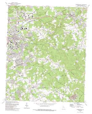
Lawrenceville Topo Map Georgia
To zoom in, hover over the map of Lawrenceville
USGS Topo Quad 33083h8 - 1:24,000 scale
| Topo Map Name: | Lawrenceville |
| USGS Topo Quad ID: | 33083h8 |
| Print Size: | ca. 21 1/4" wide x 27" high |
| Southeast Coordinates: | 33.875° N latitude / 83.875° W longitude |
| Map Center Coordinates: | 33.9375° N latitude / 83.9375° W longitude |
| U.S. State: | GA |
| Filename: | o33083h8.jpg |
| Download Map JPG Image: | Lawrenceville topo map 1:24,000 scale |
| Map Type: | Topographic |
| Topo Series: | 7.5´ |
| Map Scale: | 1:24,000 |
| Source of Map Images: | United States Geological Survey (USGS) |
| Alternate Map Versions: |
Lawrenceville GA 1964, updated 1965 Download PDF Buy paper map Lawrenceville GA 1964, updated 1985 Download PDF Buy paper map Lawrenceville GA 1992, updated 1992 Download PDF Buy paper map Lawrenceville GA 1998, updated 1999 Download PDF Buy paper map Lawrenceville GA 2011 Download PDF Buy paper map Lawrenceville GA 2014 Download PDF Buy paper map |
1:24,000 Topo Quads surrounding Lawrenceville
> Back to 33083e1 at 1:100,000 scale
> Back to 33082a1 at 1:250,000 scale
> Back to U.S. Topo Maps home
Lawrenceville topo map: Gazetteer
Lawrenceville: Airports
County Police Heliport elevation 328m 1076′GDPS - Police Heliport elevation 316m 1036′
Gwinnett County Airport-Briscoe Field elevation 312m 1023′
Lawrenceville: Dams
Arnold Dam elevation 297m 974′Dam Y3 elevation 315m 1033′
Dove Dam elevation 321m 1053′
Kennerly Dam elevation 290m 951′
Lawrenceville City Dam elevation 297m 974′
Powell Dam elevation 310m 1017′
Soseby Dam elevation 318m 1043′
Lawrenceville: Mines
Grayson Quarry elevation 262m 859′Lawrenceville: Parks
Dacula Park elevation 327m 1072′Lawrenceville City Park elevation 304m 997′
Rhodes Jordan Park elevation 301m 987′
Tribble Mill Park elevation 295m 967′
Lawrenceville: Populated Places
Acadia Woods elevation 313m 1026′Alcovy Forest elevation 284m 931′
Allendale elevation 336m 1102′
Carmel East elevation 318m 1043′
Dacula elevation 320m 1049′
Forest East elevation 328m 1076′
Forest Hills elevation 319m 1046′
Forest River elevation 316m 1036′
Grayson elevation 334m 1095′
Graystone elevation 298m 977′
Graystone North elevation 301m 987′
Gunter Estates elevation 329m 1079′
Lawrenceville elevation 325m 1066′
New Hope elevation 293m 961′
Oakdale Woods elevation 313m 1026′
Pinehurst Trace elevation 292m 958′
Robin Ridge elevation 334m 1095′
Saddleback Estates elevation 287m 941′
Sandlewood elevation 307m 1007′
Timbercrest elevation 311m 1020′
Village Gate elevation 315m 1033′
Waterton elevation 304m 997′
Waverly Woods elevation 317m 1040′
Lawrenceville: Post Offices
Dacula Post Office elevation 316m 1036′Grayson Post Office elevation 333m 1092′
Lawrenceville Post Office elevation 325m 1066′
Lawrenceville: Reservoirs
Arnold Lake elevation 297m 974′Dove Lake elevation 321m 1053′
Haynes Pond Number Three elevation 294m 964′
Kennerly Lake elevation 290m 951′
Lawrenceville City Lake elevation 297m 974′
Powell Lake elevation 310m 1017′
Soseby Lake elevation 318m 1043′
Wages Lake elevation 243m 797′
Webb Lake elevation 315m 1033′
Lawrenceville: Streams
Cedar Creek elevation 287m 941′Hopkins Creek elevation 262m 859′
Shoal Creek elevation 253m 830′
Lawrenceville digital topo map on disk
Buy this Lawrenceville topo map showing relief, roads, GPS coordinates and other geographical features, as a high-resolution digital map file on DVD:
South Carolina, Western North Carolina & Northeastern Georgia
Buy digital topo maps: South Carolina, Western North Carolina & Northeastern Georgia


